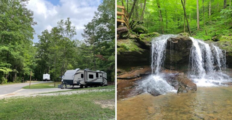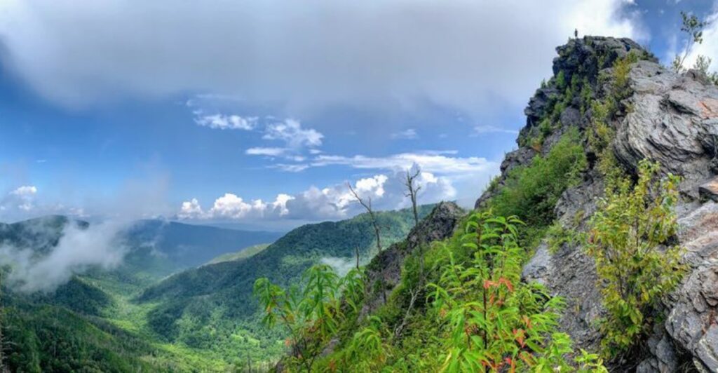
On one Tennessee mountain, hikers grip steel cables bolted into the rock just to keep moving. Those cables are not decorations. They run along narrow ledges where the trail hugs a cliff and the valley falls away below.
That’s only one trail. Elsewhere in the state, you can walk down a crack in a bluff that’s about 100 feet deep. Another route asks you to cross a wooden suspension bridge that sways over a creek.
One more sends you scrambling over giant boulders with your hands doing half the work.
I love that these views have to be earned. Still, I can’t pretend a wiggly bridge sounds relaxing to everyone, and I respect a sweaty palm.
So think of this as a friendly heads-up from someone who wants your hike to be fun. A few of these trails are short, a few are brutal, and some manage both.
1. Chimney Tops Trail
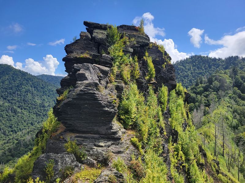
Short trails usually sound friendly, but this one climbs like it’s late for an appointment. It’s known as one of the steepest and shortest hikes in Great Smoky Mountains National Park.
The math is simple and a little rude. You gain a big chunk of elevation over a small distance, so your legs feel it fast.
A long string of stone stairs carries you upward through the forest. Then the path narrows onto a ridge where the mountains open up around you.
That ridge is where nervous hikers start paying close attention. The ground feels thinner, and the drop-offs feel closer than they did a few minutes earlier.
Good news for anyone with shaky knees: the famous rocky pinnacles are closed. The final quarter-mile stays off-limits for safety reasons, so nobody expects you to scramble up bare rock.
Instead, the trail ends at a newer observation point. From there, you get big views of Mount LeConte without climbing the old summit spires.
The area sits at roughly 4,800 feet. At that height, wind and weather can shift quickly, so a light jacket earns its spot in your pack.
Before you go, remember that parking in the park requires a parking tag. Grab one ahead of time so your trip doesn’t stall at the lot.
So should a height-shy hiker skip it entirely? Not always, but the steep stairs and narrow ridge make it a poor first test of your nerves.
Take your time on the way down, too. Steep steps can feel even trickier when gravity is pushing you along.
2. Alum Cave Trail to Mount LeConte
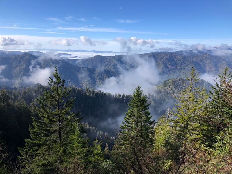
Steel cables bolted into rock tell you a lot about a trail. Here, they show up for a reason, and that reason is a cliff.
Plenty of hikers call this route a Smokies classic. It mixes strange rock formations with wide views, and it doesn’t hand either one out for free.
Early on, you’ll reach Arch Rock. The trail passes beneath a natural stone arch, using steps carved right into the rock.
Things feel playful there, almost like a theme park ride. Then the climb gets serious as you keep heading uphill.
Inspiration Point sits at about 4,700 feet. It gives you commanding views, plus a preview of how high you’ve already climbed.
Next comes Alum Cave, which isn’t really a cave at all. It’s a massive curved bluff that rises about 80 feet over the trail.
Past the bluff, the real test begins. Some sections hug the cliff closely, and cables help hikers steady themselves along the ledges.
If heights make your stomach flip, this is the stretch to think about. Turning around at the bluff is a perfectly respectable plan.
Hikers who push on face a climb of roughly 2,800 feet in total. The reward is the summit of Mount LeConte at 6,593 feet.
Wet rock and ice can make those ledges much sketchier. Check the weather and conditions before you commit to the full route.
3. Rainbow Falls Trail to Mount LeConte
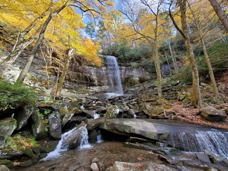
Nearly 4,000 feet of climbing makes a strong first impression. That’s the elevation gain on this roughly 13-mile round trip to Mount LeConte.
Trail descriptions call it not for the faint of heart. After reading those numbers, you’ll probably agree before lacing up.
The hike starts out sweet enough. You follow LeConte Creek and cross footbridges as the water tumbles beside you.
Soon you reach the star of the show. Rainbow Falls drops about 80 feet and is often called the highest single-drop waterfall in the Smokies.
On sunny afternoons, mist from the falls can create the rainbow that gives it its name. It’s a fun bonus if the light lines up.
Lots of hikers stop at the falls and head back. Honestly, that’s a smart move if your fear of heights starts whispering.
Beyond the waterfall, the trail twists up onto an exposed ridge. Open edges replace the cozy creekside feel of the lower section.
Exposure like that can rattle even confident hikers. Wind, open views, and long drops make the upper miles a different kind of hike.
Plan your day carefully if you aim for the summit. That distance and climb can easily eat up a full day, especially on tired legs.
Pack plenty of water and snacks. Your calves will thank you when the trail finally levels out at the top.
4. Rocky Top on Thunderhead Mountain
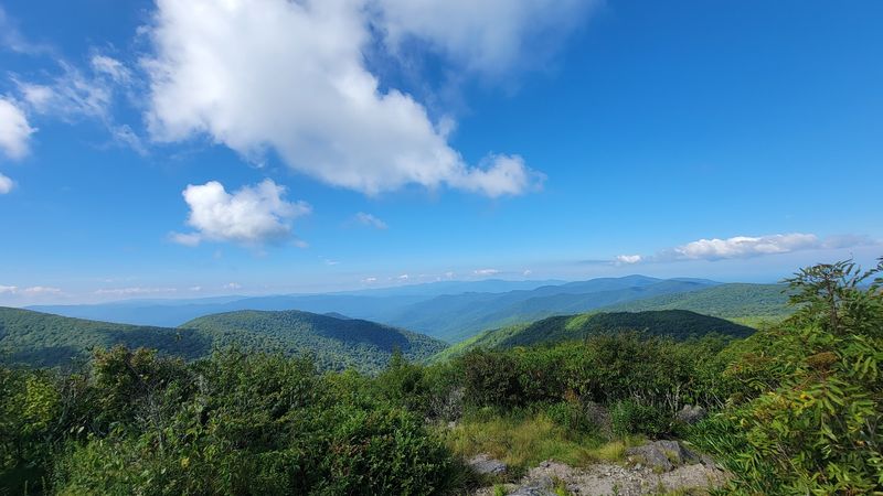
Yes, that Rocky Top, the one from the famous song. Hearing it at a football game is easy, but reaching it on foot is a different story.
This strenuous trek covers about 13.9 miles round trip. Depending on the route, you’ll climb somewhere between 3,665 and almost 4,000 feet.
Your journey begins near the Cades Cove Picnic Area. From there, the trail keeps climbing toward the high ridges of Thunderhead Mountain.
Thunderhead actually has three summits. Rocky Top is one of them, and its rocky peak is the one with the big reputation.
Once you’re up there, the views spin all the way around. You can take in surrounding mountains, Fontana Lake, and Cades Cove below.
A 360-degree view sounds dreamy until you notice how open the summit feels. Rock perches and wide sky can make nervous hikers grab for the nearest boulder.
The highest point on Thunderhead reaches 5,527 feet. At that height, clouds and wind can roll in without much warning.
So how do you know if it’s right for you? If long climbs don’t scare you but open summits do, try shorter overlooks first.
Build up your stamina with easier mountain hikes in Tennessee. Then come back when long miles and exposed rock feel exciting instead of stressful.
Start early, too. A hike this long leaves little wiggle room for slow breaks before sunset.
5. Fiery Gizzard Trail
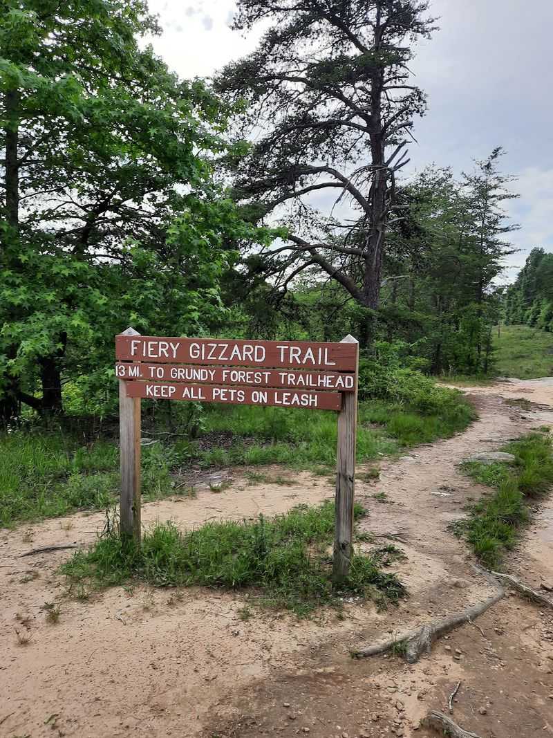
Any trail with a name this wild has to back it up. One popular story claims Davy Crockett burned his tongue on a turkey gizzard nearby.
Whether that tale is true or not, the trail certainly delivers drama. It routinely ranks among the top hiking trails in the nation.
You’ll find it in South Cumberland State Park. The southern trailhead sits at Grundy Forest State Natural Area in Tracy City.
Don’t expect a smooth sidewalk through the woods. The terrain gets rocky, rooty, muddy, and slippery in places.
Some sections are steep enough to be called potentially hazardous. That warning deserves real respect, especially after rain.
Boulder fields add another layer of fun or panic. You’ll rock-hop across big stones, sometimes using your hands for balance.
Then comes the jaw-dropper. A dramatic 270-degree overlook gives you huge views of Fiery Gizzard Gorge.
For anyone uneasy around heights, that overlook can feel like standing on the edge of the world. Stay back from the rim and enjoy the view from solid ground.
Good boots with sturdy grip make a big difference here. Trekking poles can also help on steep, slick stretches.
Want a taste without the full challenge? Shorter out-and-back sections let you sample the scenery and turn around whenever you like.
6. Edwards Point Trail
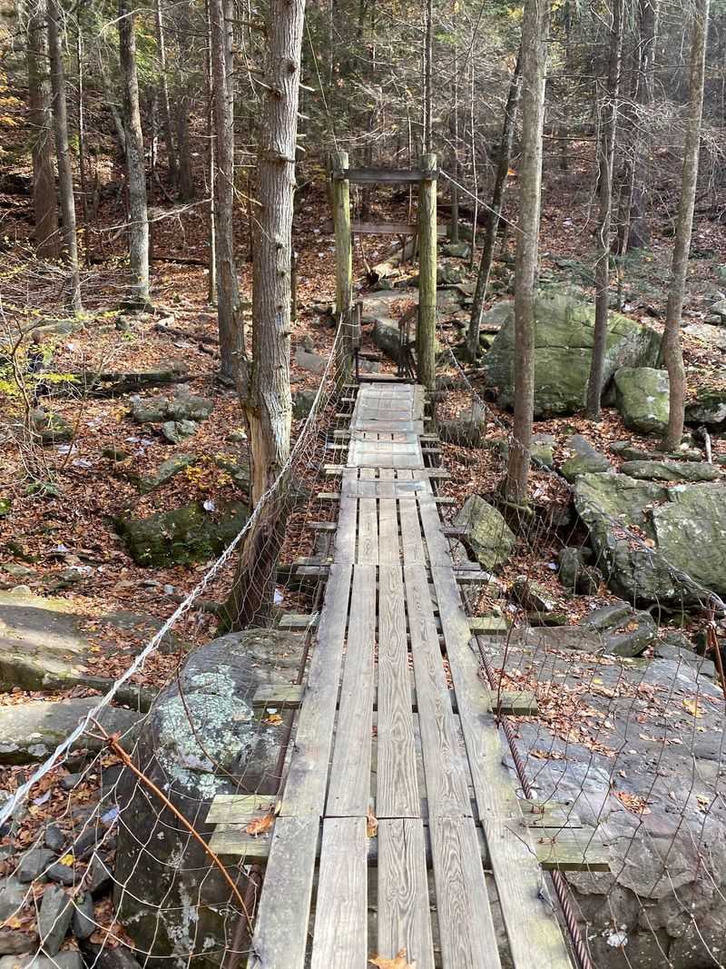
Bridges usually stay still, which is exactly why this trail gets people talking. A 100-foot wooden suspension bridge over Middle Creek sways gently as you cross.
Gently is a relative word, of course. To someone afraid of heights, any wobble can feel like a full earthquake.
This route is a section of the Cumberland Trail. It rewards hikers with sweeping views of the Tennessee River Gorge.
Plenty of overlooks line the way as the trail follows the plateau rim. Each one offers a fresh angle on the river and rugged hills below.
The hike also dips down into Middle Creek Gorge and climbs back out. That means steep sections in both directions, so pace yourself.
Here’s another surprise for bridge skeptics. Farther along the Cumberland Trail, beyond Edwards Point, another suspension bridge crosses North Suck Creek. Reaching it requires extending your hike beyond the usual Edwards Point route.
Long, swaying spans like that test both balance and nerve. A tip many nervous walkers use is to keep your eyes ahead instead of staring at the water.
Steep bluffs and rough rocky terrain add to the challenge. Some rock sections can also turn slick, especially when wet.
If you love views but dread bridges, this one is tricky. The scenery is gorgeous, but reaching Edwards Point still means crossing the suspension bridge over Middle Creek.
Bring a hiking buddy who can cheer you across. A little encouragement goes a long way on a bouncy bridge.
7. Virgin Falls Trail
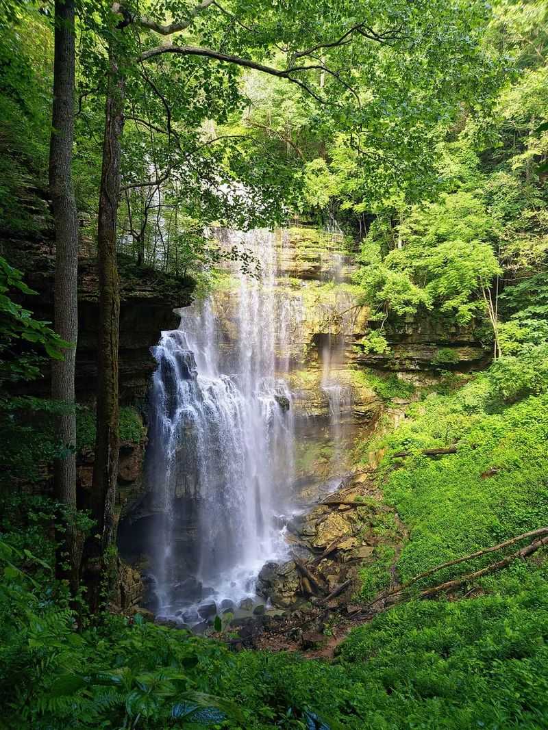
Waterfalls don’t usually pop out of a cave and then vanish into another one. Virgin Falls does exactly that, which sounds like a magic trick.
An underground stream bursts from a cave and plunges 110 feet over a cliff. Then it disappears into another cave below.
Seeing it takes real effort. The trail is a strenuous 9-mile round trip recommended for experienced hikers.
Getting there is described as not for the faint of heart. You’ll drop around 900 feet in elevation as you head into the gorge.
That descent follows a rocky, uneven path. Careful footing matters more than speed on this stretch.
Of course, going down means coming back up. That 900-foot climb out feels much bigger at the end of a long day.
Heights are part of the story here, too. Rugged terrain and cliff areas around the falls can unsettle anyone who prefers flat ground.
The area is part of the Virgin Falls Pocket Wilderness, known for unusual geological features. Caves, bluffs, and sinking streams make it feel like a different planet.
Plan for a full day and bring extra water. The parking area at the trailhead is gravel, so expect a rustic start.
Is it worth it? For strong hikers who stay calm near edges, the disappearing waterfall makes a story you’ll keep telling.
8. The Great Stone Door
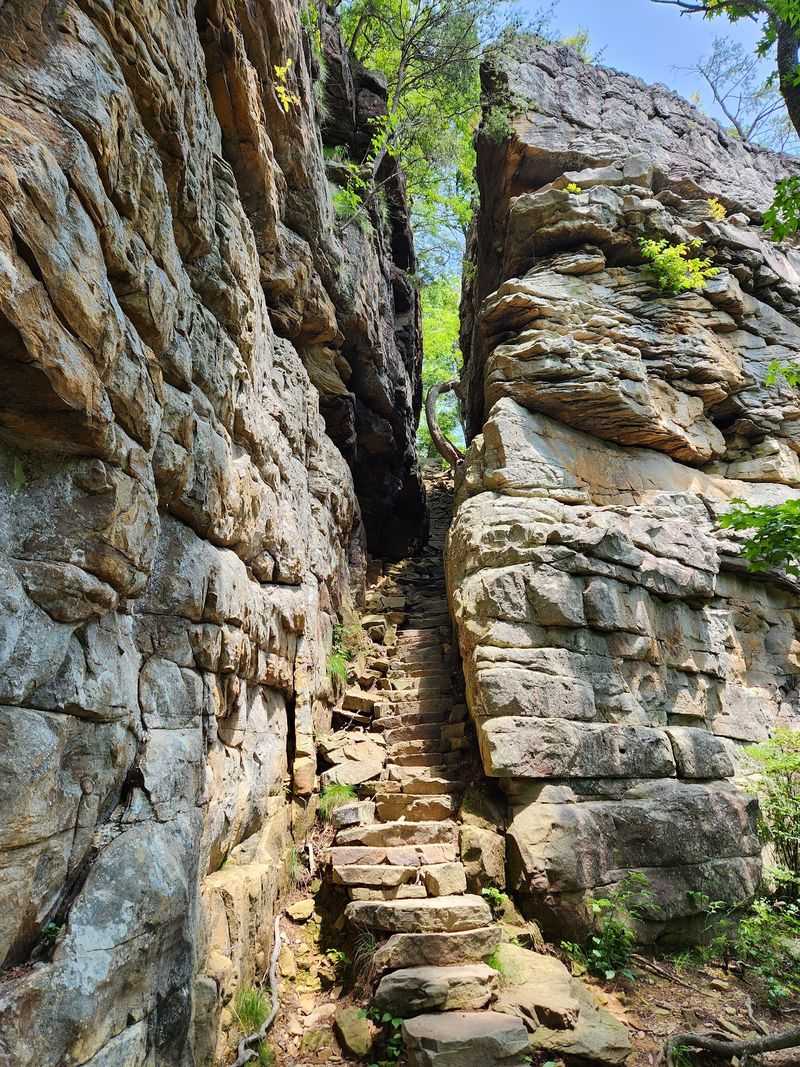
Picture-perfect names don’t come more literal than this. A massive crack splits a sandstone bluff, and it really does look like a giant door.
That crack runs about 100 feet deep and roughly 10 feet wide. Hikers use it as a natural staircase between the rim and the gorge below.
Trail writers have called it a dizzying descent. Steep, uneven stone steps make you watch every move of your feet.
You’ll find this wonder in Savage Gulf State Park. The trail starts at the Stone Door Ranger Station in Beersheba Springs.
Here’s the sneaky part for nervous hikers. The walk is often rated easy to moderate, so it doesn’t sound scary on paper. Then you reach the edge.
The cliff rim opens into a huge Big Sky overlook with 270-degree views of wilderness.
Think of the rim as a giant natural observation deck. The catch is that these exposed overlooks don’t have railings.
For some people, that missing railing changes the whole mood. Wide views feel thrilling to one hiker and terrifying to the next.
Families like the shorter distance, but keep little ones close near the edge. Solid shoes help on the bumpy rock.
Not ready for the stairs? You can enjoy the views from a safe spot back from the rim and still head home happy.
Tennessee packs a lot of drama into this one short trail, so take it slow and savor it.
Share this story