Oregon has a habit of making normal cameras look like they were edited. There are striped hills, a hole that seems to swallow the ocean, a desert as flat as a tabletop, and a lake so blue it looks filtered. This list covers 12 real places across the coast, the Cascades, and the far southeast high desert that look almost too odd to be true.
Save it for your next road trip, and get ready for friends who ask what app you used.
1. Painted Hills
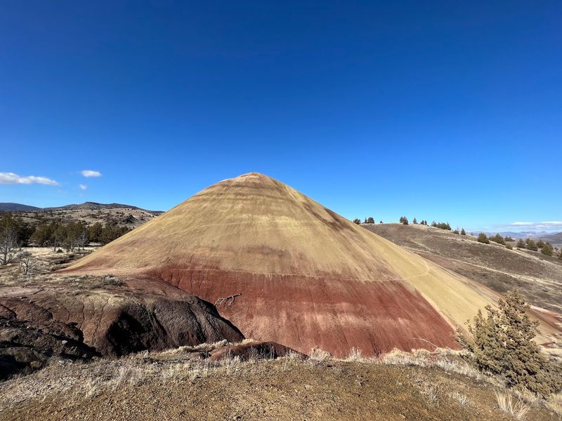
Red, gold, tan, and black stripes wrap around these rounded hills like someone layered them with a paintbrush. They are not painted, of course. The colors come from layers of weathered volcanic material that built up over a very long stretch of time.
The Painted Hills are part of the John Day Fossil Beds National Monument in Wheeler County, not far from the small town of Mitchell. That location means a real road trip through quiet central Oregon country, which is part of the fun.
Easy walking trails lead to viewpoints where the bands of color stack up in every direction. You do not need to be a serious hiker to get the classic shot.
I would save this one for late afternoon, when the light changes how bold the stripes look. Stay on the marked paths, since the claystone surface is fragile and footprints can last for years.
2. Thor’s Well
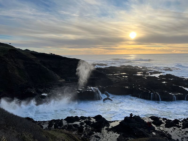
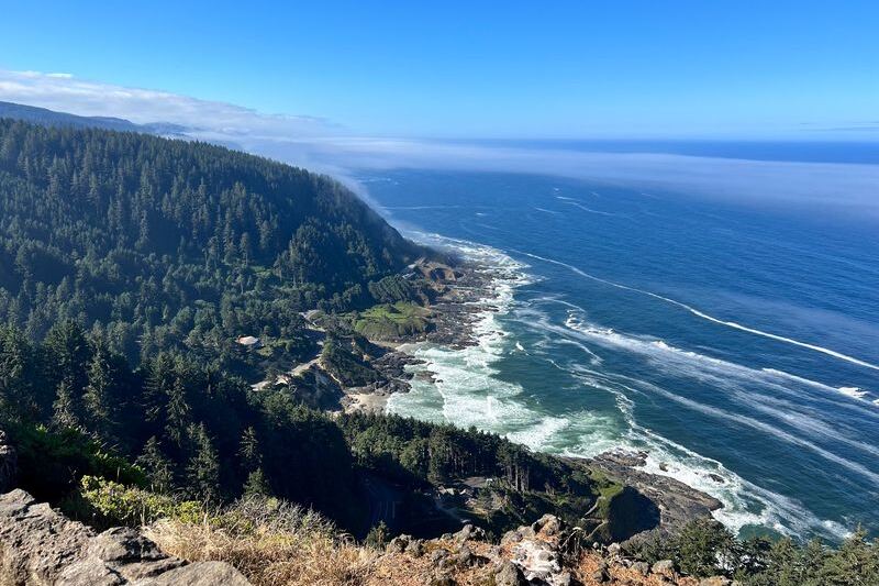
Nicknamed the Drainpipe of the Pacific, Thor’s Well looks like the ocean is draining into a hole in the rock. Waves wash over the basalt shelf, fill the opening, and then pour back down into it.
You will find it at the Cape Perpetua Scenic Area, just a few miles south of Yachats along US 101. The site is open around the clock, and there are restrooms nearby but no restaurant.
The best show happens around high tide, when water surges up, sprays over the edges, and disappears again. A short, easy trail leads to the viewing area, and it works well for kids.
Watch from a safe distance and keep an eye on the waves, which can be stronger than they look. Sunset here makes for photos that rarely look real.
3. Tamolitch Falls (Blue Pool), McKenzie Bridge
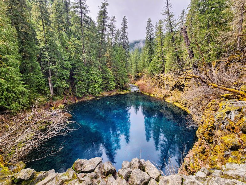
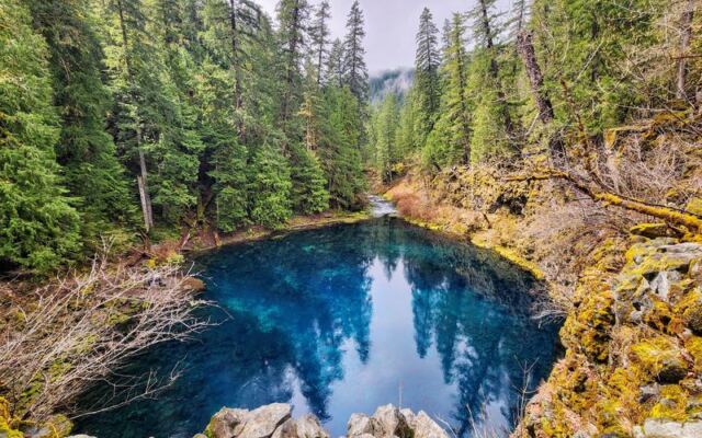
Most waterfalls need water at the top. At Tamolitch, the McKenzie River runs underground through old lava beds and then springs back up into a pool so clear and blue it looks like a swimming pool.
The Blue Pool sits in the Willamette National Forest near McKenzie Bridge. The hike is about 2.1 miles each way through old-growth forest, and dogs are allowed on the trail.
That water is frigid all year, so admire it more than you swim in it. The trail gets busy on Saturday afternoons, so a weekday or early start makes for a calmer visit.
The color is the whole reason people make the trip. It is one of those spots where the real view looks more unreal than the photo.
4. Devils Punchbowl State Natural Area, Otter Rock
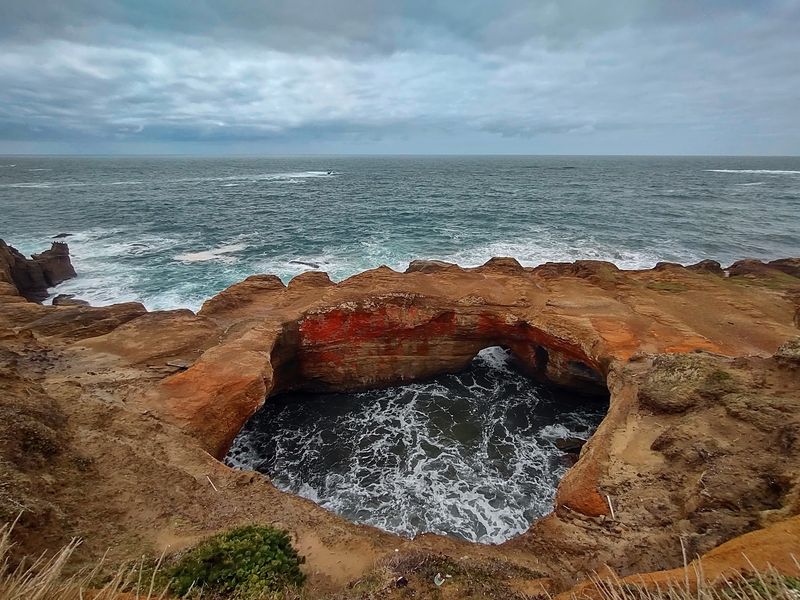
Picture a giant stone bowl with the ocean boiling inside it. That is the Devils Punchbowl, a collapsed sea cave in Otter Rock where waves rush in and swirl in a foamy circle.
From the overlook, you look straight down into the churning surf. It is a quick stop with a big payoff, and it has picnic tables and public restrooms.
When the tide drops, the rocky beach nearby opens up tide pools to explore. Trails, kid-friendly paths, and a dog-friendly policy make it easy for families.
The area is also a popular surfing spot. Pair it with a slow drive along this stretch of the central coast.
5. Fort Rock State Natural Area, Fort Rock
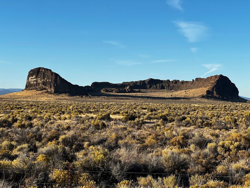
Out in Lake County, a giant curved rock wall rises out of flat sagebrush country like an old fortress. Fort Rock is a volcanic tuff ring, and it stands out because almost nothing else around it does.
The state natural area sits at the foot of the rock. Easy, family-friendly trails lead inside the curved walls, with views over the valley and an ancient lake bed.
There is real history here too, since ancient artifacts have been found in caves in the area. That gives the stop a story beyond the scenery.
Picnic tables and restrooms make it a comfortable break on a long high desert drive. Dogs are allowed, so the whole crew can come.
6. Alvord Desert
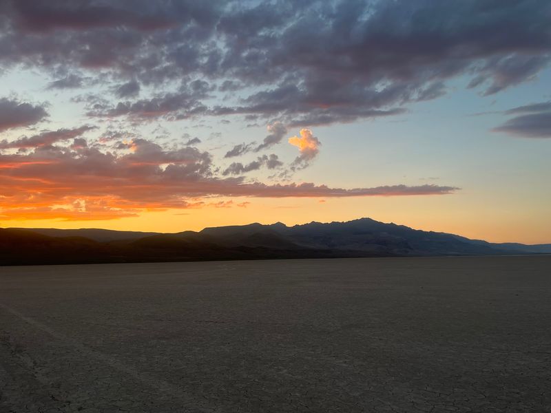
Flat. That is the first word for the Alvord Desert, and it barely covers it. The dry lakebed stretches pale and open, with the Steens Mountain escarpment rising like a wall behind it.
The desert sits in a rain shadow in remote southeastern Oregon. Because it is so far from city lights, the night sky is one of its biggest draws.
Camping, sunset photos, and stargazing are the main reasons people come. On clear nights, the Milky Way shows up overhead in a way most of us rarely see.
Plan carefully, since services are scarce out here. Bring water, fuel, and supplies, and give yourself time to enjoy the quiet.
7. Neskowin Ghost Forest
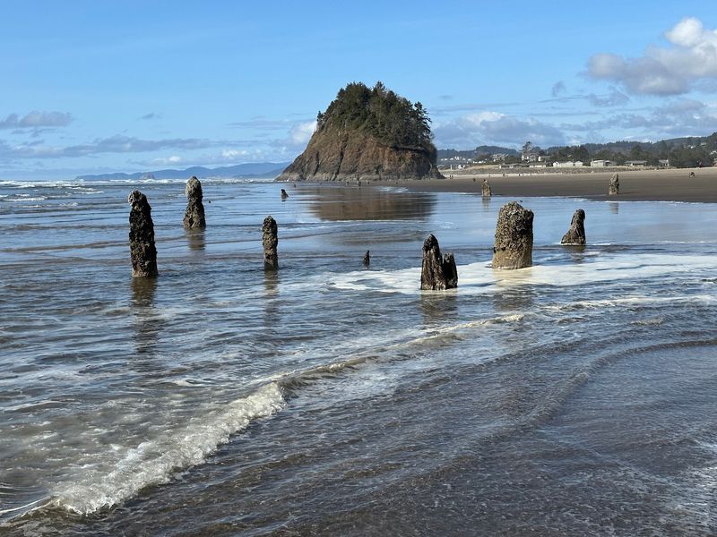
Low tide is your ticket here. When the water pulls back at Neskowin, dozens of ancient tree stumps appear on the beach, roughly 2,000 years old.
The stumps poke up from the sand and surf like a forest that wandered onto the shore. At higher tides, many of them are underwater, so check a tide chart before you go.
You also need low tide to cross the creek and see the stumps up close. Proposal Rock, a big forested sea stack, sits nearby and adds to the photos.
This Tillamook County beach is a fun one for kids, with a little stream to explore. It is a good reminder that the coast keeps a few secrets until the tide lets you in.
8. Crack-in-the-Ground, Silver Lake
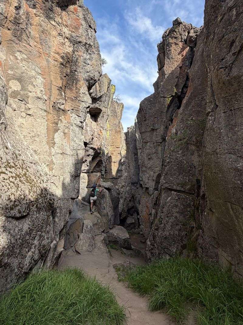
The name is honest. Crack-in-the-Ground is a long volcanic fissure near Silver Lake that you can actually walk down into.
Up top, the land is flat desert. Down inside, rock walls rise on both sides and the air stays cooler, which makes it a smart stop on a hot day.
The trail to the crack is short, and there is a free parking lot and a restroom. Expect some rock scrambling once you are inside.
The drive in is on a bumpy road, so take it slow. This site is managed by the Bureau of Land Management, and it is a fun surprise in the middle of central Oregon.
9. Crater Lake
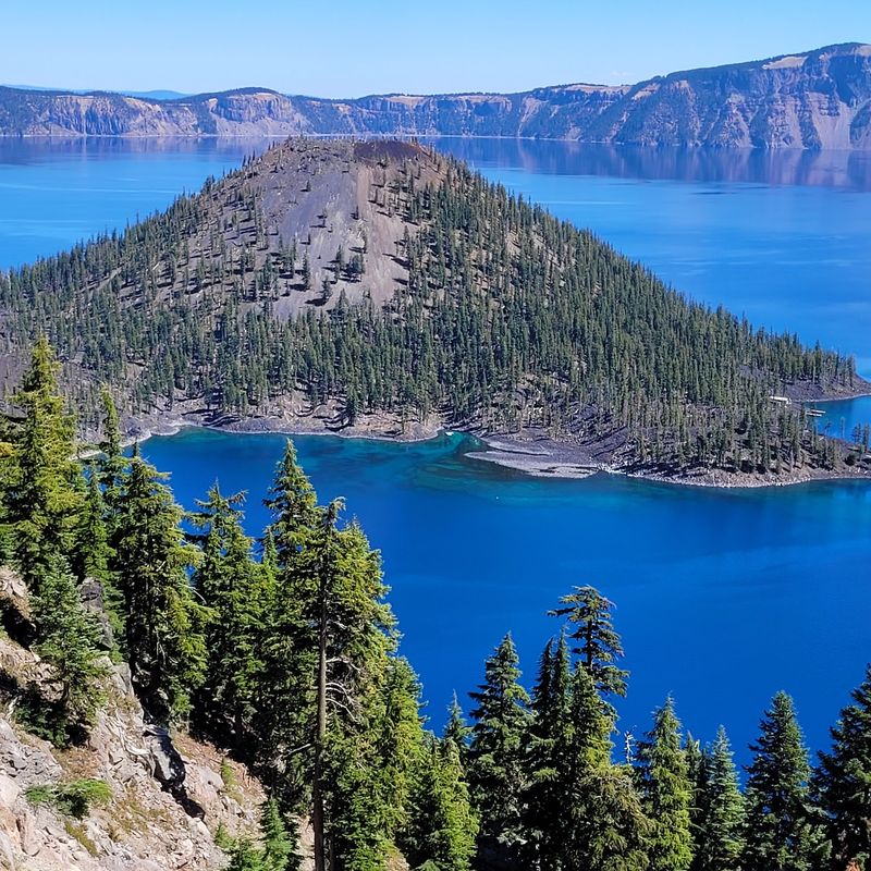
Ask anyone who has seen it, and they will say the blue is real. Crater Lake sits inside a collapsed volcano in southern Oregon, and its deep, clear water is famous for that bold color.
Scenic drives and hiking trails offer different views around the rim. Every overlook shows the lake from a new angle.
Weather can change fast here, and winter can limit access. Check conditions before you head out.
This is Oregon’s only national park, and it earns its spot on any list of strange wonders. Your photos may look edited, but they will not be.
10. Oregon Caves National Monument & Preserve, Cave Junction
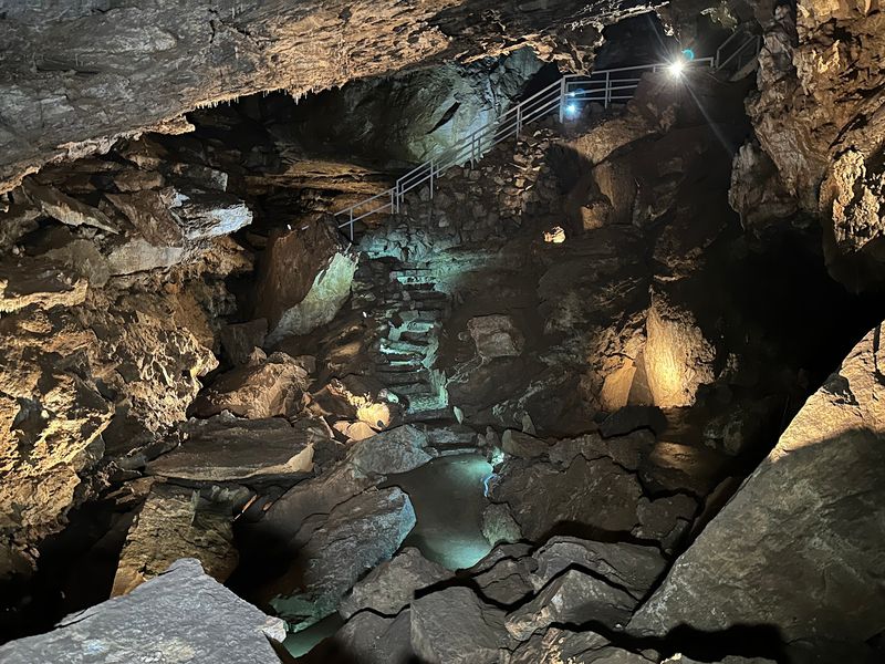
Bring a jacket, even in summer. The marble caves near Cave Junction stay around 44 degrees, and the guided tour lasts about an hour and a half.
Park rangers lead visitors through about a mile of passages filled with stalactites, stalagmites, and columns. The cave formed in marble, which is uncommon and part of what makes it a national monument.
Hours generally run from about 9 or 9:30 a.m. to 5 p.m., so check the park website before you go. There is a free parking lot, picnic tables, and public restrooms.
Kids tend to enjoy the tour and nearby hiking trails. It is a great choice for southern Oregon families looking for a cool day trip.
11. Leslie Gulch, Jordan Valley
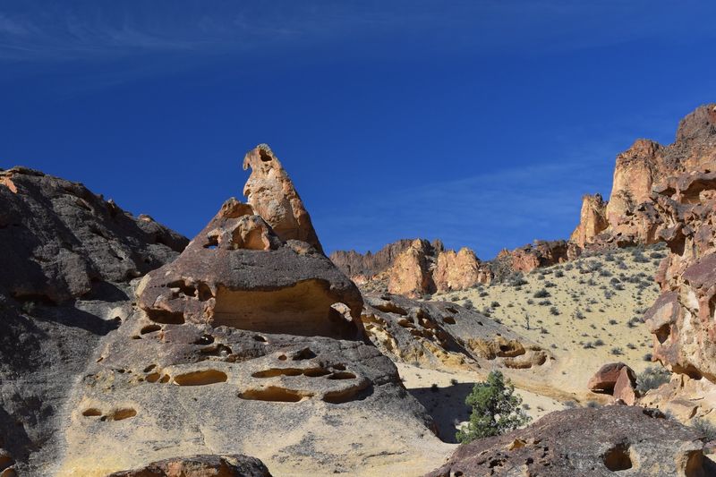
Getting there is half the story. Leslie Gulch sits at the end of a rugged dirt road drive of more than 20 miles into a canyon in Malheur County.
The reward is a city of tall red and orange rock formations made from volcanic ash. Many of the walls are carved into odd shapes and honeycomb patterns.
Bighorn sheep live in the area, and there is a campground along with hiking and picnic spots. The canyon road eventually leads toward a lake.
It is remote and quiet, so plan with care. Dogs are allowed, and kid-friendly hikes make it easier to explore as a family.
12. Pillars of Rome, Jordan Valley
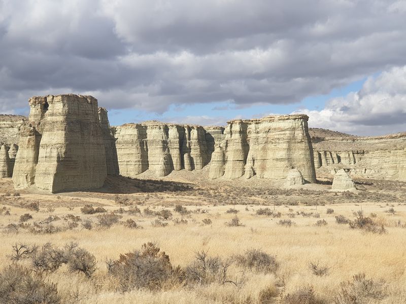
Some people say these cliffs look like Roman ruins, and the name proves it. The Pillars of Rome are pale rock formations about 100 feet tall in southeastern Oregon.
The formations stretch roughly five miles long and two miles wide. They are a historical landmark, and they show up as a surprise in wide open country.
Keep in mind that the pillars sit on private property. You can only view them from the roadway, so bring a zoom lens.
It makes a quick side trip from Rome, and it is a fitting final stop for a list of places that look made up.
Share this story