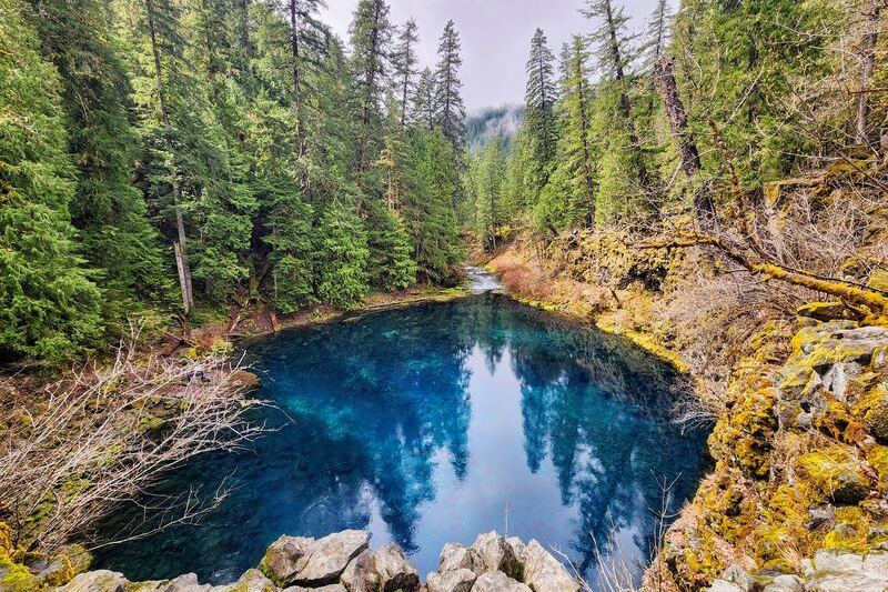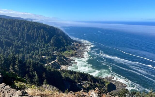
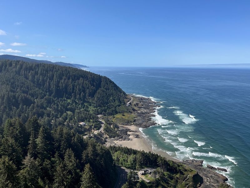
Some views make you stop talking for a minute. High on the central Oregon Coast near Yachats, there is a stone lookout where the ocean seems to stretch past the edge of the map. On a clear day, the coastline unrolls for miles in both directions, and the forest runs right down to the waves.
People drive up early to paint it, hike up to earn it, and come back again when fog hides it the first time. This spot has a 1930s history, a famous set of rocky wonders far below, and a few tricky details about parking and finding the turn. Keep reading to learn how to get there, what it costs, which trails lead up, and why so many Oregonians treat this place like an old friend worth protecting.
A Stone Lookout Above Yachats
Eight hundred feet up is a fine altitude for perspective. Cape Perpetua Overlook sits at Cape Perpetua Lookout, Yachats, OR 97498, on the central coast of Oregon in the United States.
It is listed as a tourist attraction, but that label feels a bit modest. The spot is a high viewpoint on a forested headland, reachable by a short scenic drive or by hiking trails from below.
At the top, you will find a historic stone shelter, a few short paths, picnic tables, and a vault toilet. That is the whole list of amenities, and nobody seems to mind.
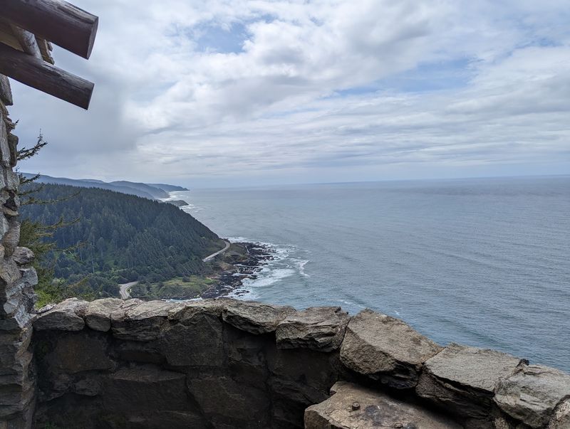
The real feature is the view. From roughly 800 feet above the Pacific, the coastline runs for miles, with forest-covered mountains on one side and open ocean on the other.
On a clear day, the view is said to reach about 70 miles along the coast. That is a long way to look without a telescope.
The overlook earns a 4.9-star average from more than 700 people, which is about as close to unanimous as a viewpoint gets. The rest of this story explains why the climb, by car or by boot, keeps pulling people back.
Built by the Civilian Conservation Corps
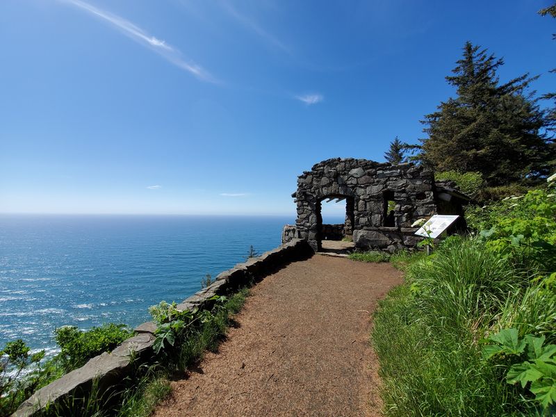
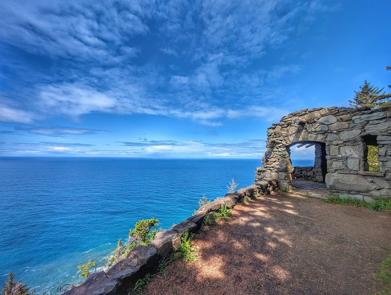
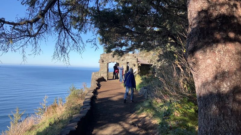
History at this lookout comes with walls. The stone shelter near the overlook was built by the Civilian Conservation Corps in the middle 1930s.
The CCC was a Depression-era program that put young workers on public land projects across the country. Here, their work became a sturdy shelter that still stands at the top of the headland.
Often called the West Shelter, the structure sits along the Whispering Spruce Trail. It works as a lookout, a resting spot, and a natural frame for photographs.
For Oregonians who care about keeping familiar places intact, this shelter is a quiet success story. Nearly a century later, it still does the job it was built for.
The building is small, and that is part of its charm. You do not need a guided tour to appreciate it, just a few minutes and a clear sky.
It also adds a human layer to a place that could easily be all scenery. Standing next to stones placed by hand in the 1930s makes the view feel a little more earned, even if you drove up.
The 70-Mile Coastline Question
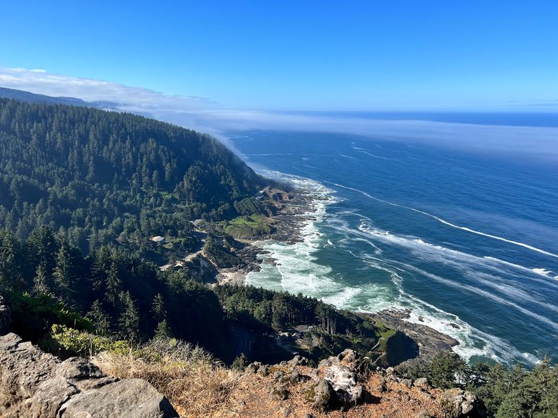
Seventy miles is the number that gets people talking. On a clear day, the view from the overlook reportedly stretches about that far along the coastline.
The southern view is the headliner. The coast curves away in a long line of rocky shore and green hills, with the open Pacific filling everything else.
Looking north takes a little more effort. Trees partly block that direction from the main shelter, but walking around the trail opens up views far up the north coast.
Out at the horizon, the sky and ocean seem to meet with no clear line between them. That is the effect the headline of this article is chasing, and on a good day it delivers.
Some people expect a full 360-degree sweep and find the forest has its own plans. Even so, you can see a long way in both directions.
There is also a fun bonus for road trippers. From up here, it is possible to spot places you visited lower on the coast, turning the lookout into a kind of living map of your trip.
Thor’s Well and Friends Below
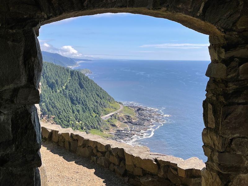
Far below the shelter, the coast puts on a different kind of show. The overlook offers views of Devil’s Churn, Thor’s Well, and Cooks Chasm.
These are some of the most famous rocky features on this part of the Oregon Coast. Waves crash into the rugged basalt shoreline, and from 802 feet up, you get the full layout at once.
Thor’s Well is the one many people look for first. From the stone structure at the top, you can look right down toward it.
Seeing these spots from above is a very different experience than standing beside them. Down at sea level, you see one feature at a time.
Up top, the whole shoreline makes sense as a single system of coves, chasms, and rock shelves. It is a geography lesson without the homework.
A smart plan is to visit both levels. Check out the features up close, then drive or hike up and find them again from the shelter, like a scavenger hunt with a very good vantage point.
Whispering Spruce Trail Loop
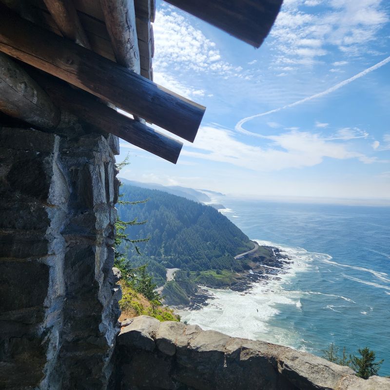
Short trails can still carry big payoffs. The Whispering Spruce Trail is the easy loop at the top of the headland, and it leads to the historic stone shelter.
The path is a well-groomed forest floor, easy to walk, and mostly level. It is the kind of trail where you spend more time stopping for views than catching your breath.
Along the way, the scenery changes from the southern coast to glimpses far up the north coast. A few different places along the route invite you to sit for a while.
Keep a few things in mind:
Steep drop-offs sit right near the trail, so little kids should stay close. Parts of the path can be muddy even in drier weather, so wear suitable shoes.
For people who are not up for a long climb, this is the sweet spot. You get the shelter, the history, and the big view with a short walk from the parking area. A couple of other short, easy trails branch off the lookout too, if you want a little more time in the trees.
The Steep Way Up
Some people prefer their views earned. The St. Perpetua Trail climbs from the visitor center to the overlook, and it does not hold back.
The route is about 2.8 miles round trip, with switchbacks that gain around 700 to 800 feet. Expect roughly 800 feet of climbing in about 1.6 miles one way.
The good news is that the trail is in good condition and pretty regular. It is steady work, not a scramble.
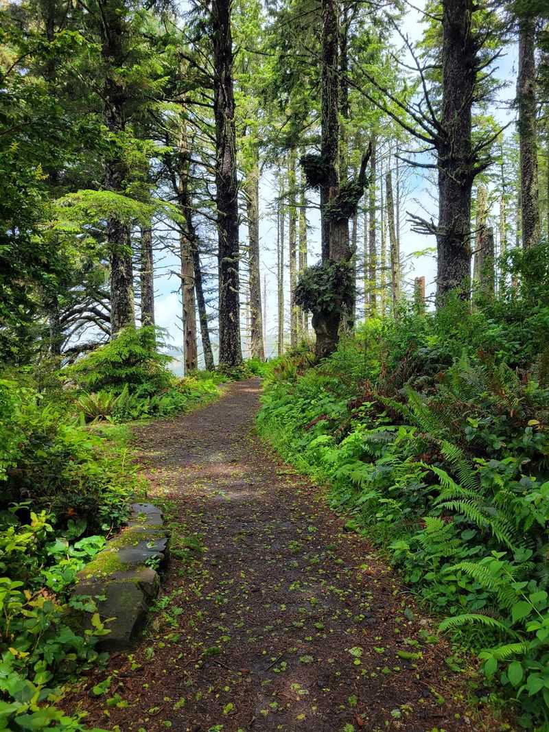
Old-growth spruce forest lines the path, with lush undergrowth and wildflowers, including pink foxgloves. Informative signs and maps help you learn about the local ecosystem and wildlife as you go.
One clever bit of trail design is the reveal. The views open up only in the last few hundred feet, so the payoff arrives right when your legs are asking questions.
The return climb is the tougher part on longer loops, so pace yourself. Bring water, wear comfortable hiking shoes, and give yourself plenty of time. Some groups spend close to four hours exploring, with frequent breaks along the way.
Linking Up With the Amanda Trail
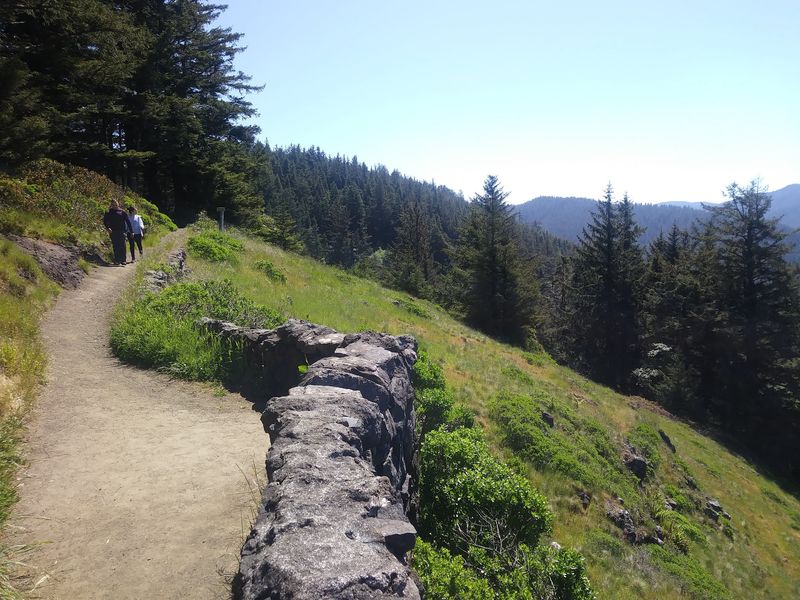
For hikers with energy to spare, the overlook does not have to be the finish line. You can loop toward the Amanda Trail, which runs about 2.9 miles one way to Yachats.
That connection turns a viewpoint visit into a real coastal hike. It links the headland with the town below on foot.
The trail options here are part of why the word trails comes up more than any other topic tied to this place. There are several routes that will challenge you, plus a handful of moderate hikes.
Planning matters on a longer outing. Check your route at the visitor center, carry water, and know how you plan to get back before you start.
Many travelers spend the night in Yachats and start at Cape Perpetua the next morning. A trail connection to town makes that plan even easier for people who like to walk.
Not everyone needs a multi-mile day, of course. It is just nice to know that the overlook is a hub, with paths heading off in several directions for whoever wants them.
Fog, Patience, and Second Chances
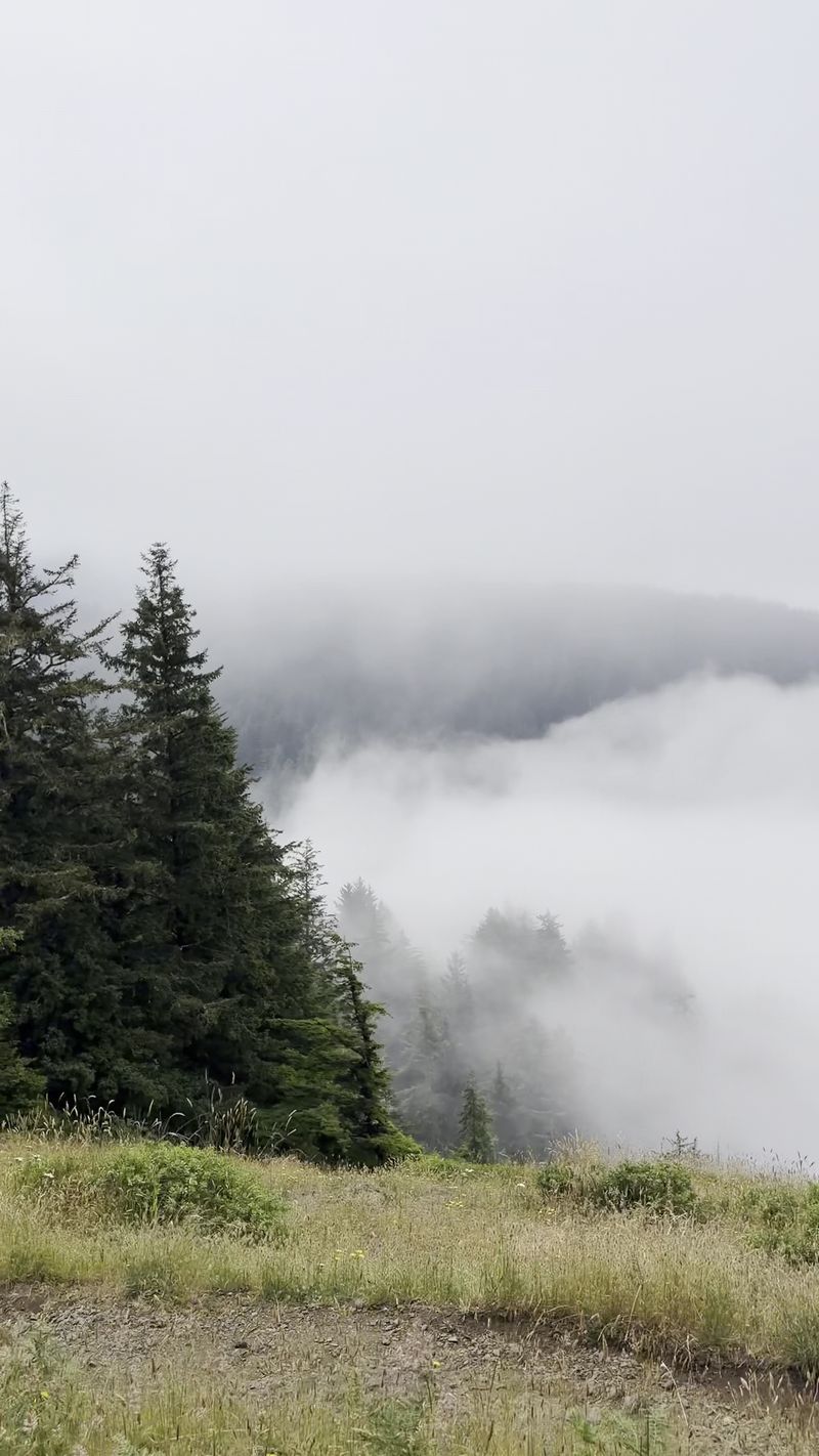
Weather writes its own schedule on the Oregon Coast. Fog can roll in and cover the overlook so thoroughly that some people see almost nothing on their first trip.
Plenty of them still call the visit worth it. Low clouds drifting through the forest create a mysterious, dreamlike setting that has its own appeal.
Then there are the second trips. Groups who were fogged out once often come back and finally get the full view, sometimes picking out the places they stopped on the earlier visit.
So what can you do about it?
Build some flexibility into your coast plans if possible. If the headland is socked in, explore lower trails or nearby sights and check again later.
Patience is a real travel tool here. The view is not going anywhere, and it has a habit of rewarding people who give it another chance. Think of a foggy visit as a preview rather than a miss.
Sunset Seats and Picnic Tables
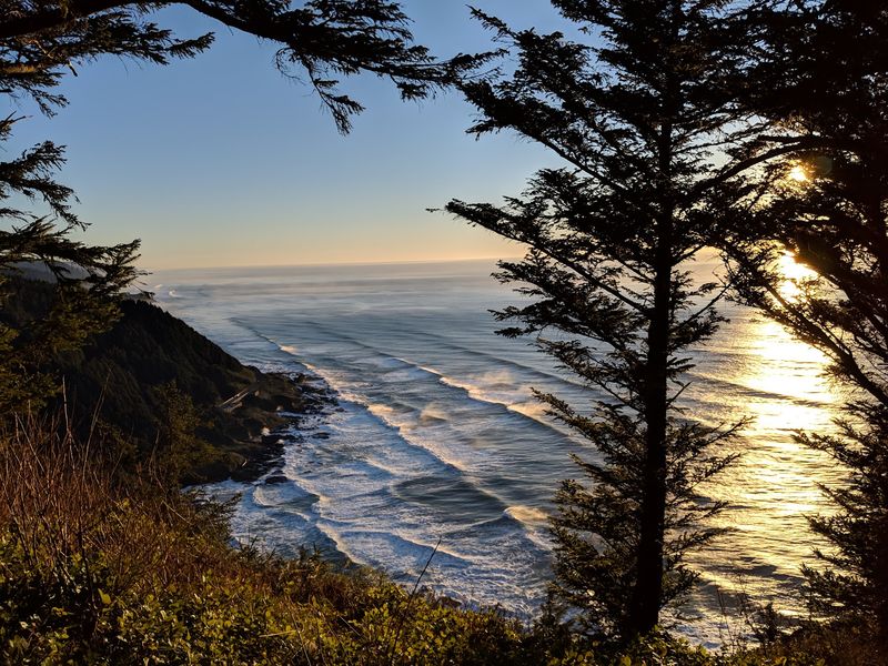
Evening may be the overlook’s best-kept trick. It is known as a great sunset spot, with a few different places to sit and take it all in.
Since the area is open 24 hours, timing your trip around the evening sky is easy. There is no gate to race before dark.
A small picnic table near the viewpoint makes lunch with a view a real option. Several picnic tables are scattered around the lookout area, so pack something and take your time.
Keep walking past the parking area to reach the little stone house. Every spot along the way has something to offer, so there is no wrong place to settle in.
Bring layers, since coastal weather changes quickly up high. A flashlight helps for the walk back to the car after the sun goes down.
Watching the sky over the Pacific from 800 feet up is a simple plan. It also happens to be the kind of evening that people talk about long after their trip ends.
Painters, Birders, and Early Risers
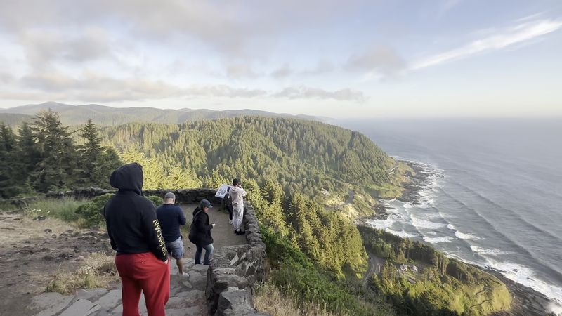
By 9 a.m., the lot can already look like a club meeting. Locals arrive to paint, while hikers, birdwatchers, bicyclists, and sightseers fill in the rest of the spaces.
That mix says a lot about the place. It is not just a quick stop for out-of-towners, it is part of everyday life for people on this stretch of coast.
Families like the easy walk to the shelter. Hikers like the steep trail options, and photographers like the world-class compositions that seem to appear at every turn.
There is room for quieter visits too. For some, the overlook has become a place to work through big emotions, a meeting point of nature and calm reflection.
Even drone pilots show up. One flyer managed to lose a drone here and actually recover it, which is probably the luckiest story on the whole headland.
Whatever brings you, the crowd is friendly and focused on the same thing. Everyone is there for the view, and everyone gets a turn.
Finding the Unmarked Turn
Here is the tricky part. The turn for the overlook is easy to miss, partly because the sign does not say overlook.
The access point is on Highway 101 South at mile marker 166.9. Look for the sign for the Cape Perpetua campground, which is the road for the drive to the summit.
Head up the hill, then turn left. There is a sign at that point to guide you the rest of the way.
Do not drive into the campground itself expecting to park. It is a large campground, and parking there is for people with a reserved spot.
The visitor center is the next turnoff after the summit road. Drivers heading north on 101 sometimes pass it before noticing, so watch closely if you want to stop there too.
Once you know the pattern, it is simple. Campground sign, up the hill, left turn, and the coast opens up in front of you.
A Curvy Drive and a Small Lot
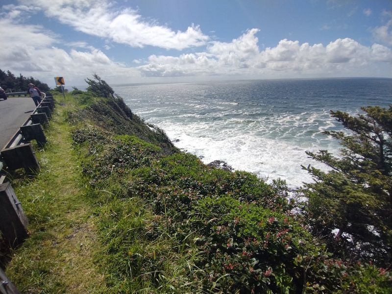
Good news for drivers of tiny cars. The road to the top is a little curvy, but a small city car can make it up the mountain with no issues.
The drive is short and scenic. It takes you nearly to the summit, which means the hike from the car to the shelter is just a brief walk.
Parking is the real challenge. The lot is not huge, and on nice days, weekends, and summer afternoons, it fills up fast.
When the lot is full, some people park down the road and walk a little farther. It adds a few minutes, nothing dramatic.
Arriving early is the best strategy. One early group got there just before 9 a.m. and found the lot filling, and by the time they left an hour later, it was close to full.
On quieter days, parking is not overcrowded at all. A weekday visit or an off-season trip can make the whole experience feel relaxed and roomy.
Five Dollars and Other Passes
Some of the best views on the coast come with a very small price tag. Day use at Cape Perpetua costs $5 per vehicle.
That fee is the kind of concrete, everyday cost Oregon families can plan around. It keeps a world-class viewpoint well within reach.
There are several ways to pay:
Buy a digital day pass through Recreation.gov. Use the automated machines on site, or purchase a physical pass at the Visitor Center.
Frequent coast travelers have other choices. The Oregon Pacific Coast Passport costs $35 for an annual pass or $10 for a 5-day pass.
The America the Beautiful Pass is also valid for entry at federal sites like this one. If you already own one, keep it handy.
Hours are simple too. The overlook is open 24 hours a day, every day of the week, so early starts and sunset visits both work. A vault toilet is available at the top, which is handy after a long drive.
Worth the Climb, Worth Keeping
Some places earn their reputation slowly, one clear morning at a time. Cape Perpetua Overlook has done exactly that.
It offers a 1930s stone shelter, a view that can reach about 70 miles, and a direct look down at Thor’s Well. It is open around the clock and costs $5 per vehicle.
You can drive up a curvy road or climb the steep trail through old-growth spruce. Both routes end at the same high perch over the Pacific.
The small hassles are manageable. Watch for the campground sign, arrive early for parking, wear good shoes, and be patient with the fog.
For Oregonians, it is also a reminder of what well-kept public places can mean. Work done by the CCC in the 1930s still serves families, painters, and hikers today.
Pick a clear day, pack a lunch for the picnic table, and give yourself time. The ocean will be waiting at the edge of forever, right where it always is.
Share this story