When most folks think of Texas, they picture wide-open prairies, dusty deserts, and endless flatlands stretching toward the horizon. But tucked away in the far western corners of the Lone Star State are mountain ranges so stunning they rival anything you’d find in Colorado or California. These rugged peaks rise dramatically from the desert floor, offering breathtaking vistas, challenging hikes, and landscapes that seem almost otherworldly.
From the soaring summits of Big Bend to the sky-scraping heights near the New Mexico border, Texas mountains prove that everything really is bigger and more beautiful in this incredible state.
1. Chisos Mountains

Big Bend National Park’s crown jewel rises like a green island from the Chihuahuan Desert, creating one of the most surreal landscapes you’ll ever witness. The Chisos Mountains form the only complete mountain range contained entirely within a U.S. national park, making them genuinely unique in the American Southwest. When you first catch sight of these peaks from the desert floor, the contrast between bare rock and unexpected pine forests creates an almost dreamlike quality that photographs simply can’t capture.
The highest points reach over 7,800 feet, which doesn’t sound massive until you realize they’re surrounded by desert sitting at 2,000 feet. That dramatic elevation change creates microclimates where Douglas fir and Arizona cypress thrive alongside cacti and agave. It’s like nature couldn’t decide between creating Colorado or Arizona, so it made both in one place.
Hiking trails wind through every elevation zone, from desert scrub to mountain woodlands. The Window Trail takes you to a natural stone frame that perfectly captures the desert sunset, while the South Rim offers panoramic views that stretch into Mexico. These aren’t casual strolls though—the terrain demands respect and preparation.
Wildlife here adapts to extreme temperature swings, with black bears roaming the higher elevations and javelinas patrolling the lowlands. Mountain lions also call these peaks home, though spotting one requires serious luck. The Carmen Mountains White-tailed Deer, found nowhere else on Earth, grazes in the mountain meadows.
Summer temperatures can hit triple digits in the basin while remaining pleasant at higher elevations, making the mountains a literal refuge. Winter occasionally brings snow to the peaks, transforming the landscape into something that looks completely un-Texan. Spring wildflowers carpet the slopes in colors that seem too vibrant to be natural, especially after good winter rains blanket the region.
The remoteness adds to the magic—Big Bend sits hours from any major city, meaning the night skies explode with stars you forgot existed. The Chisos Basin, nestled among the peaks, offers lodging and camping that puts you right in the heart of this mountain wonderland, where every sunrise paints the rocks in shades of gold and crimson.
2. Guadalupe Peak

Standing at 8,751 feet, Guadalupe Peak claims the title of highest point in Texas, and it wears that crown with serious attitude. This pyramid-shaped summit dominates Guadalupe Mountains National Park, visible for miles across the surrounding desert. The peak itself is actually an ancient marine fossil reef from when shallow seas covered this region 265 million years ago, which explains the limestone composition and the marine fossils you’ll spot along the trail.
The hike to the top covers 8.5 miles round-trip with an elevation gain of nearly 3,000 feet, which sounds manageable until you’re actually doing it. The trail starts in Chihuahuan Desert scrubland and climbs through multiple ecological zones before reaching the exposed summit. Wind at the top can knock you sideways, and weather changes faster than you can check your phone.
Early morning starts are essential, especially in summer when afternoon temperatures make the exposed sections genuinely dangerous. Carry more water than you think you need—dehydration sneaks up fast at this elevation in the dry West Texas air. The trail is well-maintained but relentlessly steep in sections, with switchbacks that seem to go on forever.
At the summit, a stainless steel pyramid monument marks Texas’s highest point, installed in 1958 to commemorate the centennial of the Butterfield Overland Mail Route. The views from up there stretch across three states and into Mexico on clear days. You can see El Capitan’s massive cliff face, the salt flats stretching toward Dell City, and mountain ranges layering into the distance like a geography lesson come to life.
Sunrise and sunset transforms the landscape into something almost spiritual, with light painting the white limestone peaks in shades of pink, orange, and gold. Many hikers tackle this as a pre-dawn adventure to catch sunrise from the summit, which requires headlamps and extra caution on the rocky sections. The experience of watching day break from Texas’s rooftop makes every challenging step worthwhile.
Wildlife encounters include mule deer, elk reintroduced to the park, and occasionally mountain lions. The mountain mahogany and ponderosa pine at higher elevations provide surprising shade and greenery that feels impossible given the desert surroundings below.
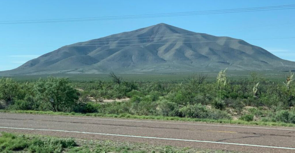
3. Elephant Mountain

From certain angles along Highway 118 south of Alpine, this mountain really does look like a reclining elephant, complete with trunk and head. The resemblance isn’t subtle either—once someone points it out, you can’t unsee the massive pachyderm lounging across the landscape. This quirky geological formation has become a favorite photo stop for travelers heading to Big Bend, proving that nature has a sense of humor.
The mountain sits in the northern reaches of Big Bend Ranch State Park, Texas’s largest state park spanning over 300,000 acres of raw Chihuahuan Desert. Unlike its more famous neighbor Big Bend National Park, this area sees fewer visitors, which means more solitude and unspoiled wilderness. The remoteness is real—cell service disappears, and the nearest gas station might be an hour away.
Geologically, Elephant Mountain formed from volcanic activity millions of years ago, part of the same processes that created much of the dramatic landscape in this region. The darker volcanic rock contrasts beautifully with lighter limestone formations nearby, creating a patchwork of colors that shifts throughout the day. Erosion carved the distinctive elephant profile over countless millennia, with wind and occasional rain sculpting the softer rock.
Hiking around the base offers close-up views of desert vegetation perfectly adapted to extreme conditions. Ocotillo plants wave their spindly arms skyward, bursting into red blooms after rains. Lechuguilla agave, creosote bush, and various cacti create a spiky garden that’s beautiful and unforgiving in equal measure.
The area around Elephant Mountain provides habitat for desert bighorn sheep, though spotting these elusive animals requires patience and binoculars. Roadrunners dart across the highway, and golden eagles soar on thermals rising from the heated desert floor. At night, the chorus of coyotes echoes off the mountain slopes, creating an authentic Old West soundtrack.
Photographers love the changing light on Elephant Mountain, particularly during golden hour when the setting sun illuminates the formation in warm tones. Storm clouds gathering behind the peak create dramatic scenes that look almost painted. The mountain’s profile works best from the north, so travelers heading south from Alpine get the classic elephant view that’s become iconic in West Texas travel photography.
4. Mount Locke

Astronomers chose Mount Locke for a reason—at 6,791 feet in the Davis Mountains, this peak offers some of the darkest skies in North America. The University of Texas McDonald Observatory crowns the summit with gleaming white domes housing powerful telescopes that peer deep into the cosmos. When you visit during their star parties, you’ll understand why scientists traveled to this remote corner of Texas to study the universe.
The drive up Mount Locke winds through scenic Highway 118, climbing steadily through grasslands that transition to juniper and oak woodlands. The air gets noticeably cooler as you gain elevation, a welcome change from the desert heat below. The observatory campus itself looks almost futuristic perched on the mountaintop, with the massive Hobby-Eberly Telescope dome dominating the skyline.
Public programs at McDonald Observatory rank among the best stargazing experiences anywhere in the United States. During evening star parties, visitors use high-powered telescopes to view planets, nebulae, and distant galaxies while knowledgeable guides explain what you’re seeing. The lack of light pollution means the Milky Way stretches overhead like a cloudy river of stars, visible to the naked eye in ways impossible near cities.
Daytime solar viewing programs let you safely observe our sun’s surface features, including sunspots and solar flares. The Visitors Center houses fascinating exhibits about astronomy, space exploration, and the observatory’s research contributions. Interactive displays make complex cosmic concepts accessible even if your last science class was decades ago.
The surrounding Davis Mountains create their own beauty independent of the observatory. These sky islands support ecosystems found nowhere else in Texas, with Montezuma quail and black bears inhabiting the higher elevations. The cooler temperatures and increased rainfall compared to surrounding lowlands create lush pockets of vegetation that seem transplanted from more northern latitudes.
Fall brings spectacular color as oak and maple leaves turn golden and red, while summer afternoons often feature dramatic thunderstorms rolling across the peaks. Winter can bring light snow to the summit, temporarily closing the observatory road but creating postcard-worthy scenes. Sunrise from Mount Locke paints the surrounding mountains in layers of purple and pink, while sunset turns the western sky into a canvas of orange and crimson.
5. Sierra Blanca Peak

Not to be confused with its more famous New Mexico neighbor, Texas’s Sierra Blanca Peak rises to 6,890 feet in remote Hudspeth County. The name means “white mountain” in Spanish, referring to the pale limestone that caps the summit and reflects sunlight like a beacon across the surrounding desert. This peak sits so far off the beaten path that many Texans don’t even know it exists, which keeps it blissfully uncrowded.
The mountain anchors the Sierra Blanca range, a small but rugged group of peaks that rise abruptly from the flat Chihuahuan Desert. From a distance, these mountains appear as a jagged wall of rock, their slopes too steep for easy access. The limestone formations create dramatic cliffs and outcroppings that glow almost white against the deep blue West Texas sky.
Access to Sierra Blanca Peak requires crossing private ranch land, so hiking opportunities are limited compared to peaks in national or state parks. The remoteness and restricted access have preserved the area’s wild character, with minimal human impact visible on the landscape. When you do manage to explore this region, you’ll find yourself in terrain that feels genuinely untouched and primeval.
Desert bighorn sheep once roamed these mountains before being hunted to local extinction, though reintroduction efforts in nearby ranges offer hope for their eventual return. Mule deer still navigate the rocky slopes, and mountain lions patrol territories that span dozens of square miles. The isolation makes this prime habitat for animals that need space away from human activity.
Vegetation clings to life in rock crevices and washes, with yucca, sotol, and various cacti creating sparse but hardy plant communities. After rare rains, wildflowers explode across the bajadas at the mountain’s base, transforming the landscape from brown to brilliant yellow and purple. These brief blooming periods attract pollinators from across the region, creating temporary oases of activity.
The views from Sierra Blanca Peak, when accessible, stretch across seemingly endless desert to distant mountain ranges in every direction. On exceptionally clear days, you can see into Mexico and New Mexico, with the curvature of the Earth visible on the horizon. The silence up there feels almost physical, broken only by wind whistling through rock formations and the occasional cry of a red-tailed hawk soaring on thermals.
6. Guadalupe Mountains

This entire mountain range deserves recognition beyond just its highest peak, forming one of the most spectacular and geologically significant landscapes in Texas. The Guadalupe Mountains stretch roughly 40 miles from north to south, straddling the Texas-New Mexico border with the majority of the range protected within Guadalupe Mountains National Park. These aren’t your typical rolling hills—they’re a massive uplifted block of ancient reef limestone creating sheer cliffs, deep canyons, and distinctive pyramid-shaped peaks.
The fossil reef that forms these mountains represents one of the best-preserved examples of its kind anywhere on Earth. About 265 million years ago, a shallow tropical sea covered this region, and a massive reef system thrived along its edge. When the sea evaporated and geological forces uplifted the reef, it became the mountains we see today, complete with fossilized sponges, algae, and marine organisms embedded in the rock.
McKittrick Canyon, carved into the eastern face of the range, creates a slash of green through the desert landscape. This canyon supports a rare desert stream that flows year-round, nourishing groves of bigtooth maple, Texas madrone, and ponderosa pine. Fall transforms McKittrick Canyon into a riot of color when the maples turn brilliant red and gold, creating scenes that rival New England’s autumn displays.
The western escarpment rises dramatically from the desert floor, with El Capitan’s massive limestone face serving as a natural landmark visible for miles. This vertical wall of rock catches the light at different times of day, glowing golden at sunrise and deep orange at sunset. The escarpment creates its own weather patterns, with clouds forming along the ridgeline and occasional snow dusting the peaks even when the desert below remains dry.
Wildlife thrives in the varied habitats created by the mountains’ elevation changes. Elk herds, reintroduced in recent decades, now roam the higher elevations and canyons. Black bears occasionally wander down from New Mexico populations, and mountain lions maintain territories throughout the range.
Over 300 bird species have been documented here, making it a premier destination for birders seeking species at the edge of their ranges.
Hiking trails range from easy nature walks to challenging backcountry routes that require overnight permits and serious preparation. The Bowl, a high-elevation forest tucked into the mountains’ interior, feels like stepping into a different climate zone entirely, with tall conifers and cool temperatures even in summer.
7. North Franklin Mountain

El Paso’s backyard mountain rises 7,192 feet right at the edge of Texas’s largest border city, creating one of the most accessible wilderness experiences in the state. North Franklin Mountain anchors Franklin Mountains State Park, the largest urban park in the United States, where you can literally drive from downtown El Paso to desert wilderness in about fifteen minutes. The mountain’s proximity to a major city makes it feel almost out of place, like someone dropped a chunk of wild country into an urban setting.
The Franklin Mountains form a narrow range running roughly north-south through El Paso, with North Franklin as the highest point. These mountains are much older than the volcanic peaks farther south, composed primarily of Precambrian igneous and metamorphic rocks dating back over a billion years. The ancient geology creates different colors and textures compared to the younger limestone peaks elsewhere in West Texas.
Hiking trails crisscross the mountain, offering everything from easy interpretive walks to strenuous summit climbs. The Ron Coleman Trail leads to the top of North Franklin, gaining about 3,000 feet over roughly four miles. It’s a workout that rewards you with panoramic views of El Paso, Juárez across the Rio Grande, and mountain ranges stretching into New Mexico and Mexico.
Desert vegetation adapted to the extreme conditions thrives here, with ocotillo, creosote, and various cacti covering the slopes. Lechuguilla agave sends up impressive flowering stalks that can reach fifteen feet tall, though individual plants only bloom once before dying. The rocky terrain provides habitat for desert wildlife including roadrunners, jackrabbits, and the occasional rattlesnake basking on sun-warmed rocks.
The mountain’s position creates dramatic temperature inversions, with cold air settling in the valleys while higher elevations remain warmer on winter nights. Summer heat can be intense, making early morning or evening hikes essential for safety and comfort. Always carry more water than seems necessary—the dry air and elevation conspire to dehydrate you faster than you’d expect.
Rock climbing enthusiasts find challenging routes on North Franklin’s cliffs and faces, with granite and metamorphic rock providing solid holds and interesting features. The park also accommodates mountain biking on designated trails, though the rocky, technical terrain demands skill and attention. Sunset from the upper slopes paints the city below in golden light while the mountains cast long shadows across the desert, creating scenes that capture El Paso’s unique character as a city embraced by wilderness.
8. Mount Livermore

At 8,378 feet, Mount Livermore claims the title of second-highest peak in Texas, though it’s far less visited than Guadalupe Peak. This summit crowns the Davis Mountains in Jeff Davis County, creating the highest point in these sky island ranges. The mountain sits on private land within a nature conservancy, which means access requires permission and coordination, keeping the peak pristine and uncrowded.
The Davis Mountains differ dramatically from the desert ranges farther west, receiving more rainfall and supporting extensive woodlands of oak, juniper, and pine. Mount Livermore’s upper slopes host ponderosa pine and Douglas fir communities more typical of mountains in Colorado or New Mexico. The cooler, wetter conditions create an island ecosystem where plants and animals isolated from similar habitats hundreds of miles away have evolved unique characteristics.
The Nature Conservancy manages much of the mountain and surrounding lands to protect these rare habitats and the species that depend on them. Montezuma quail, a bird species at the northern edge of its range, finds ideal habitat in the mountain’s oak grasslands. Black bears have returned to the Davis Mountains after being absent for decades, with Mount Livermore’s remote forests providing secure denning sites.
Geology here tells a different story than the ancient reefs of the Guadalupe Mountains. The Davis Mountains formed from volcanic activity roughly 35 million years ago, with eruptions building up layers of ash and lava that erosion later carved into peaks and canyons. The volcanic soils support richer plant growth than the limestone peaks elsewhere in West Texas.
Views from Mount Livermore encompass an enormous swath of West Texas, with the Chisos Mountains visible to the south on clear days and ranges in New Mexico marking the northern horizon. The summit area features weather-stunted trees shaped by constant wind, their branches growing only on the leeward side. Wildflowers bloom in high meadows through summer, attracting butterflies and hummingbirds.
Weather on Mount Livermore can change rapidly, with afternoon thunderstorms common in summer months. Lightning poses a serious hazard above treeline, and fog can roll in quickly, reducing visibility to yards. Winter brings snow to the summit, sometimes accumulating several feet and persisting for weeks.
The seasonal changes create dramatically different landscapes, from snow-covered winter wonderland to green summer forest to golden autumn hillsides when the oaks turn color.
9. Beach Mountains

The Beach Mountains rise from the desert in Culberson County, a small but rugged range that most people drive past without a second glance. These peaks don’t reach the heights of their more famous neighbors, topping out around 5,500 feet, but they possess a stark beauty that grows on you the longer you look. The volcanic rock creates darker tones than the limestone peaks nearby, and the erosion patterns have carved interesting shapes into the cliffs and ridges.
Located between the Delaware Mountains to the east and the Guadalupe Mountains to the west, the Beach Mountains occupy a transitional zone where different desert ecosystems meet. This creates unusually diverse plant communities, with species from the Chihuahuan Desert mixing with those more common in higher elevations. Botanists find this overlap fascinating, as it creates opportunities to study how plants adapt to changing conditions.
The range takes its name from early settlers or surveyors—the origin isn’t entirely clear, which seems fitting for such an under-documented mountain group. Unlike peaks within national or state parks, the Beach Mountains remain largely undeveloped and rarely visited. No maintained trails lead to the summits, and access crosses private land or requires navigating rough, unmarked terrain.
This isolation has preserved the mountains in a remarkably wild state. Desert bighorn sheep occasionally use these peaks, and mountain lion tracks appear in sandy washes after rains. The lack of human activity makes the Beach Mountains valuable as wildlife corridors, connecting larger protected areas and allowing animals to move across the landscape following seasonal food and water sources.
Volcanic dikes and plugs create distinctive geological features, with harder rock resisting erosion while softer surrounding material washes away. These formations stand as dark pillars and walls against the sky, their geometric shapes looking almost artificial. Mineral deposits within the volcanic rock sometimes create colorful bands and patterns, rewarding close examination with unexpected beauty.
Water is scarce in the Beach Mountains, with only ephemeral streams flowing after significant rains. Desert-adapted vegetation clusters in washes and on north-facing slopes where moisture lingers slightly longer. Lechuguilla agave, sotol, and various cacti dominate the plant communities, their spines and waxy coatings reducing water loss in the harsh environment.
Sunsets behind the Beach Mountains create silhouettes of their jagged ridgeline against colorful western skies. The isolation means minimal light pollution, so stars emerge in stunning clarity once darkness falls. The mountains’ quiet, overlooked nature makes them special in a different way than famous peaks—they’re a reminder that beauty doesn’t always demand recognition to exist.
10. Emory Peak

Emory Peak punches up to 7,832 feet, making it the highest point in Big Bend National Park and the Chisos Mountains. The summit requires scrambling up a short but exposed rock face, adding just enough adventure to make reaching the top feel like a genuine accomplishment. From up there, the entire park spreads out below you, with the Rio Grande visible as a silver thread winding through desert canyons and Mexican mountains layering into the distance.
The trail to Emory Peak branches off the popular South Rim route, adding about a mile round-trip to an already substantial hike. Most people start from the Chisos Basin, making this an all-day adventure that covers over ten miles with significant elevation gain. The final pitch to the summit involves pulling yourself up using handholds in the rock, which some hikers find thrilling and others find terrifying—know your comfort level before committing.
Named for William H. Emory, a 19th-century surveyor who mapped the U.S.-Mexico boundary, the peak has served as a landmark for centuries. From certain angles, the summit appears as a distinctive rocky outcrop rising above the surrounding ridgeline, making it easily identifiable even from miles away.
The rock formations at the top include interesting balanced boulders and weathered formations that create natural sculptures.
Wildlife encounters on the trail might include white-tailed deer grazing in mountain meadows or black bears foraging for acorns and berries. The Chisos Mountains support the southernmost black bear population in the United States, though seeing one requires luck. More commonly, you’ll spot Mexican jays, acorn woodpeckers, and maybe a peregrine falcon soaring past the cliffs.
The vegetation changes dramatically as you climb, starting in desert scrub and transitioning through oak-juniper woodlands to pine-oak forests near the summit. This ecological layering happens over just a few miles of horizontal distance, compressed by the rapid elevation change. Each zone supports different plant and animal communities, making the hike feel like traveling through multiple ecosystems.
Weather at the summit can be dramatically different from conditions in the basin below. Wind speeds increase significantly, and temperatures drop about three degrees for every thousand feet of elevation gained. Summer thunderstorms build over the peaks in afternoon, creating lightning hazards that make early starts essential.
Winter can bring freezing temperatures and occasional snow to the summit while the desert below remains pleasant.
The sense of accomplishment reaching Emory Peak comes not just from the physical challenge but from the spectacular scenery earned along the way. Every viewpoint reveals new perspectives on Big Bend’s vast landscape, making this one of the most rewarding hikes in Texas.
11. Chinati Peak

At 7,730 feet, this remote Presidio County peak rises above the Chinati Mountains, overlooking some of the most isolated country in Texas. These mountains sit south of Marfa and north of Presidio, in a region where paved roads are scarce and cell service is a fantasy. The peak itself formed from volcanic activity, part of the same geological processes that created much of the dramatic landscape in the Big Bend region millions of years ago.
The Chinati Mountains don’t receive the attention of their neighbors, partly because access is challenging and partly because they fall outside national park boundaries. Much of the range sits on private land or within remote sections of Big Bend Ranch State Park. This obscurity has preserved the mountains in a wild state, with minimal development and few visitors to disturb the natural rhythms.
Chinati Peak’s volcanic origins created different rock types and colors than the limestone peaks farther north. Dark basalt and lighter rhyolite create a patchwork of tones across the mountain slopes. Erosion has carved the softer volcanic ash into interesting formations, while harder lava flows remain as resistant ridges and cliffs.
The town of Chinati, now a ghost town, once supported silver mining operations in the late 1800s. Remnants of that era still scatter across the landscape—old mine shafts, crumbling stone walls, and rusty equipment slowly being reclaimed by the desert. These historical traces add another layer of interest to the mountains, telling stories of ambitious prospectors who braved this harsh environment seeking fortune.
Desert bighorn sheep find ideal habitat in the Chinati Mountains’ rocky terrain, and reintroduction efforts have helped rebuild populations that had declined. The sheep navigate seemingly impossible cliffs with ease, their specialized hooves gripping the smallest ledges. Watching a bighorn ram leap across a gap that would kill most animals never gets old, even for experienced wildlife observers.
Plant life adapts to the extreme conditions with strategies that seem almost defiant—storing water, growing spines to deter browsers, and timing reproduction to rare rainfall events. The sotol plant sends up tall flowering stalks that can reach twenty feet, creating dramatic vertical elements in the otherwise low desert scrub. After significant rains, wildflowers transform the bajadas into temporary gardens of yellow, purple, and red blooms.
Views from Chinati Peak encompass a vast sweep of the Big Bend region, with mountain ranges visible in every direction and the Rio Grande valley cutting through the landscape to the south. The isolation means exceptionally dark night skies, where the Milky Way appears as a bright band overhead and satellites track slowly across the heavens.
12. Baldy Peak

Baldy Peak reaches 8,085 feet in the Guadalupe Mountains, earning its name from the rounded, relatively bare summit that contrasts with the surrounding forested slopes. The peak sits in the New Mexico portion of the range, but its proximity to the Texas border and connection to the same mountain system makes it relevant to Texas mountain enthusiasts. From various points in Texas, Baldy’s distinctive profile marks the northern extent of the Guadalupe range.
The trail to Baldy Peak starts from the same area as the route to Guadalupe Peak, but heads north into different terrain. This hike sees fewer people despite offering equally spectacular scenery, perhaps because it doesn’t carry the cachet of being a state highpoint. The reduced traffic means more solitude and better chances of wildlife encounters along the trail.
Forests of ponderosa pine, Douglas fir, and southwestern white pine cloak the upper slopes, creating shaded corridors that feel remarkably cool even on hot days. The trees thin out as you approach the summit, revealing the rounded top that gives the peak its name. While not truly bald, the summit supports less dense vegetation than the surrounding ridges, making it stand out visually.
The geology here mirrors the rest of the Guadalupe Mountains—ancient reef limestone uplifted and exposed by tectonic forces. Fossils embedded in the rocks remind you that this entire mountain range once lay beneath a tropical sea. The concept of standing on an ancient ocean floor at over 8,000 feet elevation creates a mind-bending sense of geological time.
Wildlife in the area includes elk that were reintroduced after being hunted to local extinction in the early 1900s. These herds have thrived, and seeing a bull elk bugling during fall rut ranks among the most memorable wildlife experiences available in the region. Black bears also roam these mountains, along with mountain lions, bobcats, and a diverse array of smaller mammals and birds.
The views from Baldy Peak look across the entire Guadalupe range, with the white limestone cliffs of El Capitan dominating the southern horizon. On exceptionally clear days, you can see ranges in Mexico over a hundred miles away. The layering effect of multiple mountain ranges fading into blue distance creates a sense of vast space that’s increasingly rare in our crowded world.
Seasonal changes transform Baldy Peak’s appearance dramatically. Snow can accumulate several feet deep in winter, creating conditions more typical of much higher mountains farther north. Spring brings snowmelt that feeds streams and wildflowers that carpet the meadows.
Fall colors appear in the maples and oaks at lower elevations, while the evergreens maintain their green through all seasons.
13. El Capitan

Rising like a fortress wall from the desert floor, El Capitan’s massive limestone cliff face dominates the southern end of the Guadalupe Mountains. At 8,085 feet, the peak itself matches Baldy Peak in elevation, but its true impact comes from the vertical relief—the western escarpment drops over 2,000 feet in a sheer wall that’s visible for fifty miles across the salt flats and desert. This isn’t a peak you summit casually; it’s a landmark that commands respect and defines the landscape.
The name means “the captain” in Spanish, and it’s easy to see why early travelers gave this formation such a commanding title. The cliff face catches light differently throughout the day, glowing golden at sunrise, white-hot at midday, and deep orange at sunset. Storm clouds gathering behind El Capitan create some of the most dramatic landscape photography opportunities in Texas, with lightning occasionally striking the exposed summit.
Unlike Yosemite’s El Capitan, this Texas version doesn’t attract rock climbers—the limestone is too fractured and unstable for safe technical climbing. Instead, hikers approach from the north through the Guadalupe Mountains, following trails that skirt the peak rather than attempting the vertical face. The trail to the base of El Capitan from the Pine Springs area covers about eleven miles round-trip, offering close-up views of the formation’s geology.
The limestone here represents the edge of that ancient Permian reef, where the reef face dropped off into deeper water. The layering visible in the cliff shows how the reef grew over millions of years, with each band representing a different period of geological history. Marine fossils are abundant in the rock, including sponges, algae, and bryozoans that built the reef structure.
Wildlife uses El Capitan’s cliff face for nesting and denning sites inaccessible to predators. Peregrine falcons nest on ledges high up the wall, raising their young in sites that have probably been used for thousands of years. Golden eagles soar on thermals rising along the cliff, and turkey vultures ride the same air currents, their keen eyesight scanning for carrion below.
The desert at El Capitan’s base supports classic Chihuahuan Desert vegetation—creosote, lechuguilla, sotol, and various cacti. The contrast between the vertical limestone wall and the horizontal desert plain creates a stark beauty that’s uniquely West Texas. After rains, seasonal waterfalls occasionally appear on the cliff face, creating temporary ribbons of white water against the gray rock—a sight so rare that catching it requires serious luck.
14. Shumard Peak

At 8,615 feet, Shumard Peak climbs high in the Guadalupe Mountains, standing as the third-highest peak in Texas and one of the state’s least-visited major summits. The trail to Shumard is long, steep, and remote, which filters out casual hikers and rewards those willing to put in the effort with solitude and spectacular scenery. Unlike Guadalupe Peak with its well-maintained trail and steady stream of hikers, Shumard feels genuinely wild and uncommonly quiet.
The approach follows the Bowl Trail into the high-country forest zone, then branches onto a primitive route that gains elevation relentlessly. The trail passes through multiple ecosystems, starting in desert scrub and climbing through oak-juniper woodlands before reaching the ponderosa pine and Douglas fir forests that cloak the upper elevations. The ecological diversity packed into this vertical climb creates constantly changing scenery and plant communities.
The summit area offers panoramic views that rival anything else in the Guadalupe Mountains. You can see Guadalupe Peak to the south, Baldy Peak to the north, and the white cliffs of El Capitan dropping away to the west. The vantage point provides a unique perspective on the entire range’s structure, making clear how the mountains form a massive uplifted block tilted slightly to the east.
Named for geologist George Shumard, who studied the region’s fossils and rock formations in the 1850s, the peak honors scientific exploration of West Texas. Shumard’s work helped identify the marine origins of the Guadalupe Mountains, recognizing the ancient reef for what it was at a time when such concepts were still developing in geology. Standing on the summit connects you to that history of discovery and understanding.
Wildlife encounters on the trail to Shumard might include elk grazing in mountain meadows or black bears foraging in oak groves. The remoteness and limited human traffic make this prime habitat for animals that prefer avoiding people. Mountain lions maintain territories that include Shumard Peak, though actually seeing one requires extraordinary luck—they’re masters of staying hidden.
Weather on Shumard can be severe, with winter bringing heavy snow and summer afternoon thunderstorms creating lightning hazards. The exposed summit offers no shelter, making weather awareness essential for safety. Wind speeds can reach dangerous levels, and temperature swings between sun and shade, or between morning and afternoon, require layered clothing even in summer.
The length and difficulty of the Shumard hike mean most people tackle it as a long day trip, starting before dawn and returning after dark. Some backpackers camp in the Bowl area, splitting the elevation gain over two days and allowing time to explore the high country’s forests and meadows. Either approach requires solid fitness and preparation, but the reward is experiencing one of Texas’s most spectacular mountains in relative solitude.
15. Hunter Peak

Hunter Peak rises to 8,368 feet in the Guadalupe Mountains, claiming the fourth-highest summit in Texas and offering one of the most rewarding hikes in the range. The trail to Hunter Peak provides a less-crowded alternative to Guadalupe Peak while delivering equally stunning views and dramatic scenery. Many hikers who’ve climbed both actually prefer Hunter Peak for its more varied terrain and the sense of discovery that comes with being on a less-traveled path.
The route to Hunter Peak can be approached from several directions, with the most popular starting at the Pine Springs campground and following the Tejas Trail. This path winds through diverse terrain, crossing desert slopes, climbing through oak and juniper woodlands, and eventually reaching high-elevation conifer forests. The variety keeps the hike interesting and provides constantly changing views and ecosystems to observe.
The summit area features exposed limestone outcrops with enough flat space to rest and take in the panoramic views. From up there, you can see the entire southern Guadalupe range, the salt flats stretching toward Dell City, and on clear days, mountain ranges over a hundred miles away in Mexico. The sense of standing on top of West Texas, looking out over vast distances, creates a perspective that’s hard to achieve anywhere else.
Geological features along the trail tell the story of ancient seas and uplifted reefs. Fossilized marine organisms embedded in the limestone remind you that this entire landscape once lay beneath warm, shallow water. The concept becomes easier to grasp when you’re actually holding a fossil sponge at 8,000 feet elevation, connecting present-day mountains to their underwater origins millions of years ago.
Wildlife along the Hunter Peak trail includes the full range of species found in the Guadalupe Mountains. Mule deer browse in the oak groves, elk herds move through the higher elevations, and black bears occasionally cross the trail—though they typically avoid contact with humans. Bird diversity is impressive, with everything from desert-dwelling roadrunners at lower elevations to mountain-forest species like Steller’s jays and red-faced warblers higher up.
The trail’s length and elevation gain make this a challenging full-day hike requiring good fitness and preparation. Water sources are nonexistent, so carrying enough for the entire journey is essential—dehydration in the dry West Texas air happens faster than most people expect. The elevation gain exceeds 3,000 feet, which at this altitude can leave even fit hikers breathing hard on the steeper sections.
Seasonal considerations affect the Hunter Peak experience significantly. Summer brings intense heat at lower elevations and afternoon thunderstorms higher up, making early starts essential. Fall offers ideal conditions with cooler temperatures and generally stable weather.
Winter can bring snow that makes the trail difficult or dangerous without proper equipment, while spring features wildflowers and seasonal streams that add beauty but also muddy conditions.