Tennessee hides some seriously strange rock formations that seem too wild to be real. From underground lakes that stretch into darkness to cliffs cracked open like giant doors, these geological oddities formed over millions of years through water, wind, and shifting stone.
Most people speed past these spots without knowing they exist, but once you see them, you’ll understand why geologists get so excited about Tennessee’s landscape.
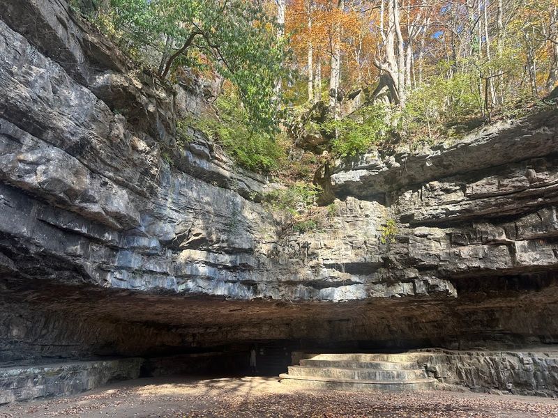
1. The Lost Sea (Sweetwater)
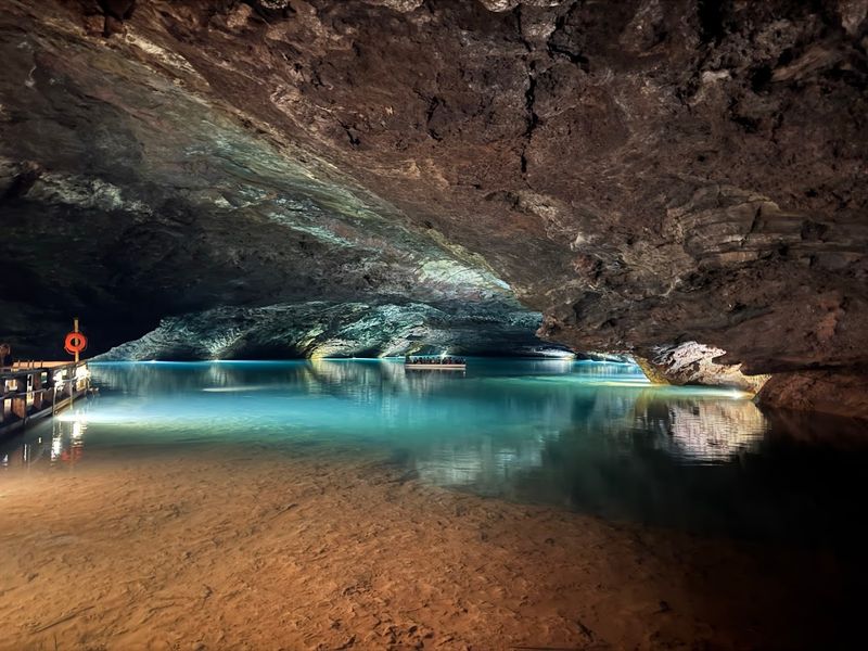
Walking through a mountain to find America’s largest underground lake sounds like something from a fantasy novel, but that’s exactly what happens at The Lost Sea. This massive body of water sits hidden inside a cave system in Sweetwater, and it’s been drawing curious visitors for generations.
The tour guides lead you down into the cool darkness, where the temperature stays around 58 degrees year-round, until you reach a sight that stops everyone in their tracks.
The lake itself stretches far beyond what you can see from the boat dock. Divers have explored over 13 acres of it, but nobody knows exactly how far it extends into the mountain. That mystery adds to the whole experience, especially when you’re floating on a glass-bottom boat watching cave fish swim beneath you in water so clear it looks fake.
What makes this place geologically fascinating is how it formed. Tennessee sits on karst topography, which means the bedrock dissolves over time as slightly acidic water seeps through cracks. That process created this enormous cavern and filled it with groundwater that’s been filtering through limestone for thousands of years.
The cave tour takes about an hour and fifteen minutes, and it’s surprisingly accessible for a wild geological feature. You’re walking on paved paths for most of it, though there are some stairs involved. The guides share stories about moonshiners who used the cave during Prohibition and Confederate soldiers who mined saltpeter here during the Civil War.
Kids usually love the whole adventure, especially the boat ride part. The cave fish are blind and colorless because they’ve adapted to total darkness over countless generations. Seeing them dart around under the boat makes you realize just how alien this underground world really is compared to the sunny Tennessee hills above.
2. Window Cliffs State Natural Area (Baxter)
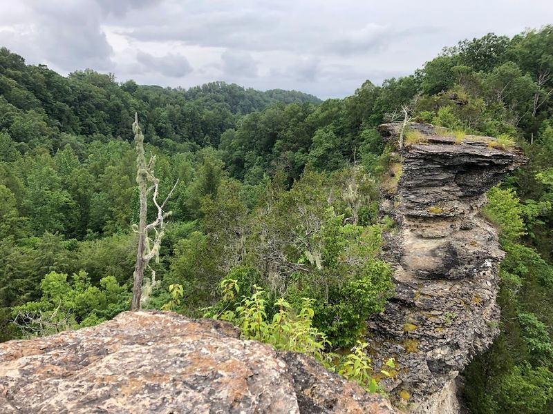
Cane Creek decided to carve itself a really dramatic shortcut through solid rock, and the result is one of Tennessee’s weirdest hiking destinations. Window Cliffs sits where the creek bent back on itself so tightly that erosion eventually cut through the narrow neck of land, leaving behind this razor-thin ridge of stone. Standing on top of it feels like balancing on the spine of a sleeping dragon.
The hike to reach Window Cliffs covers about 5.5 miles round trip, winding through hardwood forest before opening up to those jaw-dropping views. You’ll cross streams, navigate some rocky sections, and probably question your route a few times before the trail delivers you to the main attraction. But once you’re standing on that clifftop looking down at the creek far below, the effort makes total sense.
Geologically speaking, this formation is called an incised meander, which happens when a winding river cuts down through rising land over millions of years. The creek kept its curvy path while simultaneously slicing deeper into the bedrock. Eventually, the loop became so tight that the river broke through, abandoning the old curve and leaving this narrow rock wall behind.
The views from the top stretch for miles across the surrounding plateau and valleys. Photographers love this spot during fall when the forest explodes into color, but honestly, any season works. Spring brings wildflowers, summer offers a thick green canopy, and winter reveals rock layers you can’t see when leaves block the view.
Safety matters here because those cliffs drop straight down with nothing to catch you. There are no guardrails or paved overlooks, just raw Tennessee geology doing its thing. Bring good hiking boots, watch your footing near edges, and maybe leave the adventure for a dry day since wet rock gets dangerously slick.
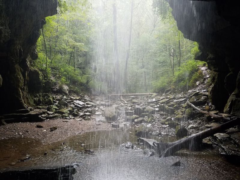
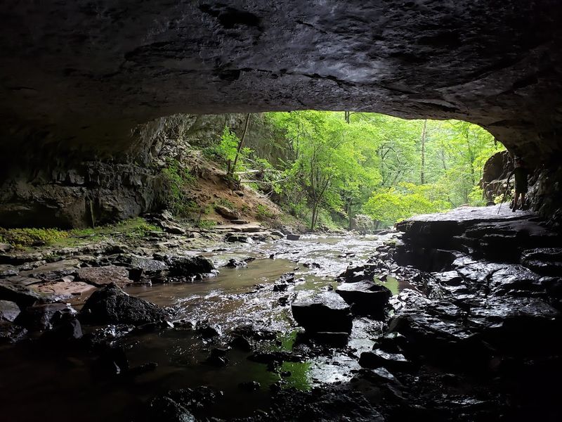
3. Great Stone Door at Savage Gulf (South Cumberland area)
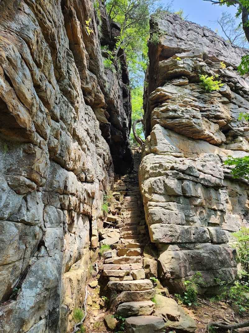
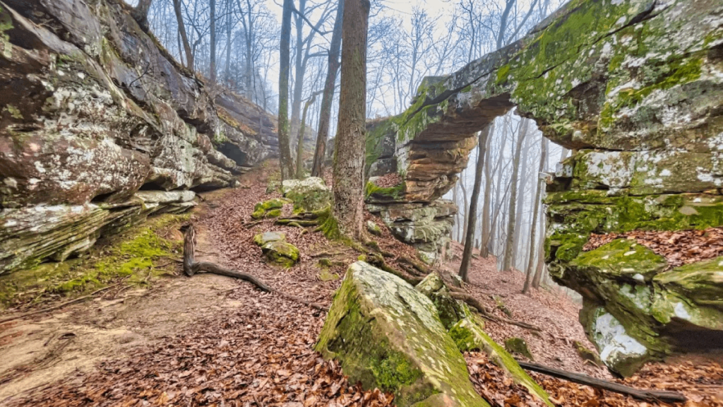
Picture a crack running top to bottom through a massive cliff face, wide enough to walk through, looking exactly like someone left a stone door cracked open. That’s the Great Stone Door, and it’s one of those geological features that makes you stop and stare because your brain needs a minute to process what it’s seeing. The formation sits right at the edge of the Cumberland Plateau, where the land drops away into Savage Gulf.
The vertical split measures about 10 feet wide and 100 feet tall, cutting clean through the sandstone cap rock. Walking through it feels like entering another dimension, especially when mist rises from the gulf below and filters through the opening.
The crack formed as the plateau edge eroded unevenly. Water seeped into existing joints in the rock, froze and expanded during winter, and gradually pried the layers apart over countless freeze-thaw cycles. Gravity helped pull the separated section away from the main cliff face, creating this dramatic gap that hikers now use as a natural gateway to the backcountry trails below.
Beyond the Door, the trail descends steeply into Savage Gulf itself, where waterfalls, rock shelters, and old-growth forest wait for anyone willing to tackle the elevation change. But even if you’re not up for a full wilderness hike, just reaching the Stone Door and peering through it into the gulf makes the trip worthwhile.
Morning light works best for photography because it illuminates the gulf through the opening, creating this ethereal glow effect. The area gets busy on weekends during peak seasons, so showing up early or visiting on a weekday gives you a better chance of experiencing the place without crowds. Bring layers because the temperature at the plateau edge can feel significantly cooler than down in the surrounding valleys.
4. Lost Creek Cave and Falls (Sparta)
Watching a waterfall vanish into the ground never stops being weird, no matter how many times you’ve seen it happen. Lost Creek does exactly that, pouring over a small cascade before the entire stream gets swallowed by a cave entrance and disappears underground. Stand there long enough and you start wondering where all that water goes, which is exactly the question that makes this place so geologically fascinating.
The cave system beneath your feet contains seven miles of mapped passages spread across five different entrances. That makes Lost Creek one of Tennessee’s larger cave networks, though most of it requires serious caving skills to explore. The water you’re watching disappear is actively carving new passages through the limestone, continuing a process that’s been happening for thousands of years.
What you’re seeing is a karst sinkhole in action. Tennessee’s bedrock dissolves when slightly acidic rainwater seeps through it, creating underground voids and passages. Eventually, surface streams find these weak spots and start flowing underground instead of staying on top of the land.
Lost Creek found its shortcut and took it, leaving behind this strange scene where a perfectly normal stream just ends.
The waterfall itself isn’t massive, maybe 10 or 15 feet depending on recent rainfall, but watching it pour straight into darkness creates this hypnotic effect. During heavy rain, the cave can’t handle all the water and it backs up, creating temporary pools and changing the whole appearance of the area. Dry spells reduce the flow to a trickle, but the cave entrance remains visible year-round.
Getting to Lost Creek requires a short hike through woods that feel pleasantly remote without being difficult. The trail isn’t heavily marked, so pay attention to where you’re going. Exploring the cave entrances requires proper equipment and experience, but enjoying the disappearing waterfall from the surface is perfectly safe and doesn’t need any special gear beyond decent shoes.
5. Natural Bridge State Natural Area (Sewanee)
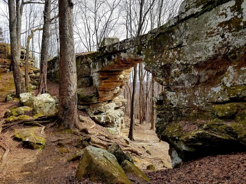
Sandstone arches usually get associated with Utah or Arizona, but Tennessee has its own tucked away near Sewanee, and most people have no idea it exists. This natural bridge spans 50 feet with a 25-foot clearance underneath, formed by water that once flowed across the top and gradually dissolved a tunnel through the softer rock layers. The arch feels almost delicate despite being solid stone, like nature’s version of careful engineering.
A wet-weather spring likely played a major role in creating the bridge. Water seeping through the sandstone found a weak layer and started dissolving it from the inside out, eventually breaking through to create the opening you see today. That same process continues during rainy periods when water still trickles through cracks in the rock, slowly expanding the arch millimeter by millimeter each century.
The hike to reach it is blessedly short, maybe a quarter mile from the parking area, which makes this one of Tennessee’s most accessible geological oddities. You can walk right up to the bridge, stand underneath it, and even climb on top if you’re careful, though the surface gets slippery when wet. Moss and ferns grow in the shaded areas where moisture lingers, adding to the fairy-tale atmosphere.
Size-wise, it’s not going to compete with the famous western arches, but that’s part of its charm. This feels like a secret spot, a geological curiosity hiding in the woods that rewards people who bother to seek it out. The sandstone shows beautiful layering and color variations, especially after rain when the surface darkens and the iron oxide streaks become more visible.
The area stays relatively quiet even during busy seasons, probably because it’s just far enough off the main tourist routes that casual visitors miss it entirely.
6. Rock Island State Park’s Caney Fork Gorge (Rock Island)
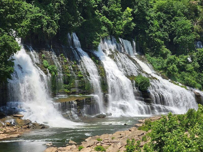
Everyone shows up at Rock Island for the waterfalls, which are legitimately impressive, but the real geological story is the gorge itself. The Caney Fork carved this deep limestone canyon between Great Falls Dam and Twin Falls, creating a landscape of sheer bluff lines, hidden seeps, weird rock formations, and pools that look almost tropical when the sun hits them right.
Walking along the gorge rim or paddling through it reveals layer after layer of exposed bedrock, telling millions of years of Tennessee’s geological history.
The gorge walls rise dramatically from the water, showing distinct stratification where different rock types stacked up over time. Limestone dominates, but you’ll also spot sandstone layers and occasional shale bands that erode at different rates. That uneven weathering creates the overhangs, small caves, and sculptural formations that make every bend in the river visually interesting.
Water seeps constantly from cracks in the bluff faces, creating these delicate curtains of moisture that support unique plant communities. Ferns, mosses, and wildflowers cling to spots where most vegetation can’t survive, taking advantage of the constant moisture and shade. These seeps also contribute to ongoing erosion, slowly reshaping the gorge walls as minerals dissolve and wash away.
The pools between rapids vary from shallow and rushing to deep and eerily calm. Some sections drop to depths that surprise people who assume the whole river runs shallow. Those deep spots formed where the current concentrated its erosive power, drilling down through softer rock layers while leaving harder formations as rapids and ledges.
Kayakers and paddleboarders get the best view of the gorge’s geological features since they’re right at water level, where the rock details are most visible. But the overlook trails offer their own perspective, letting you see how the river snakes through the landscape and appreciate the scale of stone it moved to create this canyon.
Either way, the gorge deserves more attention than it typically gets from people focused solely on the waterfalls.
7. Dunbar Cave (Clarksville)
Most caves are just caves, but Dunbar Cave is also an archaeological site containing prehistoric Mississippian artwork dating back to the 14th century. That combination of geological formation and human history makes this spot especially unusual among Tennessee’s underground spaces.
The cave has witnessed thousands of years of human activity, from ancient ceremonies to 20th-century big band concerts, all while continuing its slow geological evolution.
The main entrance sits in a bluff face, opening into a large room that early visitors used for everything from ice storage to dance halls. Roy Acuff owned the cave for a while and held concerts inside, taking advantage of the natural acoustics and constant cool temperature. But long before any of that, indigenous people created mud-glyph artwork on the cave walls, leaving behind images that archaeologists still study today.
Geologically, Dunbar Cave formed through the same limestone dissolution process common throughout Tennessee’s karst regions. Groundwater flowing through cracks in the rock gradually enlarged them into passages, creating a network that extends roughly eight miles into the hillside. Only a small portion is open for public tours, but that section alone shows impressive formations and gives you a sense of the cave’s scale.
The prehistoric artwork makes this cave particularly significant. The mud glyphs include human figures, animals, and geometric designs applied to the walls using techniques that archaeologists are still working to understand. The cave’s stable environment helped preserve these images for centuries, though they’re fragile and require careful conservation.
Tours run seasonally and focus on both the geological features and the cultural history. You’ll see flowstone formations, learn about the cave’s ecology, and get a chance to view some of the ancient artwork. The cave stays around 58 degrees year-round, so bringing a light jacket makes sense even on hot summer days.
The surrounding state park offers hiking trails and a lake, making it easy to spend several hours exploring the area beyond just the cave tour.
8. Buggytop Cave (Sherwood)
Buggytop Cave sits quietly in the woods near Sherwood, not making a big fuss about itself despite being one of those geological features that rewards people who make the effort to find it. The cave formed in the same limestone that underlies much of Middle Tennessee, carved out by water working its way through cracks and weak spots in the bedrock over countless centuries.
What makes Buggytop worth mentioning is how it represents the kind of hidden geological oddity that Tennessee has scattered everywhere if you know where to look.
The entrance opens in a bluff face, leading into passages that wind through the hillside in that typical Tennessee cave fashion. Unlike some of the state’s commercial caves with lights and paved walkways, Buggytop remains relatively wild, which means you need proper equipment and some caving knowledge to explore it safely.
The formations inside include flowstone, stalactites, and other features created by mineral-rich water dripping and depositing calcite over thousands of years.
Local cavers know the system well, and it’s popular with people who enjoy the challenge of navigating undeveloped cave passages. The geology isn’t necessarily more dramatic than other Tennessee caves, but it offers that authentic underground experience without the tourist infrastructure. You’re crawling through spaces that formed naturally and remain largely unchanged by human intervention.
The surrounding area shows typical karst topography with sinkholes, disappearing streams, and other surface features that hint at the honeycomb of passages underground. Walking through the woods near Buggytop, you can spot these clues if you’re paying attention—small depressions where the ground collapsed into voids below, places where creeks suddenly vanish, rock outcrops showing the layered limestone that makes this landscape possible.
Visiting Buggytop requires preparation. This isn’t a casual tourist stop but rather a destination for people interested in genuine caving. Bring helmets, lights, appropriate clothing, and ideally someone with experience navigating these systems.
The cave doesn’t advertise itself with signs or parking lots, maintaining its status as one of those geological oddities that Tennessee keeps semi-secret from the masses.