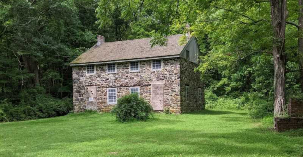
A rusted wheel half-buried beside a stream, a mansion wall with trees growing where the ballroom once stood, a furnace stack rising out of pine woods—New Jersey has a habit of hiding its best history a few steps beyond the parking lot.
These trails turn an ordinary hike into a scavenger hunt through the state’s industrial and Gilded Age past.
Some lead to preserved villages where blacksmith shops and workers’ houses still line old roads; others end at fenced foundations, collapsed estates, forgotten canal works, and stone ruins slowly being absorbed by the forest.
The fun is in that contrast: one minute you are following blazes through mountain laurel or pitch pine, and the next you are standing where hundreds of people once worked, traded, vacationed, or lived.
Lace up sturdy shoes, bring a trail map, and leave the ruins exactly as you find them. These ten hikes make history feel much closer than a museum case.
1. Watchung Reservation History Trail – Deserted Village of Feltville, Berkeley Heights
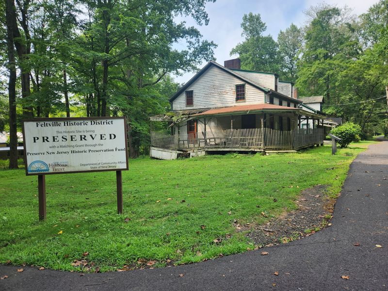
A row of weathered cottages appears through the trees here with almost theatrical timing, and suddenly the “deserted village” name makes perfect sense. The six-mile, pink-blazed Watchung Reservation History Trail threads together centuries of local history, but Feltville is the stop that tends to linger in your memory.
David Felt bought 760 acres in 1845, built a printing factory along Blue Brook, and created a company town on the bluff above it. By 1850, roughly 175 people lived here.
When the industrial ventures faded, the settlement earned its ghost-town nickname, only to get another life in 1882 as Glenside Park, a summer resort that lasted until 1916. Today, ten historic buildings survive, along with archaeological remains and interpretive signs that help make sense of what you are seeing.
You can tackle the full History Trail from the Trailside Nature & Science Center or keep things easy with the roughly one-mile self-guided walk through the village itself. The latter is a good choice if your group includes kids or anyone more interested in old porches than elevation gain.
Parking is available off Glenside Avenue, and the village grounds are open from dawn to dusk. Give yourself time to read the signs; Feltville is much better when it feels like a story unfolding instead of a quick photo stop.
2. Castle Loop – Van Slyke Castle Ruins, Ramapo Mountain State Forest
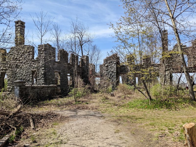
The reward on this loop is not subtle: stone walls, empty window openings, and a ruined tower perched high above Ramapo Lake. Van Slyke Castle was actually built in 1910, so it lands just outside the 1800s, but it belongs on any New Jersey ruins hike because the approach feels like a slow reveal.
The mansion, originally called Foxcroft, was built as the family home of stockbroker William Porter and later became associated with Warren and Ruth Van Slyke. It was occupied until 1940 and eventually fell into ruin, leaving behind a dramatic shell on the ridge.
The state’s Castle Loop Trail is a moderate 3.1 miles from the upper parking area on Skyline Drive. It drops toward Ramapo Lake, follows an old lakeside road, then climbs toward the mansion ruins and broad viewpoints before returning to the start.
Expect rocks, roots, and enough climbing to make sturdy shoes worthwhile. The scenery does plenty of work even before the castle appears: Ramapo Lake below, wooded ridges in every direction, and occasional skyline views on clear days.
There is no entrance fee, and the forest is open sunrise to sunset. Resist the urge to scramble on unstable masonry; the best view is from solid ground, where you can appreciate just how improbable this old estate looks sitting above the lake.
3. Batsto Village & Batsto Trails – Wharton State Forest
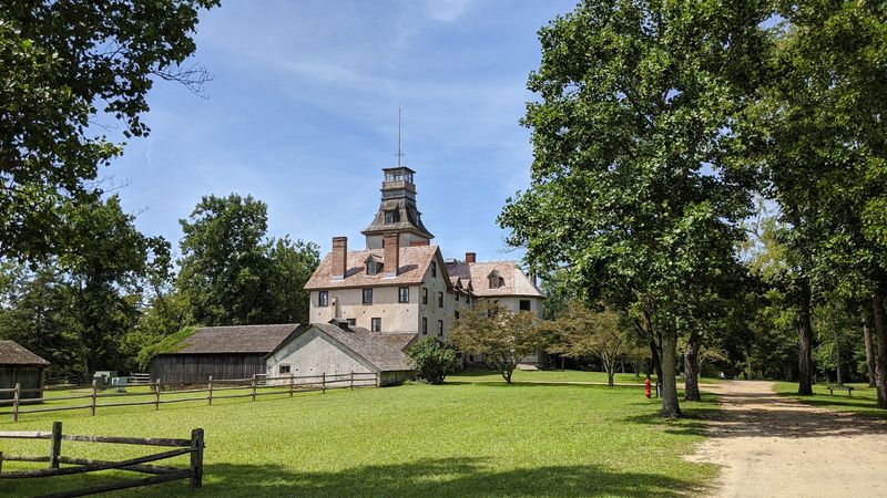
Batsto is the rare historic stop where the ruins are only part of the appeal, because much of the old company town is still standing.
Founded as an ironworks in 1766, the village grew into one of the Pine Barrens’ major industrial centers, producing iron and later glass while generations of workers lived around the furnace, mills, shops, and lake.
Today the preserved village includes the mansion, workers’ houses, a general store, post office, blacksmith shop, gristmill, sawmill, and other structures that make the place feel unusually complete. For hikers, the smart move is to pair the village with one of the marked loops beginning near the main parking area.
The easy Batsto Red Trail runs about 0.8 mile, the Blue Trail stretches roughly 1.8 miles, and the White Trail gives you a four-mile outing through pine-oak woods, cedar swamp, and views near Batsto Lake. That range makes Batsto a good pick when you want history without committing to an all-day trek.
The visitor area also gives you a chance to understand the iron and glass industries before heading into the woods, which makes every old road and waterway feel more meaningful. If you visit in summer, note that Wharton State Forest may charge a seasonal parking fee.
Come for the mansion, but save enough time to walk beyond it; the surrounding landscape is the reason Batsto existed here in the first place.
4. Batona Trail – Martha’s Furnace Ruins, Wharton State Forest
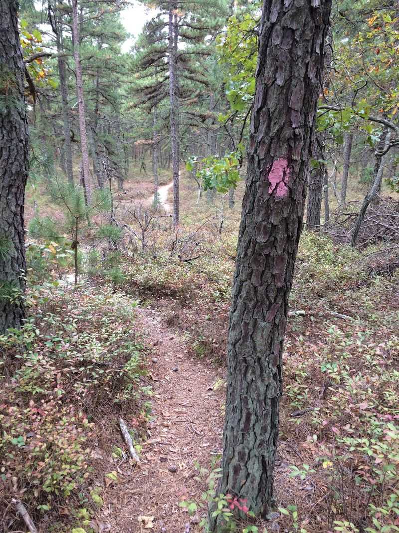
Martha is the kind of place that makes you work a little for the history, which is exactly why it feels so satisfying. The Batona Trail cuts through the heart of the Pine Barrens for more than 50 miles, and the Wharton State Forest section passes names that sound like vanished map points because, in many cases, that is what they are.
Martha Furnace operated from 1793 to 1845, smelting bog iron in a settlement that once included a stamping mill, blacksmith shop, sawmill, gristmill, store, school, hospital, ironmaster’s house, and dozens of homes. Almost none of that town announces itself now.
The furnace remains are buried and fenced for protection, and the surrounding forest has reclaimed the rest. That makes this less of a “tour the ruins” outing and more of a hike through a landscape where you have to imagine the industry that once filled it.
The pink-blazed Batona is generally moderate and famously sandy, with long flat stretches through pitch pine, oak, and cedar wetlands. For a day hike, use a legal trail access point and plan an out-and-back or loop rather than treating the entire Batona as the goal.
Cell service can be spotty, services are sparse, and summer heat can be deceptive in the open sandy stretches. Bring more water than you think you need and a current map; this is Pine Barrens history without handrails.
5. Harrisville Historic Site – Paper Mill Ruins, Wharton State Forest
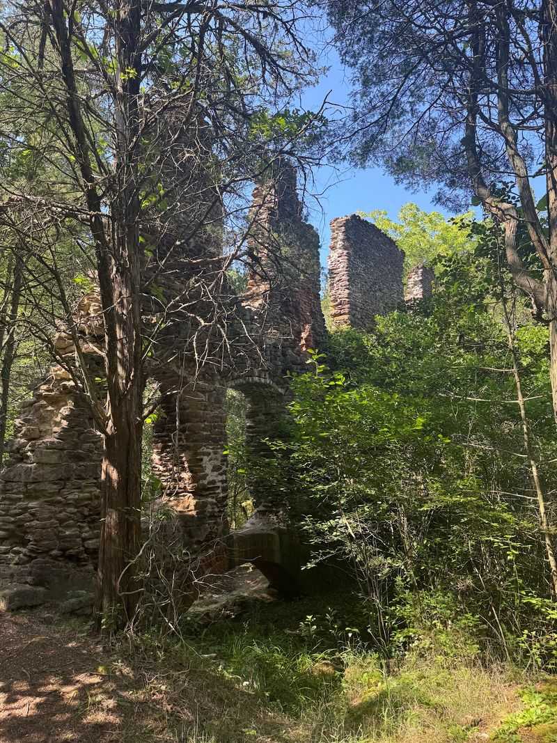
Harrisville has one of the eeriest transitions on this list: quiet pond, narrow road, then the remains of a paper-making town tucked into the pines.
The settlement grew around a mill complex in the 1800s and became a genuine company town, with workers’ housing, a store, gristmill, boarding house, and substantial homes for the families who ran the operation.
The paper mill was the engine of the place, and when it failed, Harrisville faded with it; by the 1890s, the village was largely abandoned. A later forest fire helped erase even more of the town.
What remains today is wonderfully imperfect history—brick and stone foundations, old waterways, and the fenced paper mill ruins slowly losing their hard edges to moss and vegetation.
The Harrisville Pond area off Route 679 makes a practical starting point, and a short walk can be combined with nearby forest roads and trails for a longer outing.
The ruins themselves are fenced for safety and preservation, so this is a look-don’t-climb stop. That restraint actually suits the place.
Harrisville is most interesting when you stand back and notice the layout: water powering industry, roads connecting homes and mills, and forest now occupying nearly every gap.
Bring bug spray in warm weather and be careful around roadside sections; the Pine Barrens are quiet, but the paved road is not part of the ghost-town experience you want to romanticize.
6. Huyler’s Landing History Hike – Palisades Interstate Park
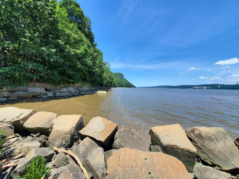
This loop manages to squeeze a river landing, a Revolutionary War route, Gilded Age estate ruins, and cliff-top Hudson views into about five miles.
Starting at Alpine Picnic Area, the route follows the Shore Trail to the old jetty at Huyler’s Landing, once a busy 19th-century shipping point where local farmers sent goods toward New York City.
The same corridor also carries a much older story: in November 1776, British troops under General Cornwallis climbed from the Hudson using the old road that is now part of the red-blazed Huyler’s Landing Trail on their advance toward Fort Lee. After the climb, the Long Path delivers a completely different chapter.
You pass a surviving parapet from Manuel Rionda’s sprawling Rio Vista estate, then reach the imposing two-story foundation of Cliff Dale, the circa-1911 summer home of flour merchant and historian George Zabriskie. More driveways and foundations from former estates appear farther along, half-hidden under leaves and roots.
The full history hike is rated moderate, takes roughly 3.5 hours, and includes a 440-foot climb from river level. Wear shoes with grip; the Palisades can be rockier and steeper than the mileage suggests.
This is one hike where stopping often is the point, because every change in elevation seems to switch the century along with the view.
7. Canal Trail – Historic Allaire Village, Allaire State Park
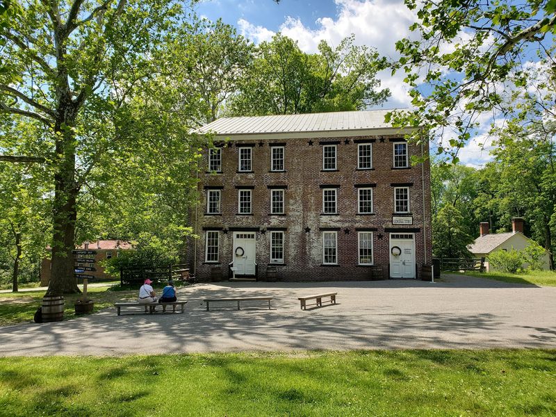
A canal through the woods is the first clue that Allaire was never just a pretty village. In the 1820s and 1830s, James P. Allaire expanded the Howell Works into a self-contained iron-making community, where bog iron was smelted into pig iron for his New York foundry and workers lived alongside a church, store, blacksmith shop, carpenter’s shop, mills, and company housing.
The restored village is the obvious history stop, but the green-blazed Canal Trail adds the landscape that made the operation possible.
The 2.7-mile route begins near the visitor center and follows the old canal through forest before continuing toward Long Swamp Pond. It is mostly easy, on packed earth and gravel, and the section closest to the historic village is reserved for hikers.
That makes it a good choice for a relaxed morning when you want more wandering than workout. Before or after the trail, walk through the village and look for the owner’s house, workers’ row houses, general store, and blacksmith shop; seeing the buildings first makes the old transportation corridor in the woods click into place.
Allaire State Park has no general entrance fee and a large main parking area, though special programs may cost extra. One practical note: the Canal Trail crosses Atlantic Avenue farther out, so pay attention at the road crossing rather than getting too absorbed in the 1830s.
8. Wawayanda Lake Loop – Double Pond Iron Furnace Ruins, Wawayanda State Park
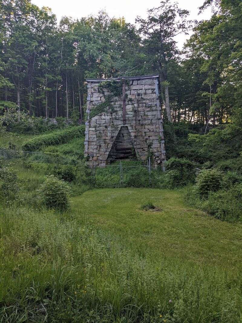
The old furnace appears almost casually beside the trail, a rough stone reminder that Wawayanda’s peaceful lake once powered heavy industry. In the mid-1800s, this area was known as Double Pond, and a charcoal blast furnace operated here using ore from nearby mines and waterpower from the dammed lake.
The furnace ruins sit near the yellow-blazed Double Pond Trail, making them easy to work into a loop with the orange Wawayanda Lake Loop and Laurel Pond Trail.
That combination gives you a satisfying mix of history, shoreline, hardwood forest, wetlands, and rocky northern New Jersey terrain without turning the day into a major expedition.
Double Pond itself is an easy-to-moderate connector trail, and the broader park has more than 60 miles of marked routes, so it is worth carrying a map even if your plan sounds simple. The best moment comes when you leave the recreation area behind and the old industrial footprint starts to reveal itself among the trees.
Unlike a reconstructed village, the furnace asks you to do some imagining: charcoal crews, ore wagons, water rushing through the works, and a settlement built around an operation that disappeared long ago. Wawayanda is also black-bear country, so normal food-storage and awareness rules apply.
If the ground is wet, expect roots, rocks, and muddy patches to slow the loop down.
9. Long Pond Ironworks Historic District & Trails – West Milford
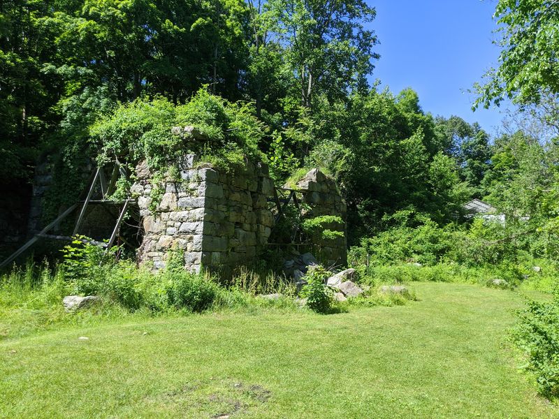
Long Pond is where New Jersey’s iron history stops feeling abstract. Stone furnace stacks, waterwheels, foundations, and old village structures sit along the Wanaque River, the remains of an ironworking community founded in 1766 by German ironmaster Peter Hasenclever.
Iron produced here served American forces during the Revolution, the War of 1812, and the Civil War, and the works kept operating until 1882.
The easiest way to connect the ruins with an actual hike is the 1.3-mile Hasenclever Iron Trail, an easy interpretive route that follows part of an old road once linking the Long Pond and Ringwood iron operations.
Signs along the way point out features that are easy to miss if you are simply charging through the woods. Around the historic district, you can also see furnace remains, casting-house ruins, charging areas, old walls, and a reconstructed waterwheel.
If you want more miles, the surrounding park has a network of tougher trails across Tranquility Ridge and Burnt Meadow Mountain. The historic grounds are free to visit, and the museum in the restored Old Country Store operates on a more limited seasonal schedule, so treat it as a bonus rather than the whole reason to come.
Do not climb the ruins. They have survived wars, industry, abandonment, and weather; they do not need your hiking boots added to the list.
10. Towpath Trail/Morris Canal Greenway – Waterloo Village, Allamuchy Mountain State Park
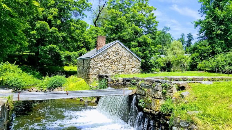
Mules once walked this corridor pulling canal boats loaded with coal, iron, and other freight, and following their old route is still the best way to understand Waterloo.
The Towpath Trail/Morris Canal Greenway traces part of the historic Morris Canal along the Musconetcong River before reaching Waterloo Village, an authentic 19th-century canal settlement squeezed between Allamuchy and Schooley’s mountains.
The marked trail runs 7.3 miles within the Allamuchy Mountain/Stephens State Parks system, but you do not need to hike every mile to get the payoff. A shorter out-and-back paired with time in the village works beautifully.
Once there, look for canal infrastructure alongside the gristmill and sawmill complex, general store, blacksmith shop, historic houses, church, and surviving pieces of the old incline-plane system.
The Morris Canal operated from the 1830s into the early 20th century, using locks and ingenious inclined planes to move boats across New Jersey’s uneven terrain.
Waterloo became an important stop because the canal passed directly through it. The towpath itself is wide, flat, and easy compared with many hikes on this list, making this a strong pick for mixed-ability groups.
Village grounds are open dawn to dusk and admission is free; interior tours and the interpretive center operate on limited seasonal schedules. Save a few minutes for the canal remains after the buildings—the engineering is the real star here.