
At 2 p.m. on a late-August trail, the difference between “pleasant walk” and “why did I leave the car?” can be one solid ceiling of leaves. New Jersey has plenty of hikes where the sun gets filtered through hemlocks, oaks, pines, and hardwoods instead of landing directly on your shoulders for three straight miles.
Better yet, many of the best heat-dodging routes come with water nearby: a shaded ravine, a reservoir, a creek, a bog, or a lake that gives the walk something to look at besides your own rapidly disappearing water bottle. These 13 trails range from quick loops to proper half-day outings, and they are spread from the Highlands to the Pine Barrens.
None turns August into October, of course. Bring water, bug spray, and sensible shoes. But when the forecast says “feels like soup,” these are the New Jersey trails where the trees do some of the work.
1. Ridge Trail – Sourland Mountain Preserve
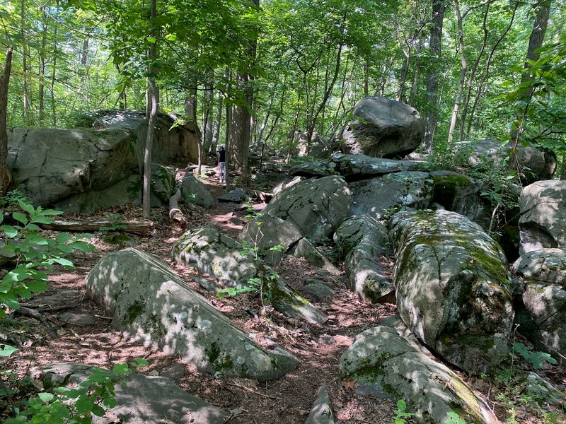
The first clue that this is not a manicured park stroll comes underfoot: roots, rocks, boardwalks, and the occasional boulder field keep the Ridge Trail interesting even when the leafy canopy is doing its best to block the August sun.
The main Ridge Trail runs about five miles through Sourland Mountain Preserve, a 6,300-acre swath of protected land in Hillsborough that feels far more rugged than its Central Jersey location suggests.
Much of the route stays under mature hardwoods, with tulip poplar, oak, black walnut, hickory, and maple creating the kind of deep woodland shade you want on a sticky afternoon. The tradeoff is terrain.
There are rocky stretches, steeper pitches, and a few spots where you will be watching your footing rather than admiring the scenery. Large exposed boulders and stream corridors give the hike its Sourlands personality, while short crossings of the pipeline right-of-way briefly trade shade for open sky.
This is a better choice for hikers who want a real workout than for anyone looking for a flat cooling-off walk. Start with a full bottle, wear shoes with decent grip, and give yourself more time than the mileage alone suggests.
The woods are the attraction here; the fact that they double as a sun shield is the late-summer bonus.
2. Blue Trail – Maurice River Bluffs Preserve
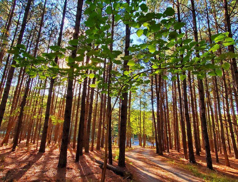
Southern New Jersey does not usually get credit for hills, which is exactly why the Blue Trail at Maurice River Bluffs catches first-timers off guard.
The preserve rises above the Maurice River on rounded bluffs, and this one-mile route packs forest, elevation changes, and river-country scenery into a hike short enough to tackle before the hottest part of the day takes over.
The trail is rated nearly flat overall, but “overall” is doing some work: there are steps and brief steeper sections, so expect more than a level riverside shuffle. What earns it a place on a late-summer list is the combination of tree cover and manageable distance.
You can get a proper woodland walk without committing to hours in the heat, then linger at one of the preserve’s viewpoints or birding areas if the weather is behaving. The bluffs are also important stopover habitat for migrating songbirds, with osprey and bald eagles among the larger visitors overhead.
One timely planning note: accessibility improvements are underway at the preserve through September 2026, and trail markers and signage along the Blue and Orange Trails may temporarily change. Pay attention at junctions rather than hiking on autopilot.
This is the smart pick when you want scenery and shade but your enthusiasm for a six-mile August march is currently at zero.
3. Riverside Trail – Hacklebarney State Park
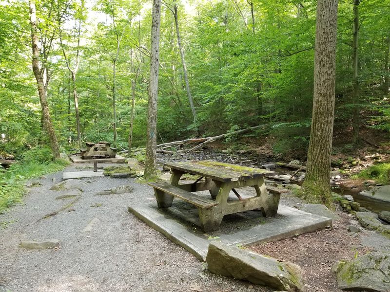
Listen before you look. On the Riverside Trail, the Black River and its tributaries do a lot of the scene-setting, with rushing water, rocky banks, and small cascades cutting through one of North Jersey’s most reliably shady ravines.
Hacklebarney’s 1.8-mile Riverside Trail sits inside a natural area where eastern hemlocks dominate the cool slopes, backed by mixed oak-hardwood forest. That canopy is exactly what makes the park such a good late-summer call, especially when open ridgelines feel like a bad life choice.
The route is not perfectly gentle, though. Hacklebarney’s terrain is rugged, and wet rocks, roots, and uneven footing can slow you down near the river.
That is part of the appeal: this feels like a compact mountain hike rather than a paved park loop. Rinehart and Trout Brooks feed into the Black River, and several small waterfalls can be seen from the park’s higher trails, so it is easy to extend the outing if the temperature cooperates.
Bikes are not permitted on the hiking trails, which helps keep the narrow, rocky sections focused on foot traffic. The park is open from sunrise to sunset and charges no entrance fee.
One practical 2026 note: a new restroom facility is still in the works, so portable sanitation units are currently being used. Come for the hemlocks and cold-looking water; stay because the trail never feels boring.
4. Deer Path Trail – Allamuchy Mountain State Park
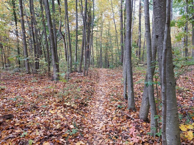
Six and a half miles sounds ambitious when the dashboard thermometer is flirting with 90, but Deer Path Trail has one major thing going for it: long stretches of genuine forest.
This white-blazed loop circles through the elevated Deer Park section of Allamuchy Mountain State Park, surrounding Deer Park Pond with a mix of single-track, rolling terrain, and dense woods.
It is a multi-use trail, so hikers may share the route with mountain bikers, and the surface is more backcountry than boulevard. Expect roots, stones, and enough undulation to keep the legs working.
The pond and connecting trails give the area a quieter, more enclosed feel than some of Allamuchy’s busier corridors, and the canopy makes it far more forgiving on a sunny afternoon than a route with extended ridge exposure.
There is one important catch right now: Deer Park Road is closed to all public use, and the state is directing visitors to alternate parking shown on the current park map.
Do not plan around the old trailhead routine or assume you can simply drive in. That access wrinkle aside, Deer Path is a strong choice for hikers who want mileage without spending the entire day baking in direct sun.
Pack more water than you think you need, leave time for the longer approach created by current access conditions, and treat the pond as the midpoint mood boost rather than a shortcut back to the car.
5. Batona Trail near Pakim Pond – Brendan T. Byrne State Forest
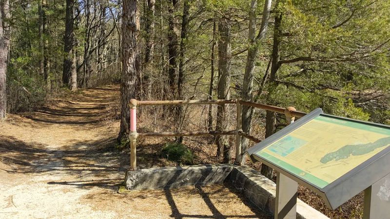
Pink blazes disappear into straight rows of pitch pine, the ground turns sandy under your shoes, and suddenly the Pine Barrens make perfect sense as a summer hiking destination.
The Batona Trail runs for more than 50 miles through Brendan T. Byrne, Wharton, and Bass River state forests, but you do not need to stage a backpacking expedition to enjoy it. The section around Pakim Pond is an easy way to sample the trail’s pine-oak woods and cedar-swamp country while keeping the day flexible.
Brendan T. Byrne has more than 25 miles of marked trails, and routes near the pond can be combined with the Batona, Mount Misery, and Lebanon trails for a roughly three-mile outing; there is also a short, easy loop around Pakim Pond if the heat wins the argument.
The terrain here is flatter than the rocky hikes up north, which matters when humidity is high and every climb feels twice as long. Shade comes in a different form, too: lower pines, oak-pine forest, and patches of Atlantic white cedar rather than a towering mountain canopy.
Do not mistake “flat” for “effortless.” Sand can sap energy, insects can be persistent, and water is still non-negotiable. The payoff is a distinctly Jersey landscape that feels quiet, aromatic, and wonderfully removed from pavement, without requiring a punishing ascent.
6. Lenape Trail to Hemlock Falls – South Mountain Reservation
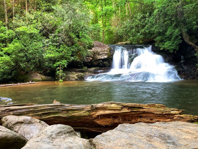
A 25-foot waterfall is a pretty convincing reason to keep walking, especially when the route to it spends much of its time under hardwoods and tall hemlocks.
South Mountain Reservation spreads across more than 2,100 acres in Essex County, and a segment of the 36-mile Lenape Trail threads through this surprisingly wild pocket between busy suburban towns.
Hemlock Falls is the natural target for a hot-weather outing: the trail dives into wooded ravines, crosses near streams and creeks, and leads to a cascade that feels much farther from traffic than the map would suggest. The best part is flexibility.
You can build a short out-and-back around the falls or connect the Lenape Trail with nearby carriage roads and footpaths for a longer loop, depending on heat, time, and how ambitious everyone feels once the incline starts.
The reservation also has ridge viewpoints, but on a scorcher there is no shame in prioritizing the lower, shadier woods instead of collecting every overlook.
Footing can be rocky and muddy near water, and the trail network has enough intersections that carrying a map is smarter than relying on instinct. This is the rare urban-adjacent hike where the destination is memorable, the forest cover is substantial, and bailing out early still leaves you feeling like you actually went somewhere.
7. Ramapo Lake Loop Trail – Ramapo Mountain State Forest
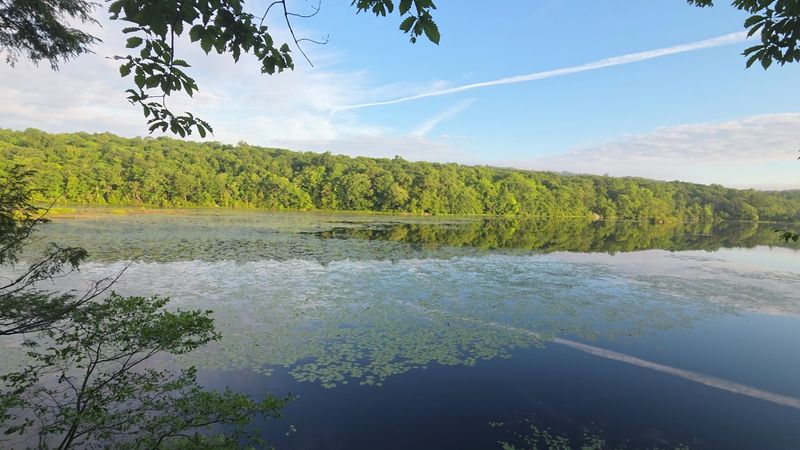
Ramapo Lake does not require a summit speech. Once you have climbed from the lower Skyline Drive parking area, the payoff is a mostly easy circuit around 120 acres of water on a broad, wooded fire road.
The blue-blazed Ramapo Lake Loop itself is 2.6 miles, reached by a roughly 0.6-mile spur from the lower lot, so the full outing is closer to four miles once the approach and return are counted. That first climb is the part you will notice on a hot day; after that, the loop settles down into gentler terrain with lake views appearing through the trees.
Shade is generous for much of the route, and the combination of forest, water, rock outcrops, and old stone features keeps an easy hike from feeling repetitive. Hikers who want more can connect to the Castle Loop or LeGrande Hill trails, but late summer is a good time to resist the urge to turn every outing into a mileage contest.
Swimming is not permitted in Ramapo Lake, so plan on admiring the water rather than jumping into it. The Skyline Drive lots are popular and can fill early on weekends, making a morning start useful for parking as well as temperature.
If your group has mixed hiking abilities, this one hits a sweet spot: a little uphill work, plenty of shade, and a lake doing most of the scenic heavy lifting.
8. Washington Valley Red Trail – Washington Valley Park
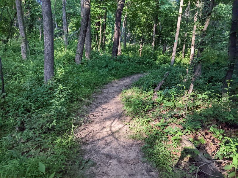
Reservoir views usually come with long stretches of open shoreline. Washington Valley’s Red Trail plays things differently, slipping between water views and a wooded interior that keeps much of the 1.8-mile loop under cover.
Starting from the Newman’s Lane side of the park, the red-blazed route follows the Washington Valley Reservoir for part of the way before curving through forest and crossing a creek. The mileage is modest, but the surface makes it feel like a real trail: rock, dirt, roots, and muddy patches after rain are all part of the deal.
That slight roughness is useful in late summer because you get texture and scenery without signing up for a long exposed climb. The trail is also used by mountain bikers, so stay alert around bends and tighter sections.
Washington Valley’s broader network can be confusing where interior, perimeter, and connector routes meet, but sticking to the Red loop keeps the plan relatively simple. A downloaded or photographed map is still worth having before you leave the lot.
The reservoir is the visual hook, yet the shady woodland half is what earns the trail a place here. This is a good “we have an hour, not an afternoon” hike: enough rocks to feel outdoorsy, enough water to make the route pretty, and enough tree cover to keep August from running the whole show.
9. Appalachian Trail through Wawayanda Hemlock Ravine – Wawayanda State Park
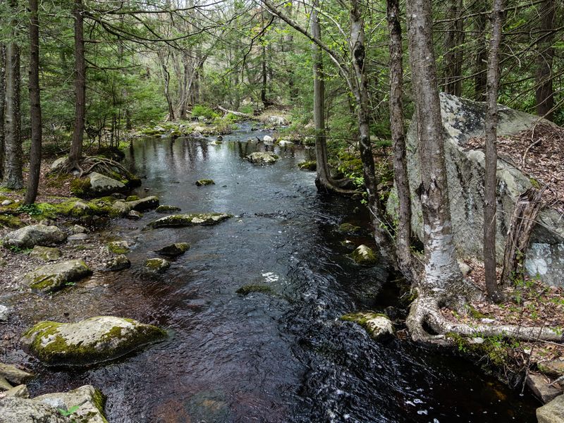
There are shady trails, and then there is a place whose official description basically advertises a “cool shady break.”
Wawayanda Hemlock Ravine Natural Area is 399 acres of steep, forested terrain where hemlock-mixed hardwoods rise around Doublekill Creek, and the Appalachian Trail runs along the natural area’s western boundary. On a late-summer day, that combination is hard to beat.
The ravine sits below surrounding hills with roughly 300 feet of relief, helping create the damp, protected feel that makes hemlock country noticeably different from an exposed ridge.
Wawayanda State Park contains 19 miles of the Appalachian Trail and more than 60 miles of marked trails overall, so this section can be part of anything from a focused out-and-back to a much longer day.
The key is not to confuse the natural area with a neatly packaged loop. There are no marked and maintained trails cutting directly through the ravine itself; access is primarily along the Appalachian Trail and from Iron Mountain Road, where parking is limited to a few pull-off areas.
Plan the route before you arrive rather than expecting a big trailhead lot and a “Hemlock Ravine Loop” sign. For hikers who value deep forest over big summit views, this is one of the most convincing hot-weather choices in the state: rocky, quiet, shaded, and refreshingly uninterested in showing off.
10. Dunnfield Creek Trail – Worthington State Forest
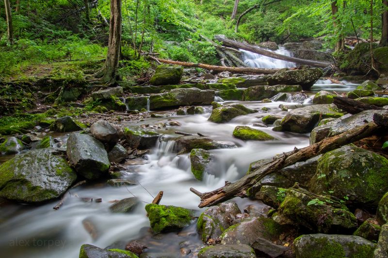
Cold-looking water is psychological air-conditioning, and Dunnfield Creek supplies plenty of it.
The light-green-blazed trail follows a rock-strewn trout stream through a ravine lined with mature hemlock, maple, birch, rhododendron, and mixed hardwoods, creating one of the most naturally shaded hiking corridors near the Delaware Water Gap.
The full Dunnfield Creek Trail runs 3.4 miles and is rated moderate, with rocky footing and some steeper sections as it works upstream. Several small waterfalls punctuate the creek, so even the lower stretches feel rewarding before the route begins its more serious climb.
Hikers continuing all the way can connect with the Appalachian Trail and reach Sunfish Pond, but that turns a cool creek walk into a more demanding mountain outing. In late-summer heat, there is a strong case for enjoying the shaded ravine at a comfortable pace and turning around before the climb stops being fun.
Worthington’s terrain is rugged, and wet rocks near the creek can be slick even when the air is dry. The forest is open daily from 8 a.m. to 8 p.m., and there is no entrance fee.
Parking in the Delaware Water Gap area can get busy, especially on weekends, so earlier is better. Bring water anyway; the creek may look irresistible, but natural water sources should never be treated as a ready-made refill station.
11. Cedar Swamp Trail – High Point State Park
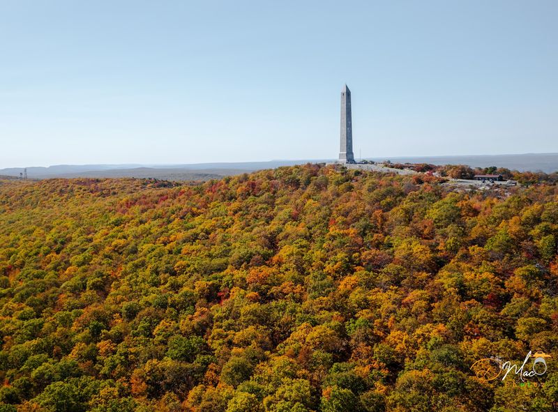
The surprise here is botanical: an Atlantic white cedar bog sitting high on Kittatinny Mountain, where you would expect rocky ridge forest instead of a wetland more commonly associated with New Jersey’s coastal plain.
Cedar Swamp Trail circles this unusual habitat in the Dryden Kuser Natural Area, moving from upland oak woods toward the bog and then crossing an open wet section on a boardwalk.
Most of the route is easy underfoot, using gravel, old access road, and boardwalk, though muddy patches can linger after heavy rain. For a late-summer hike, that makes it an appealing counterpoint to High Point’s exposed viewpoints and rocky Appalachian Trail miles.
You still get a destination with personality, but without turning the outing into a climb under full sun. Shade is strongest in the dense forest sections; the boardwalk opens things up briefly, so a hat is still useful.
Numbered interpretive stops along the route explain how a glacial lake gradually changed into the cedar swamp you see today, giving the walk more to chew on than scenery alone. Think of this as a short, easy outing rather than a distance challenge.
Park near the Cedar Swamp Picnic Area and look for the purple-blazed trail. It is quiet, strange in the best way, and completely different from the monument-and-view version of High Point most people know.
12. Otter Hole Trail – Norvin Green State Forest
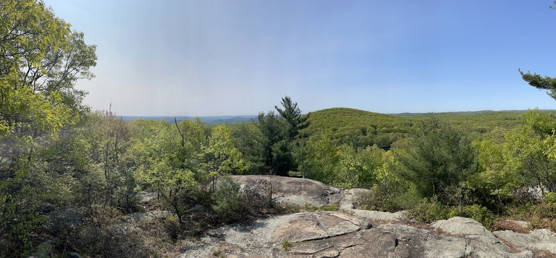
A green blaze, a rocky creek, and a name that sounds like it belongs in a children’s book: Otter Hole Trail starts playful and gets steadily more serious. The 2.7-mile route in Norvin Green State Forest bends around the Highlands Natural Pool and follows Blue Mine Brook before narrowing to single-track and climbing away from the water.
It eventually joins the Hewitt-Butler Trail, opening the door to longer loops for hikers who are not ready to head back. Norvin Green is rugged country, with park elevations ranging from roughly 400 to 1,300 feet, so “shady” does not mean “flat.” Expect rocks, uneven grades, and a more backcountry feel than the mileage might suggest.
The reward is a forested corridor where creek sounds and tree cover dominate, exactly the ingredients you want when the sun is hammering exposed ridges elsewhere. Start from the parking area on Snake Den Road and keep a map handy; Norvin Green’s trail network offers plenty of intersections and tempting side routes.
The state forest is open from sunrise to sunset and has no entrance fee. This is a good pick for hikers who find easy loops a little too tame but do not want to spend late August grinding up a bare summit. Shade helps, water nearby helps more, and the trail still delivers enough rock and climbing to feel earned.
13. Yellow Trail – Cheesequake State Park
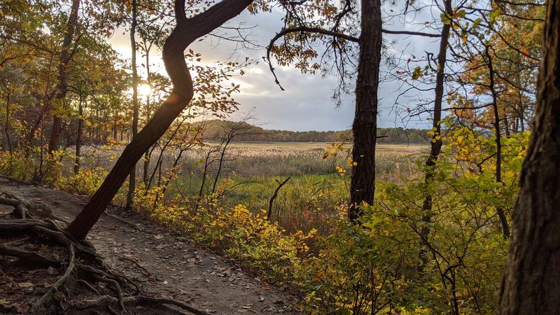
If the goal is to get outside without turning the day into an endurance test, Cheesequake’s Yellow Trail is almost comically well suited to the assignment. The loop is only about three-quarters of a mile, but it moves through mixed hardwood forest, past highbush blueberries, and along the edges of salt marsh and Hooks Creek Lake.
That habitat mix is what makes Cheesequake unusual: upland woods, wetlands, pine-barrens vegetation, and tidal marsh all sit surprisingly close together. The Yellow Trail stays easy overall, though there are some hills, steps, and uneven ground, so it is still a trail rather than a sidewalk lap.
Most of the route benefits from tree cover, with brief openings near the marsh and lake where the sun gets a clearer shot. A spur can extend the walk toward the day-use area if everyone is still feeling good.
Summer visitors should also remember that Cheesequake charges a seasonal entrance fee from Memorial Day weekend through Labor Day, with higher rates on weekends and holidays, and the gate is generally open from 8 a.m. to 8 p.m.
The park’s location near the Parkway makes it one of the easiest options on this list to fit into a busy day. Come when you want a short, shaded reset, not a conquest. In August, knowing when to stop is a hiking skill too.