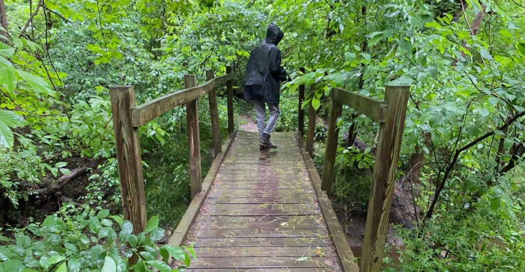
A wooden walkway cuts through the marsh, reaches the creek, and suddenly rises into a suspension bridge. At Pochuck, that crossing can steal the show before anyone has climbed a hill.
Elsewhere in New Jersey, the memorable bridge might be stone beside a waterfall, a narrow span hidden in Princeton’s woods, or a curved plank crossing deep in the Pine Barrens. These are the places where a simple trail feature becomes the reason you stop, take out your phone, and tell everyone to go ahead without you.
The nine routes below offer different versions of that moment, from easy boardwalk outings to rocky ravine walks and steep waterfall climbs. Some bridges deserve a portrait of their own; others help frame the water, trees, and trail around them.
Bring shoes with decent grip, leave room for passing hikers, and give yourself extra time. A photography walk rarely keeps a brisk hiking pace.
1. Pochuck Boardwalk, Appalachian Trail, Vernon Township
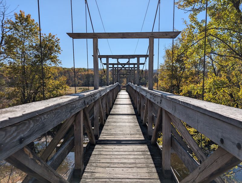
Forget the summit for a minute: the crossing over Pochuck Creek is reason enough to lace up your shoes. This section of the Appalachian Trail in Vernon Township combines a level boardwalk through wetlands with a suspension bridge that gives the outing its unmistakable centerpiece.
A straightforward out-and-back from County Route 517 covers roughly two miles, making it a manageable choice when you want scenery without committing to a mountain climb. The approach matters almost as much as the bridge.
Wooden boards lead through grasses and trees, giving you a ready-made line to follow through the photograph before the suspension span enters the frame. Try a wide shot from the approach, then a closer view that emphasizes the bridge’s structure and the creek below.
Having a walking companion continue ahead can add scale, provided you keep the crossing clear for other hikers. This is a popular stretch, so an early visit offers a better chance of taking your time without becoming the person holding up the entire trail.
Parking along Route 517 is limited, and nearby residential streets have restrictions. Use permitted spaces and obey the signs.
You can continue beyond the boardwalk into woodland, but the longer route toward Pinwheel Vista is a separate, more demanding undertaking. For a relaxed bridge outing, turning back is a perfectly respectable plan.
2. River’s Edge Trail, Institute Woods, Princeton
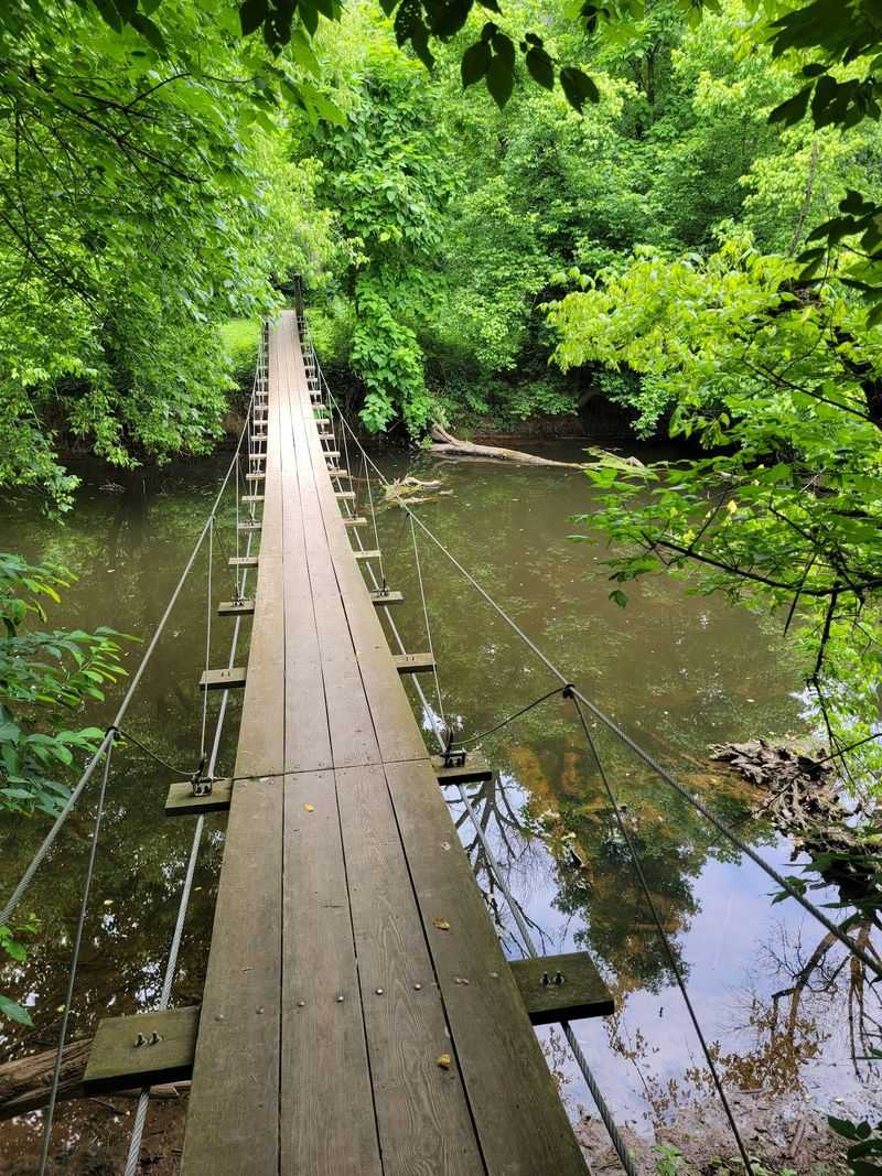
Princeton has a suspension bridge hiding behind its more familiar attractions, and reaching it requires trading downtown sidewalks for woodland paths. The swinging crossing spans Stony Brook along River’s Edge Trail in Institute Woods, on land belonging to the Institute for Advanced Study.
A roughly 2.2-mile loop from Princeton Battlefield State Park provides a relatively short way to visit it, with mostly level walking and enough intersecting paths to make a map useful. The bridge’s appeal comes from its placement: a narrow crossing surrounded by trees, with the brook providing an open strip through the woods.
Photograph it from the approach to capture that transition from solid ground to suspended walkway. Then put the camera away long enough to enjoy crossing.
A picture of someone walking toward the opposite bank can work particularly well here, giving the scene a sense of movement without requiring any elaborate setup. Start at the battlefield parking area at 500 Mercer Road, and allow time to find the correct paths rather than assuming every junction will have a helpful sign.
Mud can complicate an otherwise easy walk after rain. If you want a longer outing, add trails near Rogers Refuge, where a marsh observation platform offers another reason to pause.
The combination of battlefield, woods, brook, and bridge makes this a satisfying afternoon without much climbing.
3. Van Campen Glen Trail, Delaware Water Gap National Recreation Area
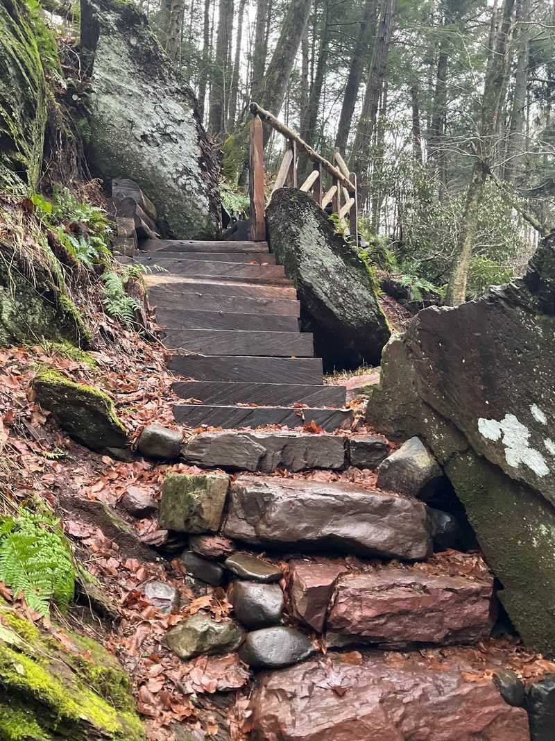
Water does most of the decorating in this Warren County ravine. Cascades slide over rock shelves, pools interrupt the brook’s downhill progress, and a wooden footbridge gives hikers a crossing within the glen.
The yellow-blazed trail follows Van Campens Brook through the Delaware Water Gap National Recreation Area, with a commonly used short out-and-back covering about 1.6 miles. That modest distance can be misleading: rocky footing, stairs, and sections close to the water call for more attention than a smooth park path.
The bridge belongs in a photograph that includes its surroundings. Leave space for the stream and rock formations rather than filling the entire frame with wood.
An overcast day can help soften the difference between bright water and shaded banks, while autumn leaves introduce color without needing much photographic persuasion. Keep the camera tucked away while negotiating uneven sections; you will have plenty of opportunities to stop on secure footing.
Access for this route is from the Lower Van Campens Glen parking area on Old Mine Road in Hardwick Township. Follow the marked trail upstream, cross the wooden bridge, and continue toward the larger waterfall if conditions allow.
Heavy rain can make the brook dramatic while also making the trail slippery or flooded, so bigger water does not automatically mean a better hiking day. Swimming and wading are prohibited here.
Enjoy the pools from the trail, where the view is already doing plenty.
4. Riverside Trail, Hacklebarney State Park, Long Valley
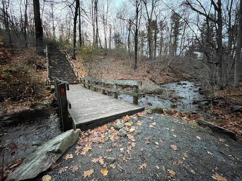
One bridge would be a pleasant bonus. At Hacklebarney, several crossings help turn a riverside walk into a sequence of small scenes worth stopping for.
The red-blazed Riverside Trail starts its work near Trout Brook, then follows the Black River through a wooded ravine with boulders, roots, and water slipping between rocks. From the main entrance at 119 Hacklebarney Road in Long Valley, use the white-blazed Main Trail to reach the stairs down toward Riverside.
Early in the walk, the area near Trout Brook Waterfall offers a particularly useful pairing of footbridge and tumbling water. Farther along, another bridge has cascades on either side.
Rather than collecting nearly identical bridge portraits, let each location suggest a different photograph: one showing the crossing above the stream, another looking along the walkway, and a third concentrating on the water beneath it. A cloudy autumn morning would be a good choice for those warm leaves and shaded rocks, though you do not need peak foliage to find something interesting.
Picnic tables around the brook make it easy to build a pause into the outing, especially if your hiking partner has already endured several requests to “wait right there.” Expect genuinely uneven footing along the river. Connecting trails offer ways to vary the walk, so carry the park map and choose a route that suits your group’s energy.
5. Dunnfield Creek Trail, Worthington State Forest, Columbia
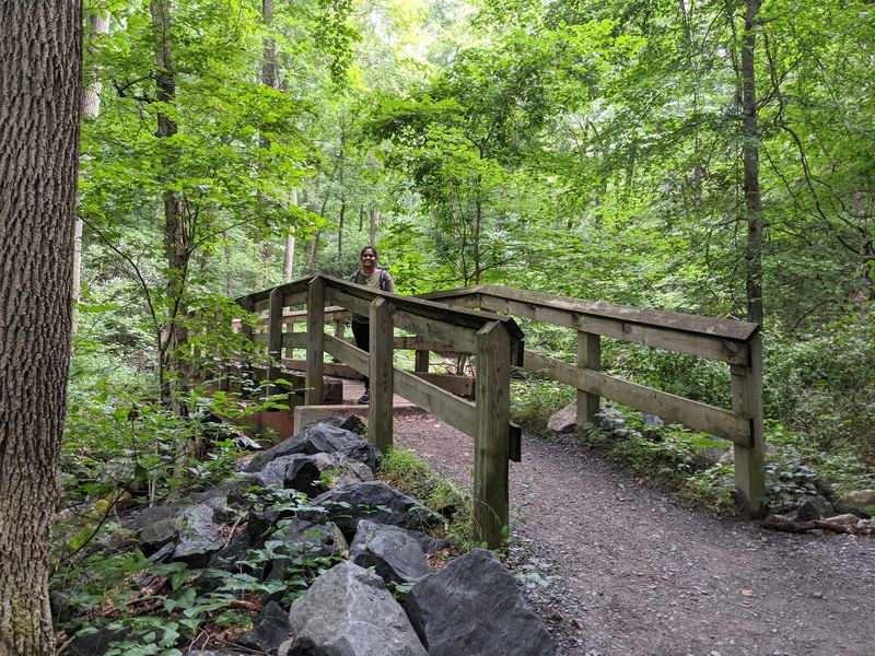
You can admire the Delaware Water Gap without signing up for the steep climb up Mount Tammany. A short outing along the Appalachian Trail and green-blazed Dunnfield Creek Trail reaches a woodland creek, cascades, and a footbridge near Dunnfield Creek Falls.
The round trip to this area is approximately 1.2 miles, making it a useful option for visitors who want moving water and a scenic crossing rather than a summit workout. Begin at the Dunnfield Creek parking area in Worthington State Forest.
The Appalachian Trail crosses a bridge near the start; farther on, bear right onto the green-blazed trail to reach another crossing beside the falls. Those are different bridges, which is helpful to know before you take a quick picture at the first one and declare the mission accomplished.
At the waterfall crossing, try including the stream’s rocky channel in the foreground and the bridge farther back. That gives the photograph depth and shows why this particular stretch deserves attention.
A tighter shot of water threading between stones can complement the wider scene, especially when fallen leaves collect around the edges. This trailhead also serves longer, popular hikes, so arrive early if you can.
The route continues beyond the falls, but visiting the bridge does not require following it all the way toward Sunfish Pond. Set your own turnaround point and enjoy the creek at an unhurried pace.
6. Black River Trail, Black River County Park, Chester Township
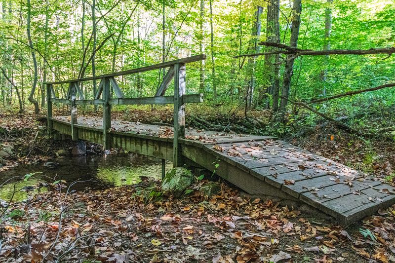
A stone gristmill makes a strong opening scene for a hike, particularly when the trail immediately supplies a footbridge and river views. Starting at Cooper Gristmill in Chester Township, the blue-blazed Black River Trail follows the water through a landscape that mixes woodland scenery with reminders of the area’s working past.
There is a small wooden crossing near the mill, while a longer route using green and orange connectors reaches a more substantial wooden bridge over the Black River. That distinction matters when planning your visit.
A short walk toward Kay’s Pond gives you the mill, river, and initial crossing; reaching the larger bridge requires continuing onto the connecting trails. Beyond that crossing, an optional extension leads toward the stone remains of Kay’s Cottage and a nearby dam.
Bring a map so you can choose the outing you actually want. For photographs, start with the relationship between the mill and water, then let the woodland crossings change the mood.
The larger bridge offers river views on both sides, so look in each direction before settling on a composition. You may prefer the photograph looking away from the crossing to the bridge portrait itself.
Parking is at Cooper Gristmill, 66 Route 24. Much of the riverside trail is relatively level but rooty, making this a good place to slow down, watch your footing, and notice details between the obvious stops.
7. Hemlock Falls Loop, South Mountain Reservation, Essex County
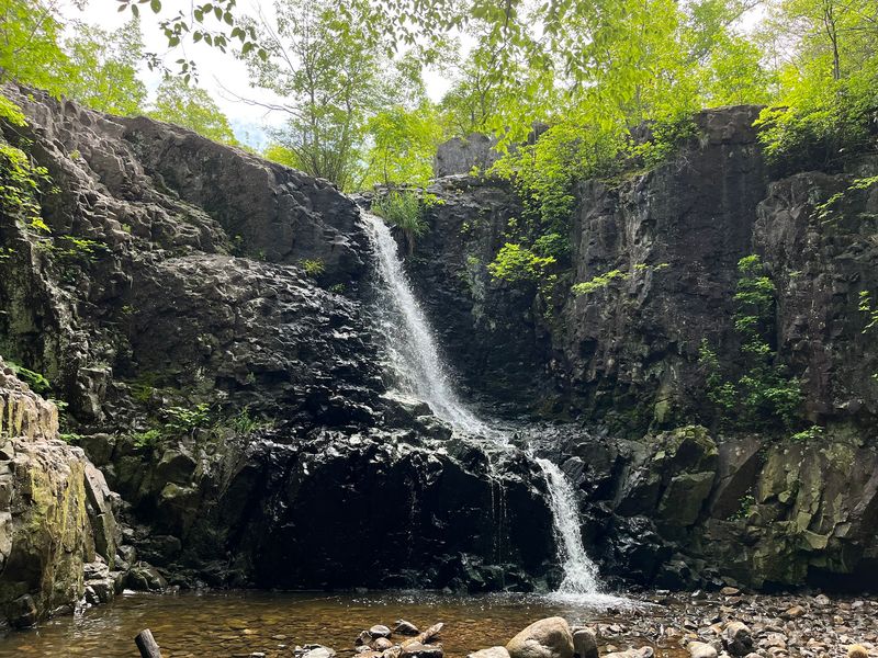
Stone gives this crossing a different personality from the wooden spans elsewhere on the list. Near the base of Hemlock Falls, a stone bridge carries hikers across the brook, with the waterfall and wooded slope providing the surrounding scene.
The falls drop about 25 feet, and their flow changes considerably with recent weather. After rain, the water can command the photograph; during a dry spell, the bridge, rock textures, and trees may become the stronger subjects.
A convenient approach begins at Tulip Springs in West Orange, where you follow the yellow-blazed Lenape Trail toward the falls. The route crosses a pedestrian bridge over South Orange Avenue before reaching the woodland stream crossings.
From Tulip Springs, an out-and-back to Hemlock Falls is roughly 1.2 miles, while continuing onto the trail marked with red dots on white creates a longer loop. At the falls, take a moment to examine the scene before climbing the stone stairs.
A photograph from the approach can show how the bridge fits into the brook corridor; closer images can concentrate on stonework and moving water. The stairs offer another perspective, though there is no need to leave the path or edge toward a drop for a better shot.
This is a particularly satisfying choice when you want several photographic subjects within a compact walk. You get a bridge, a waterfall, and changing elevations without organizing an all-day expedition.
8. 1808 Trail, Wharton State Forest, Batsto
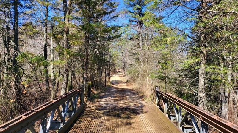
The Pine Barrens contribute a completely different bridge scene: a long, curved wooden footbridge crossing a stream amid dense vegetation. On the 1808 Trail near Batsto, that bend in the walkway is the detail to watch for.
It gives the photograph a softer line than a straight crossing, encouraging your eye to follow the boards into the trees. A nearby bench also supplies a welcome excuse to sit down before deciding that you need just one more angle.
Reach the green-blazed 1808 Trail using the orange-blazed Sand and Water Trail from the Batsto Village visitor-center area. That approach passes through an Atlantic white cedar swamp using smaller wooden crossings, so the photographic opportunities begin well before the larger bridge.
On this route, the curved crossing is approximately 2.1 miles from the start. Plan your return accordingly; this is a longer commitment than a quick wander around the village.
The trail follows the route of an old logging road through Mordecai Swamp, and mountain laurel adds another reason to visit, particularly around its late-spring flowering season. Try photographing the curved bridge from either end while staying on the established route.
One direction may emphasize the bend, while the other shows more of the stream. Sandy ground, exposed roots, swamp vegetation, and wooden walkways give this outing plenty of texture.
Add time for Batsto Village afterward, rather than rushing back to the car immediately.
9. Buttermilk Falls Trail, Delaware Water Gap National Recreation Area
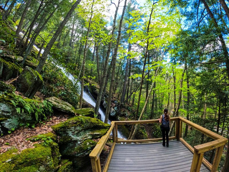
Most visitors look up at the waterfall first, which is fair enough. But climb the wooden stairs beside Buttermilk Falls and you will find a smaller scene above the main drop: a stream, an upper cascade, and a wooden footbridge carrying the blue-blazed trail onward.
This is the Buttermilk Falls in the Delaware Water Gap National Recreation Area near Layton, reached from Mountain Road. The bridge makes a rewarding destination even if you have no intention of tackling the steep trail beyond it.
When road access is open, the waterfall is close to the parking area, but getting to the upper crossing means climbing the stairs. Pause at the viewing platforms on the way rather than treating them as obstacles between you and the bridge.
The changing angles show how the water moves over the rock face, while the upper crossing lets you photograph the quieter stream feeding the spectacle below. Try a horizontal frame for the bridge and surrounding woods, then a vertical one where the stairs or falling water provide a stronger line.
Recent rain can improve the waterfall’s flow, though wet steps deserve care. Mountain Road is unpaved, and seasonal or damage-related closures can change the approach, so check current access before setting out.
Once you reach the bridge, turning around is entirely reasonable. Continuing uphill leads into a much more strenuous hike; the stairs and crossing already make a worthwhile outing.
Share this story