Some of the best afternoons in Oregon cost nothing at all. On the north coast, a flat path follows the Columbia River for about six and a half miles, past working docks, giant cargo ships, and a crowd of sea lions that never seem to run out of things to say. It runs along an old rail line, slips under one of the most famous bridges in the Pacific Northwest, and passes right through a historic downtown.
Walkers, runners, cyclists, and step counters all share it. Stick around, because the story of this path, the best place to start, and the small details that make it special are all coming up next.
A Free Path Along the Columbia in Astoria
The riverfront walk in question is the Astoria Riverwalk, found in Astoria, OR 97103. It hugs the shoreline of the Columbia River on Oregon’s north coast.
The route is a point-to-point trail of roughly 6.4 to 6.5 miles. That means it has two ends, and many people pick one and walk partway before turning back.
Plenty of locals admit they have started from either end without ever finishing the whole thing in one go. Nobody hands out medals, so that is perfectly fine.
The best part might be the cost. Access is free, which is a very good price in a state where everyday expenses keep climbing.
Many access points line the route, so joining it rarely takes much planning. A short stroll after lunch or a long weekend trek both work.
For residents, it is the kind of familiar public place that quietly makes a town feel like home. For travelers, it is an easy introduction to how Astoria lives with its river.
Rails Turned Into a Riverside Trail
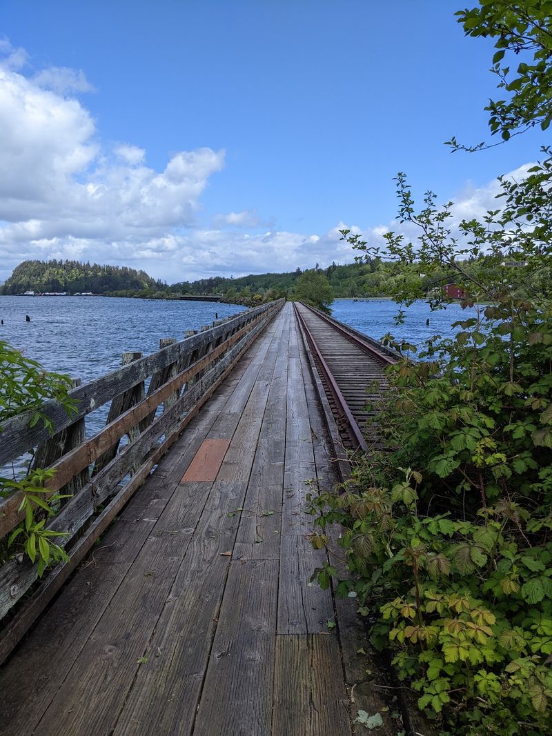
Long before joggers claimed it, this route carried trains. The path follows a portion of the old Astoria and Columbia River Railroad line coming into town.
To bring the railway straight in along the water, the Army Corps of Engineers built rock levees. Those levees created small lagoons that still sit along the eastern stretch today.
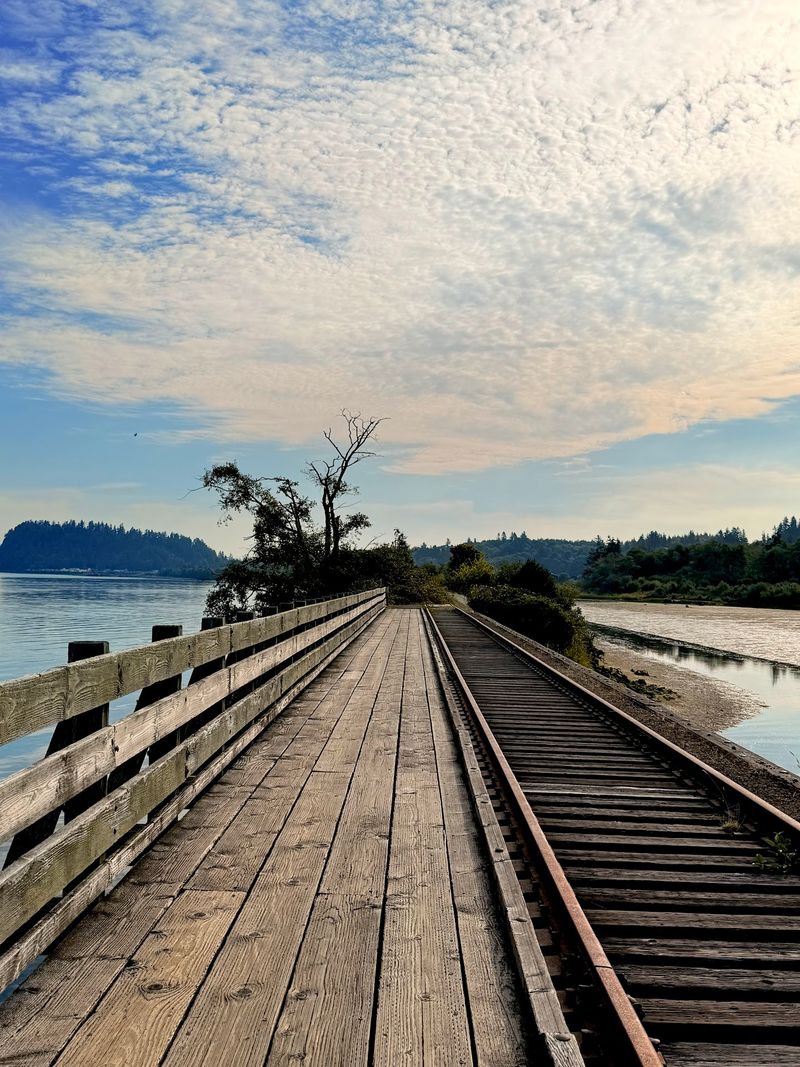
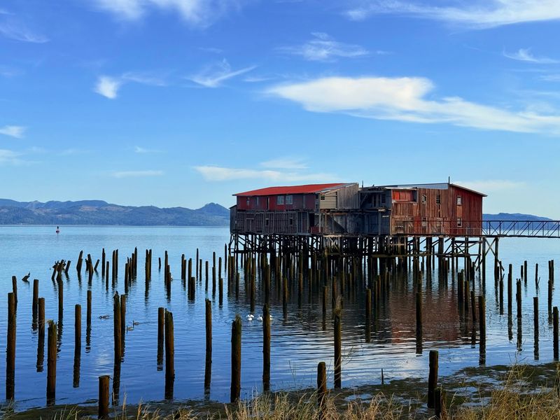
Ancient wooden trestles remain part of the scenery. They are reminders that this shoreline once moved freight and passengers rather than strollers with coffee cups.
Sections of the old rails still run beside the path. Cyclists should take note, since the tracks and wooden bridges can make pedaling a little challenging in spots.
History buffs will find the whole thing a quiet lesson in reuse. A transportation corridor built for industry now serves people who simply want to stretch their legs.
Preservation does not always mean a museum. Sometimes it means keeping an old line open and letting the public keep walking it.
The Lagoon Road Trailhead Secret
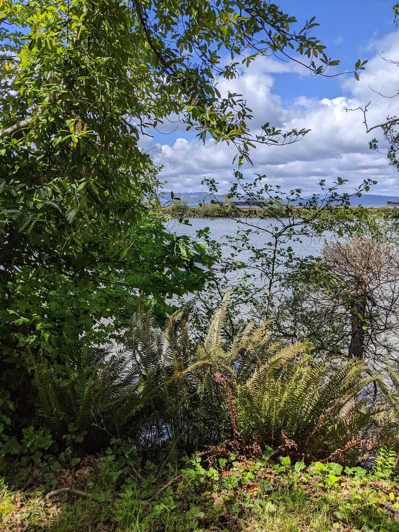
Ask someone who knows the route where to begin, and Lagoon Road may come up. A small trailhead there makes a favorite starting point on the eastern end.
It is a shady spot with a little wooden bridge crossing a creek. From there, the trail heads toward the river and opens up to wide views.
This end also has lots of blackberry bushes lining the way. In season, that makes the walk a bit slower for anyone easily distracted by snacks growing on a vine.
The lagoons formed by the old rail levees sit nearby. Combined with the trestles, they give the east side a quieter, less built-up feel than the downtown stretch.
As the path continues west, it crosses into what one could call civilization. Lighted pylons begin there and illuminate the trail for about four miles into town.
That lighting makes the route a bit safer when daylight fades. It is a small detail, but it turns a scenic trail into a practical everyday path.
Sea Lions With Plenty to Say
Keep an eye, and an ear, out along the water. The sea lions of Astoria are hard to miss and even harder to ignore.
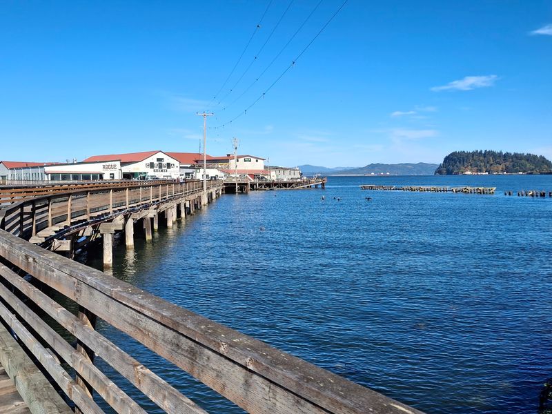
They crowd onto old docks that no longer serve their original purpose. To the sea lions, those docks are prime real estate with a river view, and the rent is free.
Sightings happen at more than one spot along the route. Several sections past the piers and farther west offer another chance to catch them lounging together.
Kids tend to stop in their tracks here. Adults usually do too, even the ones who claimed they were only out for exercise.
The animals are wild, so watching from the path is the way to go. A respectful distance keeps everyone happy, flippers and sneakers alike.
These residents give the walk a personality that a regular sidewalk could never match. Few towns can say their waterfront comes with its own noisy welcome committee.
Ships, Piers, and a Famous Bridge
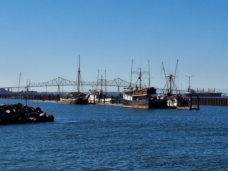
Enormous container ships glide along the Columbia here, and the path offers front-row seats. They make even a fast walker feel slow.
Closer to town, the route passes well-known piers, waterfront apartments, and fishing boat launches. The working character of the river stays visible the whole way.
The Columbia River Maritime Museum sits along the walk as well. It is an easy landmark for anyone who wants to pair a stroll with some local maritime background.
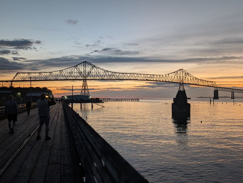
Then comes the headliner. The trail passes right under the Astoria-Megler Bridge, a structure that many people recognize long before they ever set foot in Astoria.
A veterans memorial stands along the route too. It adds a reflective pause between all the boats and bridges.
Further on, more bridges appear, along with the town’s marina. The path rewards anyone who keeps going instead of turning around at the first good view.
Downtown Charm Meets Working Waterfront
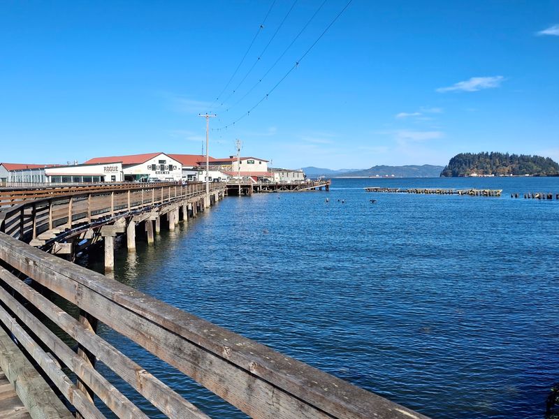
Not every trail runs straight through a historic downtown. This one does, which means a stretch of the walk doubles as a tour of Astoria itself.
Charming restaurants and coffee shops sit close to the path. They also solve a practical problem, since restrooms are available at businesses along the route.
The walk is often described as a nice walking tour of the area. It is a simple way to see both the river and the town without needing a car.
Head farther west and the scenery shifts to the utilitarian side of Astoria. The marina, warehouses, and boat yards show the town at work rather than on display.
Eventually the path reaches the west trailhead, which sits along the Youngs River. That marks the end of the line for those who made it the full distance.
The contrast is part of the appeal. Postcard views and everyday industry share the same strip of shoreline, and both feel honest.
Room for Bikes, Boards, and Leashed Pups
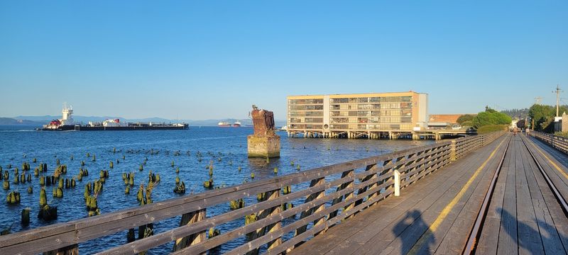
Step counters, rejoice. The paved, flat grade makes this an easy walk, and long-distance step chasers can rack up serious numbers here.
Walkers are only part of the crowd. Bikes, skateboarders, and runners all use the path, so it pays to stay aware and share the space.
Cyclists will enjoy the route, though the wooden bridges and old railways can add a bit of challenge. Slowing down in those sections is a smart move.
Dogs are welcome as long as they stay on a leash. Four-legged hikers seem to appreciate the sea lion entertainment as much as anyone.
The path is also described as handicap doable and highly recommended. That accessibility makes it a rare scenic outing many different people can enjoy together.
For a break from moving under personal power, there is also the trolley option. Riding part of the route is a relaxed way to see the waterfront from a seat.
Worth an Afternoon, or Several
Every bit of feedback on this path lands at five stars, which says plenty about how people feel after a few miles here. Words like relaxing, interesting, and easy come up again and again.
Practical planning is simple. There is no fee, many access points, restrooms at nearby businesses, and lighting along about four miles of the route.
A good approach is to choose one end and set a comfortable goal. The Lagoon Road trailhead offers a shady, quieter beginning, while downtown puts shops and the bridge close at hand.
Nobody needs to finish all 6.5 miles in one session. Coming back for the other half just means another good day by the river.
In a time when so many outings carry a price tag, a free waterfront path that locals and travelers can share is worth celebrating and protecting.
Bring comfortable shoes, a leash if the dog is coming, and some patience for the sea lions. The ordinary afternoon will take care of the rest.
Share this story