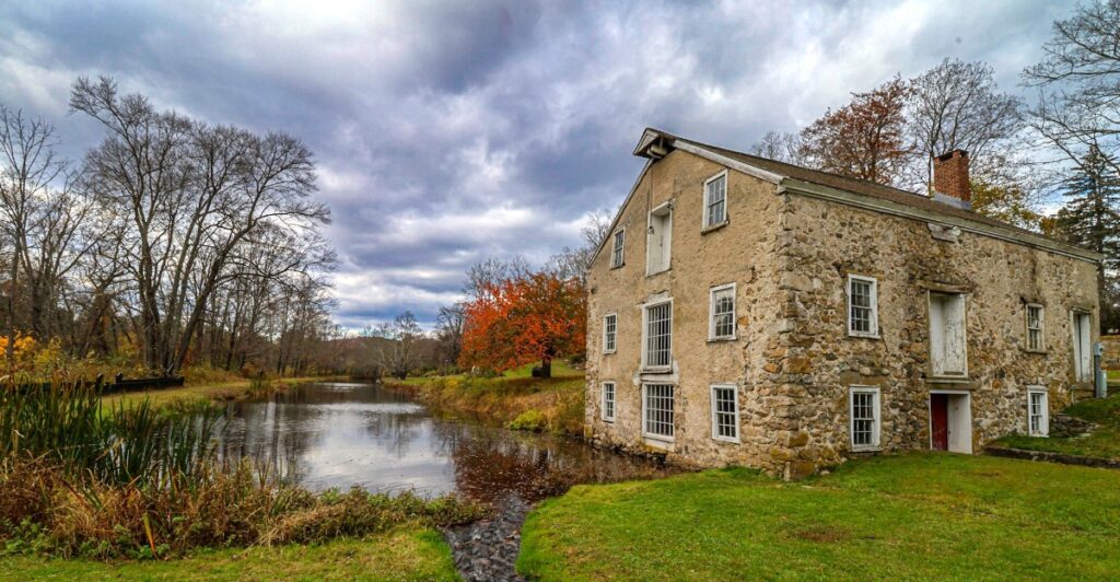
A boat loaded with coal approaches a hill, leaves the water, and rides uphill on rails. That was ordinary business on the Morris Canal, where engineers gave freight boats a way across New Jersey’s stubbornly uneven landscape.
At Waterloo Village, the surviving canal, old store, mills, and houses reveal what happened when that transportation route passed through a farming property. A waterfront economy took shape, with boat crews buying supplies, mules needing shoes, and families building lives around the traffic.
Today, the scene is considerably quieter. Set in the Musconetcong River Valley in northwestern New Jersey, Waterloo offers a walk through a community whose buildings still explain why it existed.
The boat-lifting machinery no longer operates, but its story gives this village an unexpected edge. Come for the historic scenery, and you may leave thinking more about rails, water power, and the considerable trouble involved in getting coal over a hill.
Waterloo’s Story Began Long Before the Canal Arrived
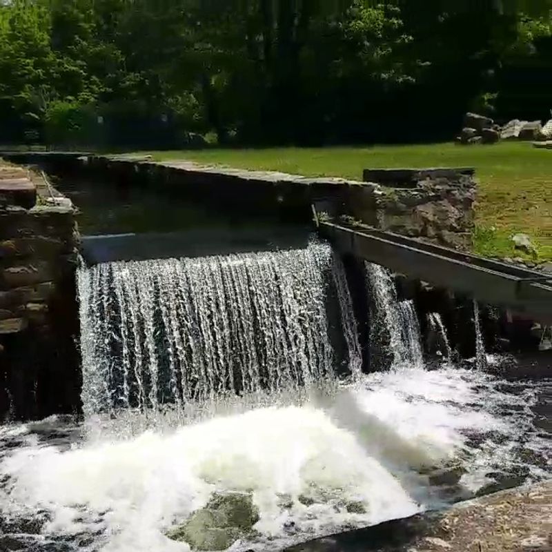
The Musconetcong River was useful long before anyone proposed hauling freight boats across the Highlands. Indigenous people lived in this region for thousands of years, and the Lenape history interpreted at Waterloo gives the landscape a much longer timeline than its nineteenth-century buildings suggest.
Winakung, the site’s reconstructed Lenape educational area, introduces that earlier relationship with the woods and waterways. Its name means “place of sassafras,” a fitting detail in a setting where trees belong in the story as much as buildings do.
Housing reconstructions and interpretation of fishing, hunting, food, and woodland resources help explain how a community could draw on the surrounding environment. These are educational reconstructions rather than surviving seventeenth-century homes, a distinction that matters when moving between this area and the historic canal village.
There is another chapter between the Lenape interpretation and the canal boom. During the eighteenth century, the place later called Waterloo was associated with Andover Forge and the region’s iron industry.
Eventually, the Smith family owned Andover Forge Farm, with its orchards, crops, and livestock. Agriculture was already part of the property’s identity when the canal introduced a different commercial opportunity.
Viewed together, those layers make Waterloo more interesting than a collection of old houses. The river supported different communities and enterprises, each with its own uses for the land.
A good way to approach the visit is to keep that changing relationship in mind. Look beyond individual buildings and consider what people needed from the valley at different points in its history.
The canal would dramatically expand the possibilities, but it arrived in a landscape that already had a working past. That gives the later boat traffic some context, along with a reminder that Waterloo’s most eye-catching engineering story is only one part of the place.
How the Morris Canal Carried Boats Over Hills
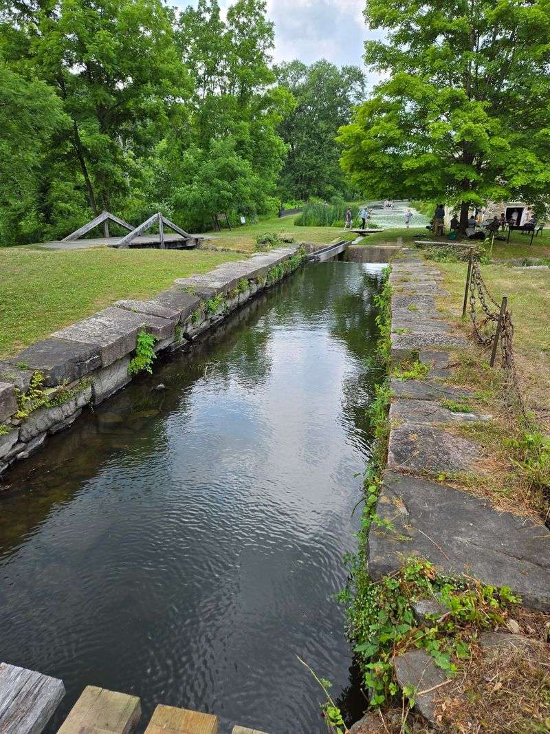
New Jersey’s Highlands presented a fairly blunt problem for canal builders. Waterways work nicely on level ground; a route crossing steep changes in elevation needs considerably more persuasion.
The Morris Canal’s solution combined conventional lift locks with inclined planes, essentially short railways that carried boats between different canal levels. A boat entered a submerged cradle car, which supported it as machinery hauled the car along the rails.
At the other end, the boat returned to the water and continued its journey. The largest planes could overcome a 100-foot elevation difference in roughly 15 minutes.
There were 23 inclined planes and 23 lift locks along the main route, making the hills part of the transportation system rather than a reason to abandon it. Across the Highlands, the canal climbed toward its summit near Lake Hopatcong and descended toward the Delaware River, handling a combined elevation change of 1,674 feet.
Water supplied the power as well as the channel for travel. Early plane machinery used waterwheels; later improvements introduced stronger reaction turbines capable of moving larger loads.
That is the especially satisfying part of the design. Engineers used water flowing downhill to help freight boats travel uphill.
At Waterloo, Inclined Plane 4 West handled an 80-foot change in elevation. Its remains belong to the village’s canal landscape, although visitors should not expect a working boat lift or an intact railway ready for passengers.
Historic interpretation helps connect the surviving pieces with the operation they once supported. It is worth separating the jobs of the animals and machinery, too.
Mules towed boats along the canal’s level stretches, while water-powered equipment handled the inclined planes. Imagining a heavily loaded boat rising out of the canal makes the system sound theatrical.
For its operators, however, this was freight handling, with cargo to deliver and another section of water waiting beyond the hill.
Canal Traffic Turned Farmland Into a Busy Village
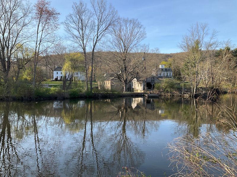
Peter Smith understood the value of having customers arrive practically at the doorstep. Knowing that the Morris Canal would bring a lock and an inclined plane to the old Andover Forge site, he established a general store beside the canal.
The position made sense for boat crews needing supplies and for a family ready to turn passing traffic into business. Smith and his extended family operated the gristmill and sawmill, supported a school, and helped build the church.
Alongside those enterprises came people with specialized jobs, including a lock tender, a plane tender, a storekeeper, and a teacher. The farm property was becoming a village with work, services, and a daily rhythm tied to the waterway.
Once the canal opened in 1831, it connected communities across northern New Jersey; its extension to Jersey City was completed in 1836. Pennsylvania anthracite coal and regional iron ore gave the route an industrial purpose, while agricultural products also traveled along it.
For Waterloo, that meant a stream of people who needed more than a clear channel through the hills. Boatmen bought provisions, arranged to have their mules shod, and exchanged news before moving on.
Think of the store and blacksmith shop as essential stops in a long delivery route. A delay involving an animal or equipment could interrupt the whole journey.
The Smith family benefited from this expanding economy over three generations, and Andover Forge Farm acquired the name Waterloo sometime between 1840 and 1860. The preserved houses and business buildings make that transformation easier to understand because the pieces remain close enough to consider together.
The village’s waterfront was a workplace, a shopping stop, and part of people’s home lives. Stand near the old store and the commercial logic becomes clear.
A boat passing through brought customers directly to a business that had positioned itself exactly where they would need it.
The Old Shops and Mill Still Tell the Village’s Story
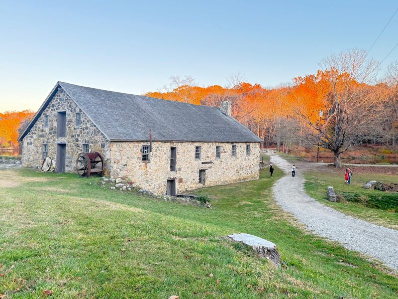
Start with the buildings that did the practical work. Smith’s Store, the blacksmith shop, and the gristmill and sawmill explain Waterloo with less effort than a grand house ever could.
Each addressed a need that kept the surrounding community functioning. The store connected canal crews with supplies.
The blacksmith’s work included shoeing the mules that towed boats, linking a small village shop to a transportation route stretching across the state. The gristmill processed grain, while the sawmill belonged to the same network of local production and commerce.
Together, they give the village a useful sense of scale. Goods moved through Waterloo, but people also made, repaired, and processed things here.
Rather than treating each structure as a separate photograph, look at the distances between them and their relationship to the canal. That arrangement helps explain why this particular cluster of businesses developed.
The wider village includes workers’ houses, tenant houses, the hotel, church, and several Smith family homes. Those different building types introduce another question worth carrying through the walk.
Who lived close to their job, who owned the enterprise, and what services did the community require beyond trade? The surviving layout lets you think about those roles without reducing the town to its wealthiest residents.
Preservation is part of what makes that possible. Waterloo’s historic buildings have required careful study and conservation, and their continued presence gives visitors physical evidence of an economy that otherwise might be difficult to picture.
Interior access depends on programming and opening schedules, so an outdoor visit and a guided visit offer different experiences. Closed doors still leave plenty to observe, including the buildings’ placement and the canal beside them.
When demonstrations or tours are available, the working details add depth. A mule needing shoes sounds like a small matter until you remember that the animal was helping move someone’s livelihood across New Jersey.
The Canal Museum Explains the Engineering Behind It All
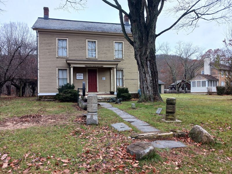
The easiest way to understand a boat riding on rails is to see the arrangement at a manageable scale. Inside the Canal Society of New Jersey’s museum, models and exhibits help explain inclined planes, locks, canal construction, and the people who operated the waterways.
A model of a Morris Canal inclined plane gives the machinery a shape that is harder to grasp from scattered outdoor remains. Boat models also help distinguish vessels built for different canals.
Those comparisons matter because a boat’s design had to suit the waterway and the equipment it encountered along the route. Allow time for the human side of the displays as well.
Tools, artifacts, and representations of canal workers bring the story back from impressive machinery to ordinary responsibilities. Someone had to steer, handle the animals, maintain equipment, and manage life aboard.
Waterloo also has a separate Canal Boat Exhibit in the Samuel T. Smith Carriage House, centered on surviving material from an actual Morris Canal boat.
Its preservation story takes an unexpected turn down at the Jersey Shore. In 2016, work to raise a building in Highlands revealed that it had been constructed over the forward section of a canal boat.
Recoverable material was donated and transported to Waterloo, where volunteers developed an exhibit around its discovery and rescue. Associated displays include boat equipment and a full-size rudder reproduction, helping visitors understand what the vessel required beyond a hull.
The museum and boat exhibit complement each other particularly well. One makes the transportation system easier to follow; the other offers a direct physical connection to a boat that participated in it.
Their opening schedules are more limited than access to the grounds, so confirm the day’s arrangements if indoor exhibits are the main reason for the trip. Seeing both adds detail to the walk outside, especially when the canal’s quiet surface gives little indication of the loads it once carried.
Following the Towpath Through Waterloo Today
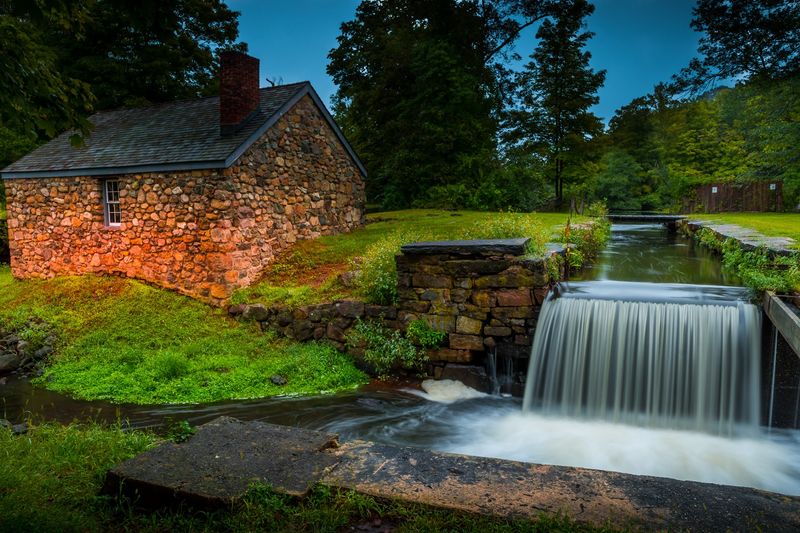
A towpath has a different meaning once you know what walked along it. The canal-side route was part of the machinery of transportation, providing ground for the mule teams pulling boats through the water.
Today, it offers a way to read the village’s setting at walking speed. Follow the water-filled canal section, pause near the store and mill, and use the historic signs to connect the buildings with their earlier jobs.
A map is helpful here, particularly if you want to investigate features beyond the central village. Some former connections are interrupted, so do not assume every historic bridge or route shown in an old photograph remains usable.
The grounds are open from dawn to dusk, and the state lists no entrance fee. For navigation, the historic site’s address is 526 Waterloo Road, Stanhope, although the village itself is in Byram Township.
That small geographical wrinkle can save confusion when planning the drive. Wear shoes suitable for outdoor paths, and allow a couple of hours for an unhurried look around rather than treating the village as a quick roadside photograph.
Museum access, building tours, and interpretive programs follow separate seasonal schedules. Calling the historic site at 973-347-1835 is useful when a particular program or interior is central to your plans.
An outdoor walk still gives the canal story plenty of room to develop. Consider the distance between a worker’s house and the water, or how conveniently the store sat beside passing boats.
Then look beyond the buildings toward the surrounding valley. The canal eventually lost its commercial role as transportation changed, and it was drained in 1924.
What remains at Waterloo preserves a smaller, more readable portion of that enormous undertaking. Beside the quiet water, the shops and houses hold their positions, marking where a farming property became a community because boats needed a way through the hills.
Share this story