If you’re looking to get outdoors and enjoy the beautiful scenery of the mountains, lakes, or waterfalls near Bristol — try one of these great hikes or trails near Bristol TN-VA.
Most of these Bristol trails are located within an hour’s drive of Bristol, making them great for day trips.
Whether you’re looking for family-friendly hikes near Bristol, hikes great for dog walking, or difficult hikes guaranteed to break a sweat — here are the best hiking trails near Bristol.
🌿 Please remember to Leave No Trace and stick to the designated path! 🌿
You may also want to check out these hiking trails near Johnson City!
Best Hiking Trails near Bristol, Tennessee & Virginia
1. The Great Channels


- Distance from Bristol TN-VA: 50 Minutes
- Directions: The Channels Natural Area Preserve
- Length: 6.6 miles out-and-back
- Hiking Time: 4-5 hours
- Difficulty: Moderate
One of the best hikes near Bristol can be found in the Virginia Natural Area Preserve where you’ll find The Great Channels — 20 acres of sandstone labyrinths, formed approximately 400 million years ago during the Ice Age.
There are two trails to access The Great Channels — The Channels Trail (11 miles) or the Brumley Mountain Trail (6.6 miles).
We recommend the shorter hike via the Brumley Mountain Trail.
You’ll begin by hiking about 3 miles from Brumley Mountain Trail to Middle Knob, atop Clinch Mountain.
Once you reach the top of Middle Knob, you’ll see the remnants of an old fire tower that was retired in 1970. Take in the 360-degree views of the mountains and valleys before you.
Now, descend down the trail into the sandstone formations known as The Great Channels. Get lost (not literally) in the maze of the sandstones and check out all the nooks and crevices.
🚙 Parking — The parking lot only holds 10 cars. Parking is apparently enforced here and your car could be towed if you decide to park on the road. If there is no parking available, we recommend visiting another day or time.
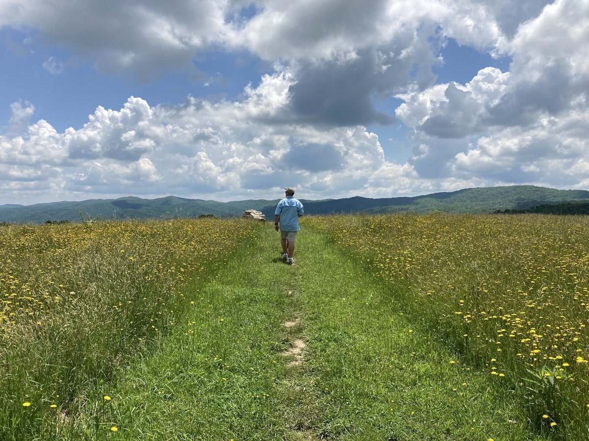
2. Cross Mountain
- Distance from Bristol TN-VA: 40 minutes
- Directions: Cross Mountain Trailhead
- Length: 5.8 miles out-and-back
- Hiking Time: 3-4 hours
- Difficulty: Hard
You’ll be able to say that you’ve hiked the Appalachian Trail on this hike to Cross Mountain.
Begin hiking from the Cross Mountain Trailhead, where you’ll walk along the Old Osborne Farm surrounded by green pastures and sweeping views extending into the Virginia Highlands.
After a mile of walking, you’ll reach the woods along Cross Mountain. Hike to the Double Spring Shelter (3 miles), which also makes a good spot to pitch a tent for camping or fill up your water bottle for the trek back.
If you keep hiking this trail, you’ll eventually find yourself in Damascus, VA.
If you’re wanting a shorter hike, just hike the Osborne Farm trail (approximately 1 mile) which is actually an ADA-accessible section of the Appalachian Trail. Once you reach the bench, turn around.
3. Hiking Trails of Steele Creek Park

- Distance from Bristol TN-VA: 5 minutes
- Directions: Steele Creek Park
- Length: Varies (see map)
- Hiking Time: Varies (see map)
- Difficulty: Varies (see map)
Visiting Steele Creek Park is one of the best things to do in Bristol as it contains more than hiking trails. You’ll find everything from disc golf, to a 52-acre lake with water activities, biking, playgrounds, camping, and more.
Steele Creek Park contains more than 25 miles of hiking trails and is the 3rd largest municipal park in Tennessee.
View the map to view the 20+ hiking trails found in the park. Most trails lead into other trails, so you can hike as long as you’d like with varying difficulties.

- Lakeside Trail — 2.1 miles
- Fox Ridge Trail — 1.13 miles
- Lake Ridge Trail — 1.85 miles
- Slagle Hollow Trail — 2.48 miles
- South Ridge Trail — 3.13 miles
Our favorite trail at Steele Creek Park is the Lake Ridge & Lake Side Trails, as they follow along the edge of Steele Creek Lake, making a relaxing and peaceful walk. This trail is popular for biking, hiking, and birding.
If you’d like to hike this trail, park at Rooster Front Park on the opposite end of Steele Creek Park.
Stop by one of these Breweries in Bristol for a refreshing beverage post-hike! 🍺
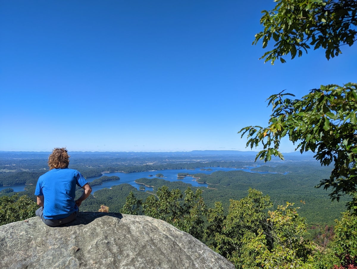
4. Flint Mill Trail
- Distance from Bristol TN-VA: 35 minutes
- Directions: Flint Mill Trail
- Length: 2.6 miles out-and-back
- Hiking Time: 2-3 hours
- Difficulty: Hard
Flint Mill Trail, located in the Cherokee National Forest, is a challenging hike with a high reward. Once you reach the top you’ll have 180° views of South Holston Lake from Flint Rock.
The first part of the hike is a gradual incline through the woods, while the second half of the trail is more challenging as it’s very steep.
Many hikers have reported slipping down the steep trail, especially if the ground is wet. However, the view you’ll have once you’ve reached the top is worth it!
After your hike, stop by the Blue Hole Falls to cool down as it’s one of the best waterfalls near Bristol, TN!
Look for the trailhead on the side of Flatwoods Road. The Trailhead is marked with a #49 blue circle.
5. Backbone Rock

- Distance from Bristol TN-VA: 40 minutes
- Directions: Backbone Rock
- Length: Approximately 1 mile
- Hiking Time: 30 minutes – 1 hour
- Difficulty: Easy
Backbone Rock is a great place to go if you’re looking for an easy hike near Bristol TN-VA.
This rock was blasted through by rail line workers, and instead of blasting away the entire rock as they intended, they ended up creating the shortest tunnel in the world.
This hike is approximately 0.3 – 1 mile depending on if you decide to hike down to Backbone Falls.
For an even better trip, stay the night by camping at Backbone Rock Campground.
Also Read: 9 Best Campgrounds Near Johnson City
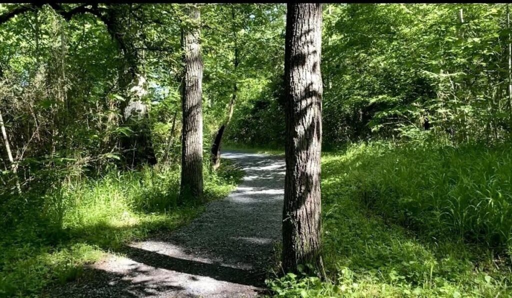
6. Mendota Trail
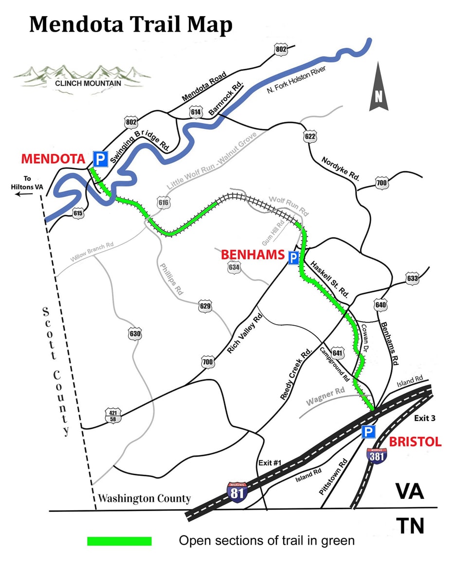
- Distance from Bristol TN-VA: 5 minutes
- Directions: Mendota Trail
- Length: 12.5 miles out-and-back (easily shortened)
- Hiking Time: 1-6 hours
- Difficulty: Easy-Moderate
The Mendota trail is an easy hiking and biking trail just minutes from downtown Bristol, TN-VA.
This old railroad spans from Bristol to Mendota, VA through the woods and along the river and creeks. The entire distance of the trail is 12.5 miles, if that’s too much don’t fret, just turn around when you’re ready.
If you need gear before your trek (or bike), stop by Mountain Sports which is located near the Bristol trailhead.
7. Spillway Trail
- Distance from Bristol TN-VA: 25 minutes
- Directions: Spillway Trail
- Length: 3.5 miles out-and-back
- Hiking Time: 1-2 hours
- Difficulty: Easy
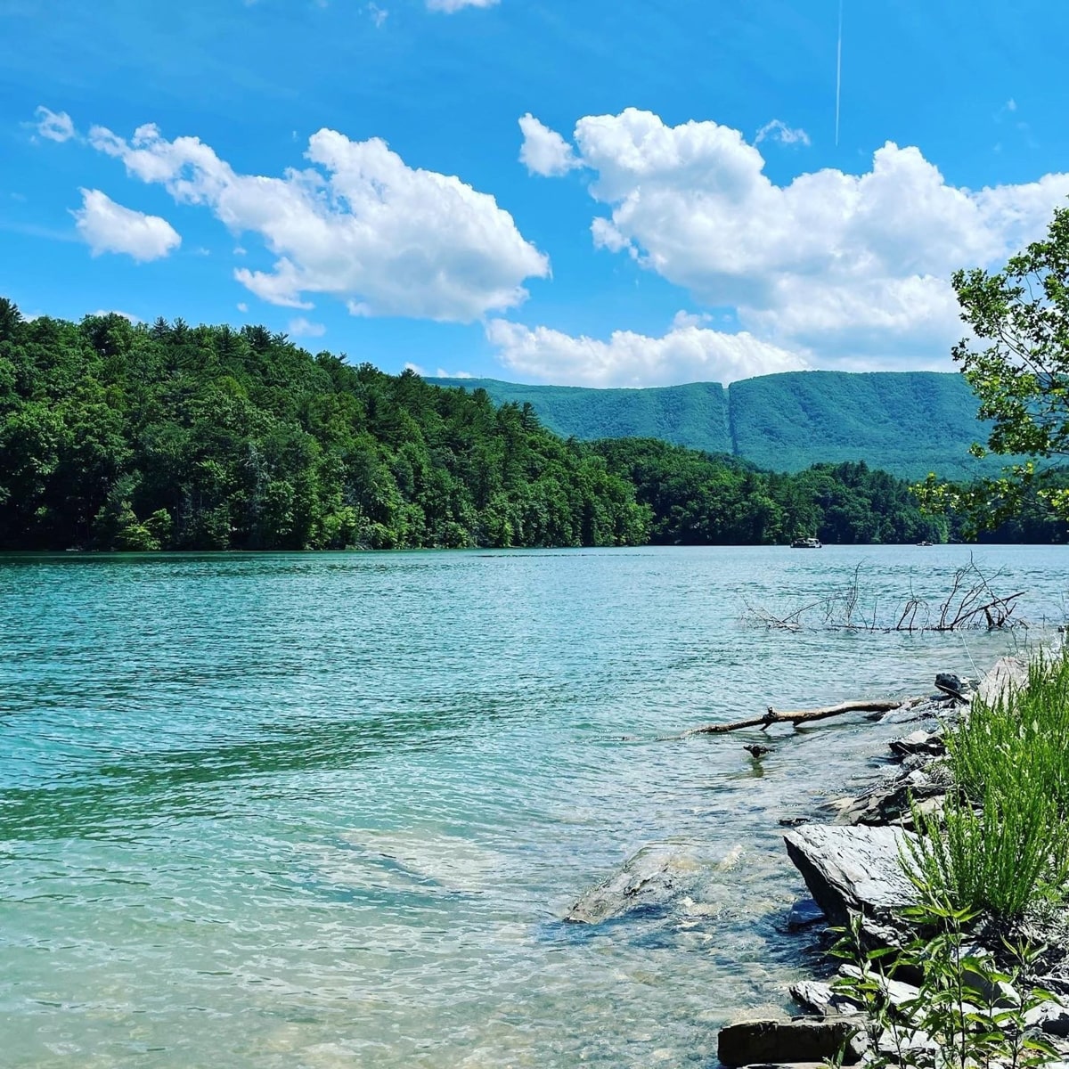
Spillway Trail is an easy graveled trail along South Holston Lake, great for running, walking, and hiking.
The trail is slightly inclined and is shaded by many trees. Once you reach the end of the trail at the spillway, the trail opens up providing beautiful views of the lake and mountains.
If it’s a hot day, you’ll have the opportunity to jump into the lake to cool down.
8. South Holston Tailwater Trails

- Distance from Bristol TN-VA: 15 minutes
There are multiple trails along the Holston River and near the South Holston Dam Reservation, just 5 miles from Bristol, Tennessee.
All of the trails listed below are great for dog walking and some would be good for strollers as the walkways are paved or graveled.
The river here is popular among anglers as it’s great for trout fishing. So if you like to fish, bring your fishing pole! Don’t forget your fishing license — purchase your TN fishing license here.
8a. Osceola Island Loop
- Distance from Bristol TN-VA: 15 minutes
- Directions: Osceola Island Loop
- Length: 1.6 mile loop
- Hiking Time: 30 minutes
- Difficulty: Easy
If you’re looking for an easy and relaxing hike, try the Osceola Island Loop along the South Holston River.
This hike is more like a walk, as most of the graveled pathway is flat and easy to complete. You’ll likely encounter some wildlife such as deer, ducks, and birds, as well as being a great spot to go fishing for trout.
Osceola Island Loop isn’t likely to be crowded as it’s not a widely known trail.
You can also combine this trail with Emmett and Trailwater Trails to make a longer hike, both listed below.
8b. Trailwater Trail
- Distance from Bristol TN-VA: 15 minutes
- Directions: Trailwater Trail
- Length: 0.5 mile out-ane-back
- Hiking Time: 30 minutes
- Difficulty: Easy
This trail is an easy hike along the river on a dirt path that ends in a slight incline. It would be easy to combine with Emmett Trail found below to make a longer hike.
You’ll see both names as Trailwater or Tailwater Trail, but they are both the same trail.
8c. Emmett Trail
- Distance from Bristol TN-VA: 15 minutes
- Directions: Emmett Trail
- Length: 1.1 mile loop
- Hiking Time: 30 minutes
- Difficulty: Easy
Emmett Trail is an easy graveled path along the Holston River that is great for viewing wildlife and fishing.
You can easily combine this hike with Trailwater Trail listed above.
8d. Bouton Trail
- Distance from Bristol TN-VA: 15 minutes
- Directions: Bouton Trail
- Length: 1.5 mile loop
- Hiking Time: < 1 hour
- Difficulty: Easy
Bouton Trail is a 1.5-mile easy loop with both graveled and dirt paths. Some of the dirt paths do have roots but it will still be suitable for strollers and walking dogs.
Do you have any hiking trail recommendations near Bristol, TN-VA? Let us know in the comments below! 👇
Hungry after your morning or afternoon hike? Enjoy a scrumptious meal at one of these restaurants in Bristol
Featured Image Credit: Osceola Island Loop Trail by Appalachian Granna